A Journey to the Nujiang River: A Symphony of Mystery and Majesty Deep in the Gorge
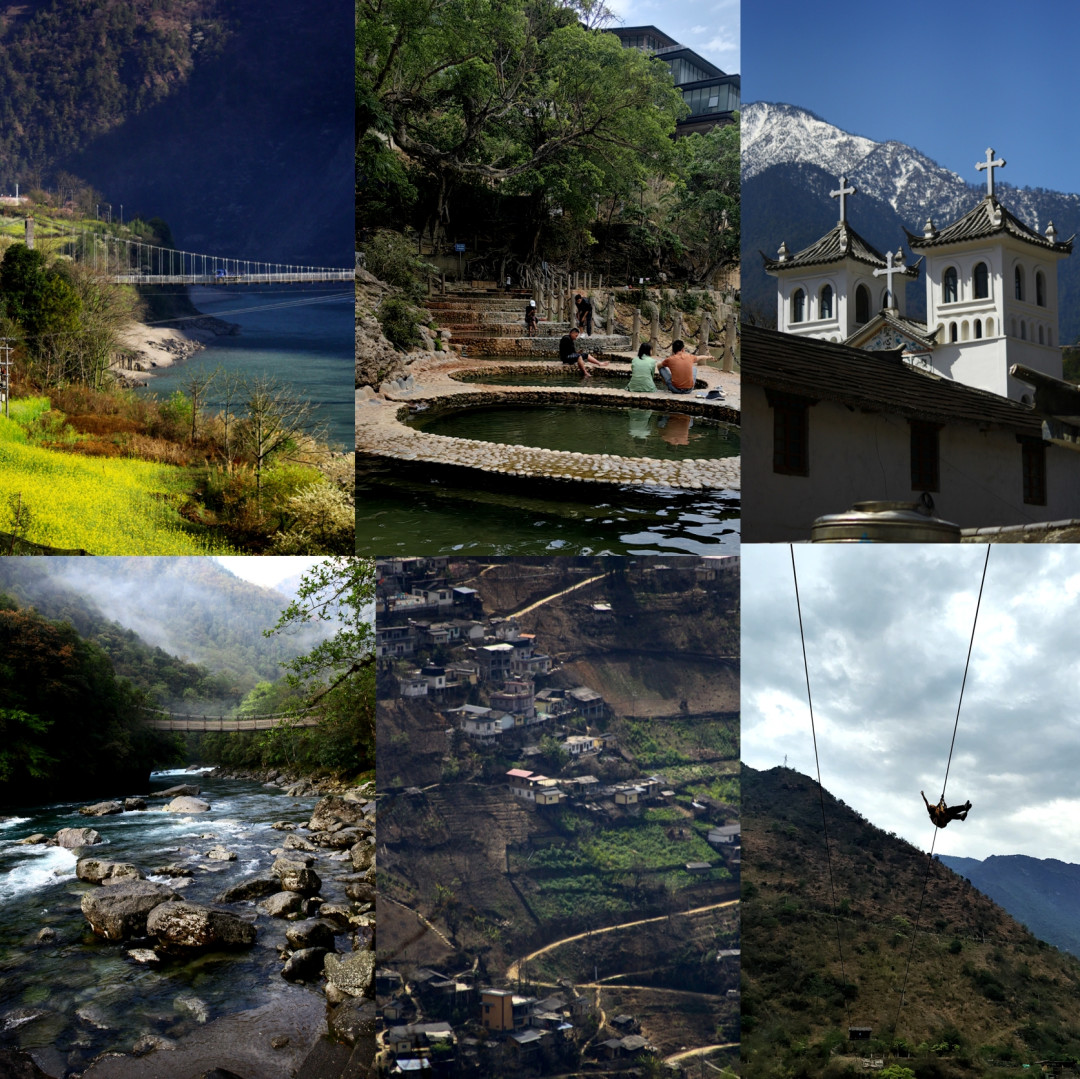
A Journey to the Nujiang River: A Symphony of Mystery and Majesty Deep in the Gorge
Travel is a dialogue with the unknown.
We are two freshly graduated designers, armed with cameras and restless hearts, who set foot on the land of the Nujiang River—a hidden realm carved by towering mountains and surging waters. Here, the mountains and rivers are the protagonists of our lens, and dawn and dusk mark the passage of time. We measure the world with our footsteps, freeze moments of emotion with our shutters, and hope to meet kindred spirits who share our passion for exploration.
Destination: Nujiang River
Travel Time: April 13, 2025, 9 days total
Cost per Person: Varies by individual; you can spend as much or as little as you like
Travel Companions: Couple / Husband and Wife
First Impressions of the Nujiang River: A Hidden Realm Carved by Mountains and Rivers
Nujiang Lisu Autonomous Prefecture lies in the northwest of Yunnan, bordering Myanmar along a 449.5-kilometer frontier. It connects to Diqing, Dali, and Lijiang in the east, Baoshan in the south, and Linzhi in Tibet to the north. Over 98% of its land is steep mountains and deep valleys. Four great mountain ranges—Dandang Lika, Gaoligong, Biluo Snow Mountain, and Yunling—stretch north to south, while three mighty rivers—the Dulong, Nujiang, and Lancang—flow side by side through the mountains. Twenty-two ethnic minorities call this place home, with the Dulong and Nu peoples being unique to the region.
Before arriving, I was captivated by a few key phrases: zip lines, open-air hot springs, a place people love to visit, a town where time stands still, tattooed women, the last area in China to be connected by road, and a village cut off from the world without a road. Each phrase was like a riddle waiting to be solved. Last March and this April, we made two self-driving trips deep into this land, gradually unraveling these mysteries and being struck time and again by the region's charm. The Nujiang River—only by visiting can you truly feel its uniqueness and richness, its delicate beauty and grandeur.
Nujiang Zip Line: A Heart-Pounding Leap Across a Natural Barrier
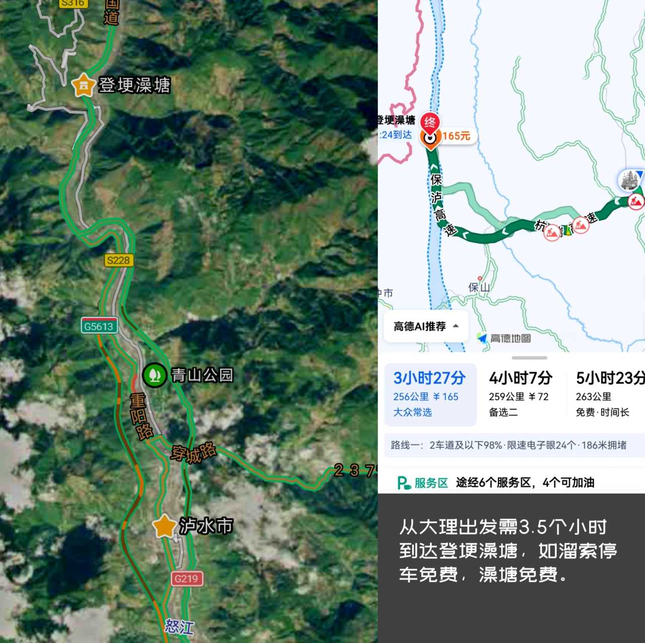
Starting from Dali, we got off the expressway at Lushui and turned onto National Highway 219, officially beginning our Nujiang journey. Seventeen kilometers past Lushui, we arrived at Denggen Hot Spring, the first stop to decipher the "open-air hot spring" and "zip line."
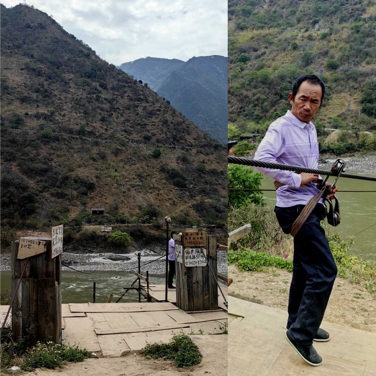
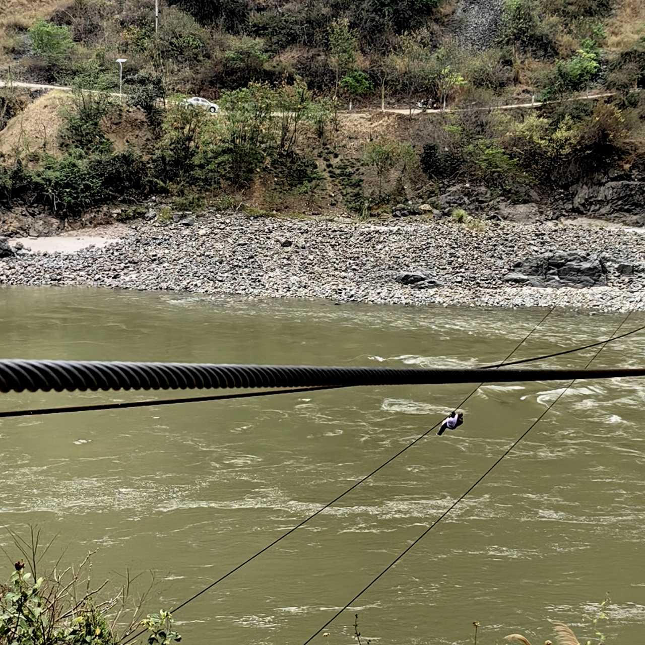
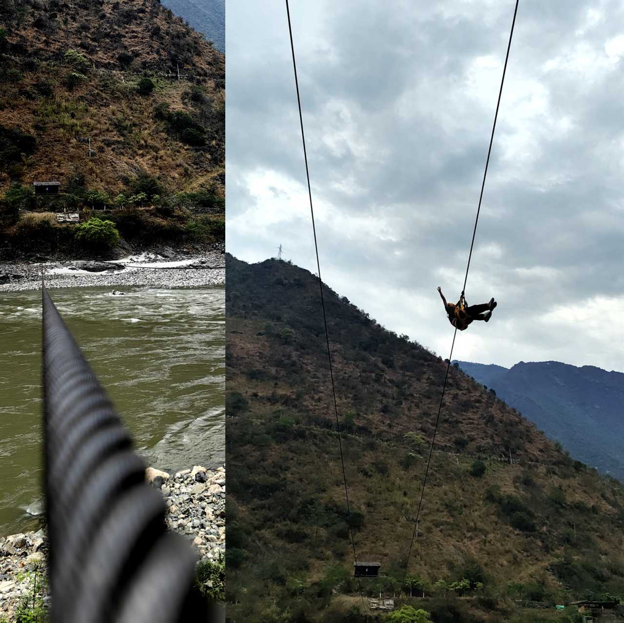
From a distance, we spotted the parking sign by the roadside. Following a local guide, we first tried the zip line. Zip lines were once the primary means of transportation for the various ethnic groups in the Nujiang Grand Canyon. Legend has it that a pair of Lisu lovers living on opposite banks of the Nujiang, inspired by a rainbow, set up the first zip line across the river. From then on, this convenient mode of transport became an "aerial bridge" for the people on both sides. In 2013, the state launched a "zip line to bridge" project, completing all 36 bridge projects by 2016, officially retiring zip lines from the stage of major transportation.
Zip lines come in two types: flat zip lines and sloped zip lines. We experienced the sloped variety.
- Flat zip lines: Both ends are at the same height, crossing the river horizontally. They can be used for travel in both directions, but once you reach the middle of the river, you have to use your arms to pull yourself to the opposite bank.
- Sloped zip lines: These have a slight incline, with one end higher than the other. You glide naturally to the opposite bank, making the ride very light and fast. Usually, there are two lines with opposite slopes, allowing for effortless travel in both directions.
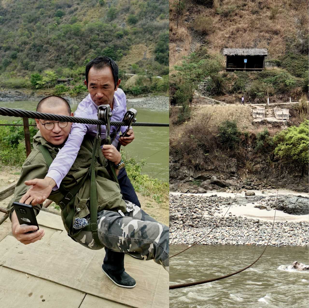
After fastening the safety rope, the guide gave us a gentle push, and within 20 seconds, we were on the other side. The peaks on both sides and the roaring river below passed by in a blur—the zip line speed reached 70 to 80 kilometers per hour. Coming back from the other side, the entire experience was thrilling and unforgettable.
Denggen Hot Spring: Legends and Warmth in the Thermal Waters
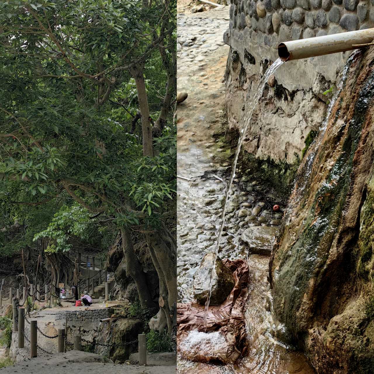
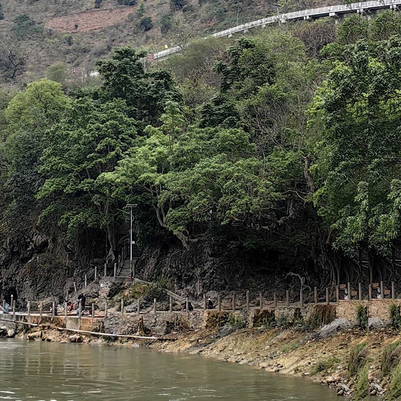
After watching a few more people cross the zip line, still exhilarated, we walked along the dirt path by the river toward Denggen Hot Spring. From a distance, we saw an ancient tree entwined; up close, we realized the hot spring outlet was right beneath it. Testing the water with our hands, it was close to 50°C. Several springs fell into different pools at varying heights, each with a different temperature.
Legend has it that long ago, two Lisu sisters refused to marry a tribal chief and jumped off a cliff on Gaoligong Mountain. Their blood turned into the springs of Denggen Hot Spring, allowing the poor to bathe, detoxify, and heal. To honor them, the Lisu people bathe at Denggen Hot Spring every Spring Festival. Today, during the Spring Festival, many locals bring their families, along with bedding, cooking utensils, and food, to bathe for several days as a form of healing. This is the annual "Bath Festival" at Denggen.
Travel Tips
- Destination: Denggen Hot Spring, located in Lushui City, right next to Nujiang Provincial Road 228, 17 kilometers from Lushui.
- How to Get There: Self-drive or hire a car. It's 17 kilometers from Lushui City, about 0.5 hours.
- Tickets: Denggen Hot Spring is free; zip line costs 50 RMB per person.
- Time to Spend: 2-3 hours.
- Reminders: Zip lines involve some risk; those who are timid should be cautious. People with high blood pressure, heart conditions, or high blood sugar should avoid soaking in the hot springs.
Tiger Leap and the Flying Stone: Legends in the Gorge
After experiencing the zip line and open-air hot spring, we continued along National Highway 219. To our left stretched the endless Gaoligong Mountains, and to our right flowed the swift Nujiang River, offering a magnificent panorama.
Tiger Leap
Passing by Tiger Leap on the Nujiang, known as "Lakualuo" in the Lisu language, it is considered one of the important birthplaces of Lisu culture. Legend has it that a tiger once leaped across the Nujiang here, giving the spot its name.
The Flying Stone
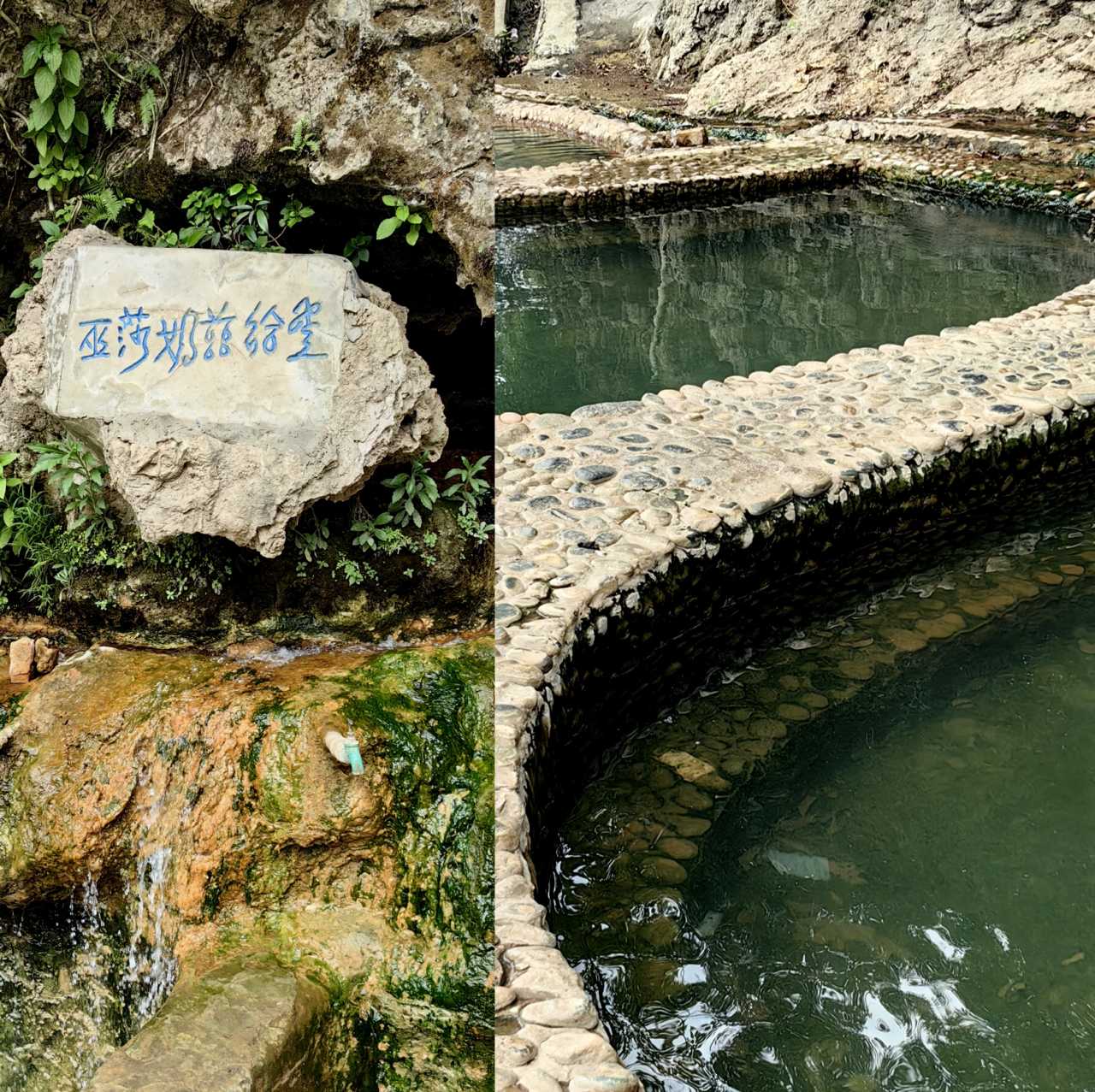
The Flying Stone of the Nujiang River is located on the campus of Fugong County Ethnic Middle School. In the early hours of March 19, 1983, this massive boulder silently flew in and stood proudly in the schoolyard. Aside from a slight damage to the eaves of a small bungalow to the north, which was pressed against the stone, the surrounding buildings were unharmed. Afterward, people searched the Biluo Snow Mountain and Gaoligong Mountains but found no trace of the boulder's origin. Its source remains an unsolved mystery to this day.
Laomudeng: A Place People Love to Visit
After witnessing the surging Nujiang River, we continued along National Highway 219 and arrived at Laomudeng Village in Fugong County. In the Lisu language, "Laomudeng" means "a place people love to visit." At an altitude of 1,850 meters, the area is rich in oxygen and is hailed as a natural oxygen bar. It leans against Biluo Snow Mountain to the east and faces Gaoligong Mountain to the west, with the Nujiang River roaring southward at its feet.
Natural Scenery
Across from Laomudeng Village stands the famous Crown Mountain, a prominent peak in the northern section of the Gaoligong Mountains. A masterpiece of nature, it is also the iconic landmark of Laomudeng. The village's observation deck offers the best view of Crown Mountain and allows you to overlook the Nujiang River as it flows slowly from north to south at the foot of Biluo Snow Mountain and Gaoligong Mountain.
Religious Beliefs

Many locals are Christians. Laomudeng Church is the largest Christian church in the Nujiang River basin, built on the edge of a cliff, a red-and-white Gothic-style building. Every Sunday, as well as on Wednesdays and Saturdays at 8 p.m., Christian believers from surrounding villages gather here for worship. Last year, we happened to attend a service. Sitting in the church, quietly listening to the locals chanting the Bible in the Lisu language, felt surreal. In such a remote mountain village, a foreign religion had taken such deep root. Before leaving, we left a small offering at the donation box.
Cultural Highlights
Laomudeng is primarily inhabited by the Nu and Lisu peoples. It is a gathering place for intangible cultural heritage, including Nu ethnic culture, traditional architecture, customs, musical instruments, cuisine, clothing, and dance. It boasts the national-level intangible cultural heritage item, the Nu traditional dance "Dabiya," as well as provincial-level items like the folk song "Odede," the Nu traditional festival "Rumisi," and the "mouth harp music." The owner of the inn we stayed at is a bearer of the mouth harp tradition, but unfortunately, he was away performing that day, so we missed out.
Delicious Tea
An unexpected highlight of this trip was the tea from Laomudeng. The innkeeper specifically recommended I try it. I thought it was just ordinary black tea, but it turned out to be sweet and rich in flavor. Upon learning more, I found out that this tea is produced on the western slopes of Biluo Snow Mountain, at altitudes between 1,400 and 2,200 meters. The unique soil, temperature, rainfall, and sunlight conditions give it a distinctive taste.
Travel Tips
- Destination: Laomudeng Village, Pihe Nu Ethnic Township, Fugong County, Nujiang Prefecture, Yunnan Province.
- How to Get There: Self-drive or hire a car. It's 53 kilometers from Fugong County, about 1 hour.
- Tickets: No ticket required.
- Time to Spend: 2-3 hours.
- Reminders: It's recommended to stay overnight; you can watch the sea of clouds the next morning.
Zhiziluo: A Town Where Time Stands Still
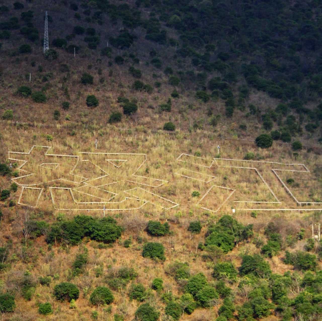
Zhiziluo, meaning "a good place" in the Lisu language, sits on a ridge of Biluo Snow Mountain at an altitude of 2,023 meters. It is backed by Biluo Snow Mountain to the east and faces Gaoligong Mountain to the west, with the Nujiang River rushing past at its foot. This was a key thoroughfare connecting the Lancang and Nujiang rivers, gradually developing into the administrative center of the Nujiang region from the late Qing Dynasty. It remained the seat of the Nujiang Lisu Autonomous Prefecture until 1974.
A Journey Through Time
In the 1960s, with the completion of the Wagong Highway, the transportation focus shifted. In 1974, the prefectural government moved to Liuku, which offered better transportation advantages, and Zhiziluo lost its status as a transportation hub. In 1986, the original Bijiang County was abolished, and the former prefectural and county seat fell silent, now serving as the seat of the Zhiziluo Village Committee.
Stepping into Zhiziluo feels like entering a frozen historical space. Everywhere you look, you see the appearance of a border town from the 1950s to the 1980s, leaving behind 80 single old-style buildings, including the Octagonal Tower, the Workers' Club, and the former prefectural and county government offices. Here, you can feel the memory of time, the marks of an era, and the passionate years of the older generation dedicated to revolutionary construction. It's also a great spot to climb high and enjoy the view of the gorge and the Nujiang River.
Octagonal Tower
Once a library, it is also the most "imposing" building in the village. Completed in April 1984, it covers a total area of 832 square meters across three floors. The architectural style is unique with strong characteristics of the era, and the walls still bear slogans from that period. Today, it serves as the Nu Ethnic Museum.
Old Revolutionary Committee Office Building
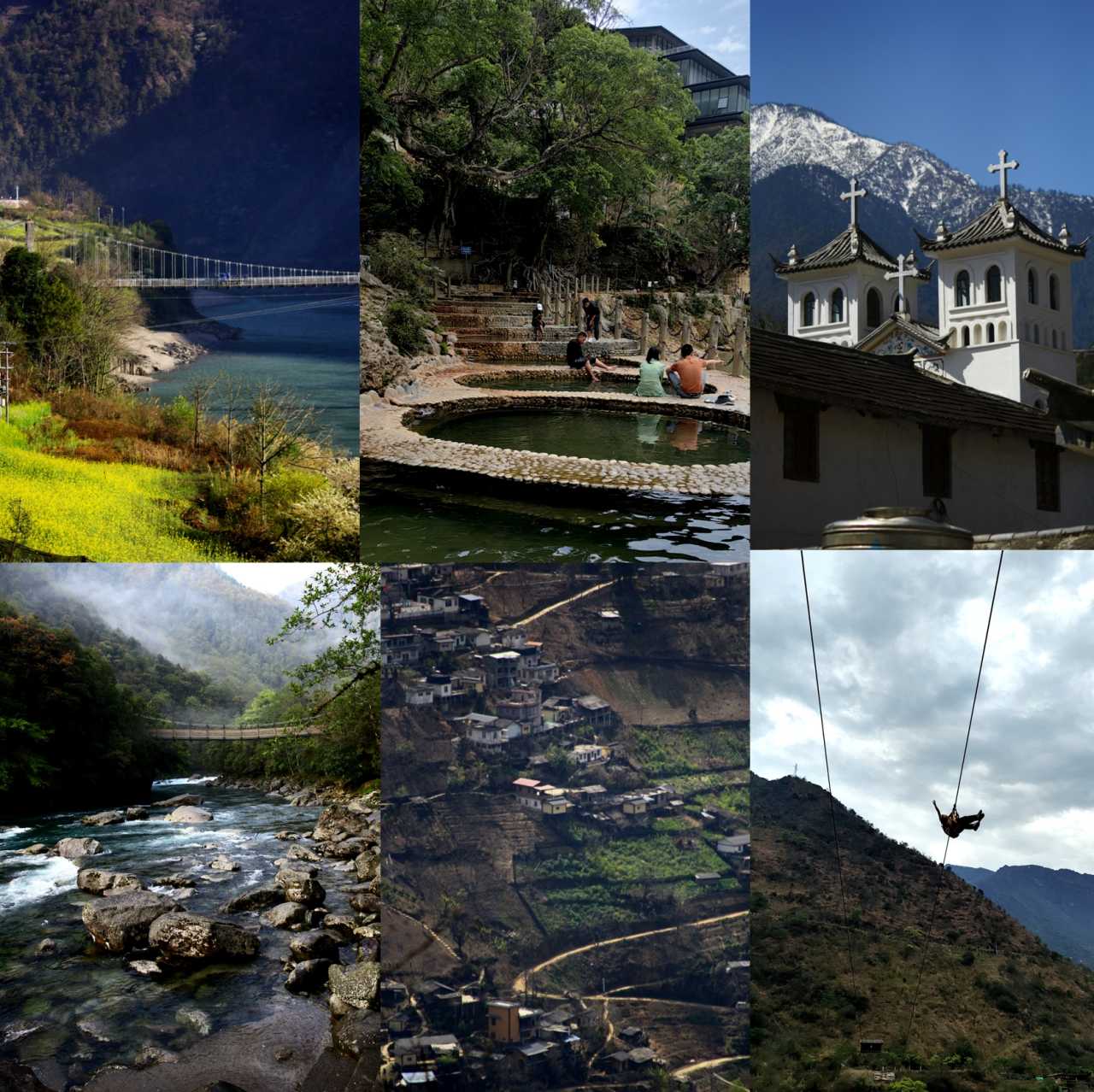
Preserving the architectural style of the 1960s and 1970s, its mottled walls bear the marks of time, witnessing the former glory of Zhiziluo and transporting visitors back to that fiery era.
Xinhua Bookstore, Transportation Bureau, and Other Buildings
These structures still maintain their old appearance, serving as important components of Zhiziluo when it was a county seat. They carry the collective memories of local residents and attract many tourists to explore this sealed-off history.
Cultural Preservation
As the former prefectural and county seat, Zhiziluo preserves a wealth of historical buildings and cultural relics, which are important physical materials for studying the history and culture of the Nujiang region. Fortunately, this year, we saw that a cultural tourism plan based on these heritage features was slowly being implemented. In the old days, everything was slow—trains, carriages, and mail. I hope that while commercial tourism develops, it won't destroy Zhiziluo's "slow culture."
Travel Tips
- Destination: Zhiziluo Village, Pihe Township, Fugong County, Nujiang Lisu Autonomous Prefecture, Yunnan Province.
- How to Get There: Self-drive or hire a car. It's 58 kilometers from Fugong County, about 1.2 hours.
- Tickets: No ticket required.
- Time to Spend: 2-3 hours.
- Reminders: It's recommended to stay overnight; you can watch the sea of clouds the next morning. Accommodation in Zhiziluo is limited; you can stay in Laomudeng Village, which is only 5 kilometers away.
Braving the Dulong River: In Search of the "Tattooed Women"
At dawn, after watching the sea of clouds around Crown Mountain from the observation deck at Zhiziluo, we set off again. Today's destination was Dulongjiang Township. The navigation showed that the 250-kilometer road from Laomudeng to Dulong Township would take 5 hours. We expected difficulties, but it turned out to be even harder than anticipated.
Known Challenges
Dulongjiang is a typical high-mountain gorge landscape, shaped like "two mountains sandwiching a river." The Dugong Highway is the youngest road in China, opened in 1999. Before that, the Dulong River area was only accessible by the ancient Tea Horse Road. Due to the climate, the area experiences up to half a year of heavy snow blocking the roads, making vehicle travel risky. During the rainy season, natural disasters like landslides, mudslides, and falling trees are common.
Twisting Mountain Roads
After passing through Gongshan County on National Highway 219, we turned onto the Dugong Highway. The road was relatively smooth at first, and we stopped to see the Flying Squirrel Waterfall. At that moment, a car came down from the mountain and stopped beside us, saying that the road ahead had been blocked for nearly two hours. They had given up and were turning back. We were reluctant to give up and drove a few more kilometers to the Dimopa Observation Deck to wait. After waiting an hour, a car came down and told us the road was clear.
Then came the endless turns—turns, turns, turns! Roughly counting, the 80-kilometer Dugong Highway has over 700 bends, and it took us over 3 hours to reach Dulong Township. The journey was treacherous, but with waterfalls, snow-capped mountains, and pines clinging to the cliffs, it was well worth it.
Rushing River
The Dulong River is one of Yunnan's six major water systems. It originates in Chayu County, Tibet, flows from north to south through the middle of Dulongjiang Township, and then turns west into Myanmar in the southern part of the township. It is 250 kilometers long, with a significant drop in its riverbed. Its tributaries include over 100 waterfalls, and within the township, the river flows 90 kilometers, rich in hydropower potential. Dulongjiang Township's overall construction is quite new. The small town has all kinds of functional departments and schools, and while supermarkets, restaurants, and hotels are modest, they are well-equipped. The main road is built along the water, with the swift Dulong River running through the entire town. At night, the sound of the river accompanied us as we slept.
The Search
We woke up early the next day to fulfill our mission—to find the "tattooed women." Tattooed women are a unique traditional cultural phenomenon of the Dulong people, traceable back to the Tang Dynasty's "embroidered face tribes." Theories about the reasons for tattooing include avoiding abduction, totem worship, a rite of passage, aesthetic concepts, and spiritual identification. This custom was completely abolished after the founding of New China, in 1967. Currently, there are fewer than 10 tattooed women left among the Dulong people in the Nujiang area.
Just after 8 a.m., we arrived at Pukawang, a village named after the river. Morning mist still lingered on the peaks, and the Pukawang River beside the village flowed swiftly. Walking onto the suspension bridge and looking out over the river felt incredibly soothing. When we asked about the whereabouts of a tattooed woman in the village, we were told there was one in Kongga Village, three kilometers away. Without delay, we headed straight there.
At the entrance of the village, we asked twice before finding the home of the elderly tattooed woman. She was 97 years old and, surprisingly, still sharp-eyed and clear-eared. After obtaining her consent, I hesitated as I raised my camera—wasn't searching for and photographing her just to satisfy the curiosity of outsiders like us? Wasn't it disrespectful to her? In the end, I left a gift and said goodbye to the old woman.
The Long Road Back
We walked along the Dulong River toward the confluence of two rivers. The villages along the way looked well-organized, having been uniformly renovated with government funds. After about 30 kilometers, we reached the area near the confluence of the two rivers at Xiongdang Village. However, it was the fire prevention season, so we didn't continue further. On the way back, passing through Dizhengdang Village, Xianjiudang Village, and Longyuan Village, we could admire the unique architectural style of the Dulong people and experience their traditional culture and way of life. We stopped to take a look before returning to the Dugong Highway. By evening, we arrived at Bingzhongluo Town.
Travel Tips
- Destination: Dulongjiang Township, Gongshan Dulong Nu Autonomous County, Nujiang Lisu Autonomous Prefecture, Yunnan Province.
- How to Get There: Self-drive or hire a car. It's 80 kilometers from Gongshan County, about 2-3 hours.
- Tickets: No ticket required.
- Time to Spend: 1-2 days.
- Reminders: The Dugong Highway is prone to mudslides and landslides; check road conditions before going. This road is challenging for self-driving, with narrow roads and many curves; drive carefully.
Bingzhongluo: A Paradise Shared by Humans and Gods
Bingzhongluo lies in the core area of the "Three Parallel Rivers" World Natural Heritage site. Formerly known as "Jiachangputong" in Tibetan, meaning "Nujiang Xiaokangpu," it was originally inhabited by the Nu people. After Tibetan Buddhism was introduced during the Daoguang reign of the Qing Dynasty, Tibetans gradually migrated here. The terrain is higher in the north and lower in the south, with the Nujiang River flowing from north to south through the entire area. On both sides of the river are Biluo Snow Mountain and Gaoligong Mountain, forming a typical gorge landscape. It is also the last supply stop before entering Tibet.
Nature's Gift
Before reaching Bingzhongluo Town on National Highway 219, you can gradually see some sizable villages, suspension bridges, and bus stops on the opposite bank of the Nujiang. After passing through the Bingzhongluo Tunnel and turning right, you'll immediately see the First Bend of the Nujiang—the rushing river takes a sharp turn here, with the beautiful Kantong Village inside the bend, making it an iconic landscape of Bingzhongluo. Looking to the left, the layers of Bingzhongluo Town amidst the wheat fields resemble a city in the sky.
Skipping Bingzhongluo Town, we continued 12 kilometers along Highway 219, passing through the last village before entering Tibet, Qiunatong. Another 15 kilometers brought us to the Yunnan-Tibet boundary marker, which is also the必经之路 for those taking the Bingchacha route into Tibet. Since we weren't entering Tibet, we turned back to Bingzhongluo for accommodation and rest.
Coexistence of Humans and Gods
Bingzhongluo Town is home to the Nu, Lisu, Tibetan, Dulong, and other ethnic groups, who live together harmoniously, forming a unique ethnic culture. It boasts national-level intangible cultural heritage items like the Nu "Fairy Festival" and the Dulong "Kaquewa Festival." This is a place where Tibetan Buddhism, Catholicism, and Christianity coexist, with some residents also worshipping ancestors and natural spirits.
- Puhua Temple (Tibetan Buddhist): Located in Jiasheng Village, Bingzhongluo, it was built in the 48th year of the Qianlong reign of the Qing Dynasty (1783) and is the only lamasery in Nujiang Prefecture. The temple's architecture is unique, with exquisite murals and Buddha statues inside, holding high artistic value. There is also a Christian church in the village, but it wasn't open.
- Chongding Church: Located in Jiaying Village, Bingzhongluo, it is the largest Catholic church in Gongshan, built by French missionary An-Shou Ren (also known as Father Ren) in the early 20th century, blending Tibetan architectural styles. The interior features beautiful murals and statues, showcasing a unique religious culture. The church doors were locked, so we only viewed the exterior and the biography of Father Ren in the courtyard. We were deeply moved by the dedication of this kind priest—he never left after setting foot on Chinese soil, using his kindness to serve the local villagers until the end of his life. Truly admirable.
Travel Tips
- Destination: Bingzhongluo Town, northern Gongshan Dulong Nu Autonomous County, Nujiang Lisu Autonomous Prefecture, Yunnan Province.
- How to Get There: Self-drive, hire a car, or take a bus. By car, it's 43 kilometers from Gongshan County, about 1 hour. By bus, take a bus from Liuku Bus Station to Gongshan County, then transfer to Bingzhongluo Town.
- Tickets: No ticket required.
- Time to Spend: 1-2 days.
- Reminders: Puhua Temple is open year-round. Chongding Church and the Christian church are only open during events; otherwise, you have to rely on luck.
Wuli Village: A Secluded Paradise
Where Is It?
Wuli Village is a settlement of only 54 households along the Nujiang River. The villagers are primarily Nu, with some Lisu and Tibetans. Built on the ancient Tea Horse Road, the village is hidden in the clouds and mist, like a fairyland. Rustic wooden houses, green fields, and clear streams create a beautiful pastoral landscape, earning it the title of "China's Most Beautiful Village."
How to Get In
Wuli Village is backed by the foothills of Biluo Snow Mountain and faces the Nujiang River, split in two by the Wuli River cascading down from the mountains. The village's geographical environment is relatively isolated, and to this day, there is no road leading to it. Entry is only possible on foot, by motorcycle, or by electric scooter. A 1.5-kilometer section of the ancient Tea Horse Road, carved into the cliff face to the north, is the only transport channel connecting Wuli Village to the outside world. To the south, a chain bridge and a winding stone-paved path connect the village, accessible only on foot.
As we stepped onto the stone path, a little yellow dog approached us, as if it had come to be our guide. It hopped and skipped, leading us up and down steps for nearly a kilometer. Suddenly, a vast expanse of farmland opened up before us. The little yellow dog ran off to reunite with its companion in the fields, and we began our own exploration.
What's Inside?
The ancient Tea Horse Road carved into the cliff face to the north is the only transport route for Wuli Village and a testament to history. Walking along it, you can feel the hardship and resilience of the ancients. Wooden houses are scattered orderly across the fields, accompanied by curling smoke from chimneys, creating a peaceful and harmonious scene. The green mountains and the rustic village complement each other, beautiful like a fairyland. It happened to be planting season, and everyone was busy in the fields, plowing and sowing, a scene of bustling activity.
This village is one of the best-preserved examples of Nu ethnic architecture. The houses are heavily influenced by Tibetan style, mostly built as "wooden pile houses" with stone slab roofs, locally known as "wooden block houses." The upper floor is for living, while the lower floor is for livestock, giving the buildings a simple and rugged appearance.
Most residents follow Lamaism, with white pagodas and Mani piles built in the village, surrounded by prayer flags. Villagers gather around the white pagodas to chant and pray. A minority are Christians, holding worship services in their homes.
How Do They Make a Living?
Due to the relatively closed geographical environment and underdeveloped infrastructure, the village has long been isolated. Villagers use oxen to plow fields on the terraces along the Nujiang River. This "cliff-side agriculture" is backward in technology and extensive in methods, resulting in very low crop yields. In recent years, with the village being named one of China's most beautiful villages and the growing popularity of the Bingchacha tourism route, Wuli's tourism industry has gradually developed. There are already guesthouses, campsites, and artist/writer retreats under construction in the village. It is believed that in the near future, it will become a standard tourist attraction.
Travel Tips
- Destination: Wuli Village, 8.8 kilometers north of Bingzhongluo Town, Gongshan County, Nujiang Prefecture, Yunnan Province.
- How to Get There: From Bingzhongluo Town, drive 8.8 kilometers north on National Highway 219, about 10 minutes. Then hike into the village along the Nujiang River. The northern entrance is the ancient Tea Horse Road (dirt path, accessible by motorcycle), and the southern entrance is a stone step path with relatively better conditions.
- Tickets: No ticket required.
- Time to Spend: 2-3 hours.
- Reminders:
- The paths in the village are all paved with stone, steep and slippery on slopes—be careful.
- The village is split in two by the Wuli River; don't miss either side.
The Peacock Mountain Incident: A Lesson Learned the Hard Way
After staying in Bingzhongluo for two days, we needed to return to Dali. There were two routes back: retrace our steps along National Highway 219, or cross Peacock Mountain via the Degong Highway and go through Weixi to Dali.
The Degong Highway
Starting from Deqin County in Diqing, Yunnan, and ending in Gongshan County in Nujiang, this 95-kilometer road is a section of Provincial Road S318. It broke the geographical barrier between the two regions, promoting the circulation and sharing of resources and boosting economic development in the border minority areas. It connects the areas between the Lancang and Nujiang rivers, linking Dali, Lijiang, Diqing, Nujiang, Tengchong, and Dehong to form the "Three Parallel Rivers" golden tourism route, making "a day trip to see three rivers" a reality.
Peacock Mountain
With 76 peaks over 4,000 meters above sea level, the mountain is dotted with waterfalls and alpine lakes, earning it the name "Mountain of Ten Thousand Waterfalls and a Thousand Lakes." Along the way, there are dense primeval forests with many rare plants. At the summit, there are the Twelve Heavenly Lakes, offering a clear view of Biluo Snow Mountain.
Crossing and Danger
We crossed Peacock Mountain twice, witnessing two different scenes and encountering two different dangers.
During our first crossing in mid-March last year, we hit the heavy snow season. The snow had just started to melt, and the road conditions were extremely poor. The road was only one car width wide, with the rest covered by thick, high snow. Most of the time on the Degong Highway, we slowly drove past snowdrifts as tall as the car. The snow in the sheds along the way was also piled high. When encountering oncoming traffic, we had to reverse into the snow to find a spot to pass. You can imagine the difficulty of those 95 kilometers.
This time, crossing Peacock Mountain was on a clear, sunny day. Along the way, we passed a high mountain plain and could see Biluo Snow Mountain in the distance. We stopped to take photos. Not far from the cliff edge, there were a few large sheep. I marveled to myself: high mountains, distant views, and sheep—I quickly pressed the shutter. Little did I know, danger was approaching.
At that moment, the leading ram walked up to us. My travel companion was photographing with his back to it. When he turned around and saw it, he reached out and touched its head. As the ram lifted its head, it looked at me with a hint of cunning in its eyes. I took a step back, and it charged at me, slamming me hard against the car door. My companion reacted quickly, grabbing the ram's horns and wrestling with it. During those few minutes of struggle, my mind went blank, and I was helpless in the car. Fortunately, my companion seized the moment and jumped into the car, and we slammed the doors and drove off.
After driving several kilometers, still shaken, we stopped to check our injuries. The right side of my calf was swollen from the impact, and his wrist was slightly bruised. Thankfully, neither was serious. At that time, we were likely in territory the ram considered its own. It had initially come toward my companion, and if he hadn't turned around and touched it, the situation could have been much more dangerous. A reminder to all self-driving friends: if
You should also read:
God’s Abandoned Palette: A Self-Drive Journey Through Yunnan’s Dongchuan Red Land
God’s Abandoned Palette: A Self-Drive Journey Through Yunnan’s Dongchuan Red Land Travel has never been about reaching some distant geographic coordinate. It’s about encountering, along the way, the version of yourself buried beneath the rubble of daily routine. During this May Day holiday, I finally…
Continue reading...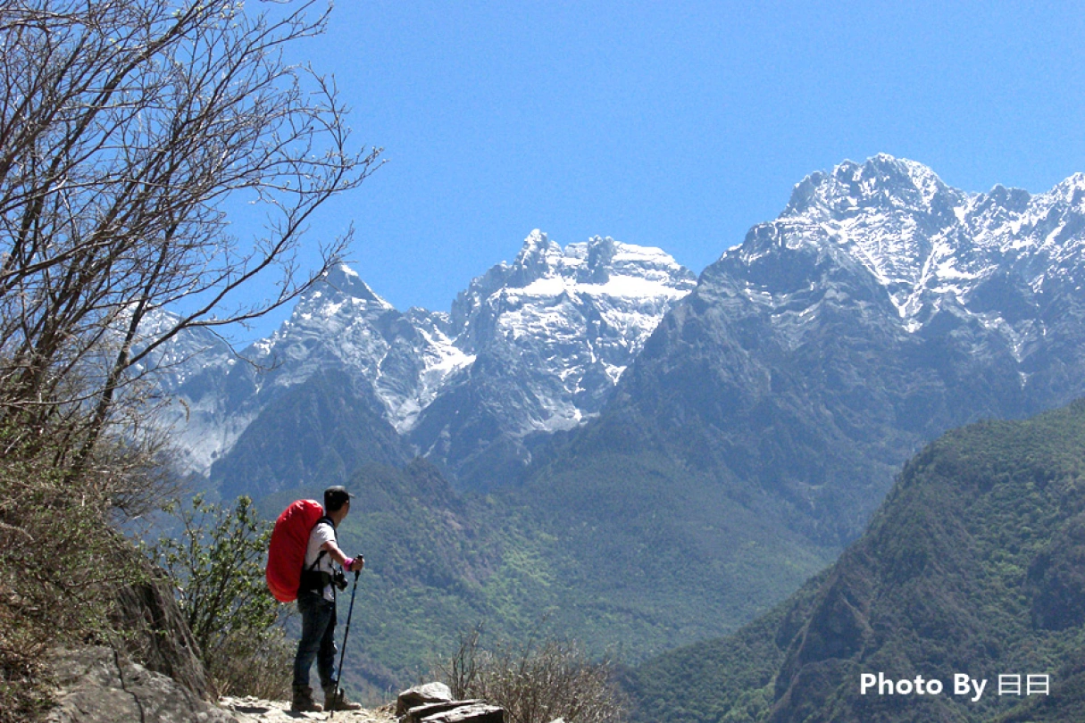
Body in Hell, Heart in Heaven: A Pilgrimage Through Tiger Leaping Gorge — A Dialogue Between Heaven and Earth
Body in Hell, Heart in Heaven: A Pilgrimage Through Tiger Leaping Gorge — A Dialogue Between Heaven and Earth Introduction: When the Gorge Splits Open Beneath Your Feet Some say Tiger Leaping Gorge is the closest place on Earth to the border between "hell" and…
Continue reading...
Cloud Travelogue · Dali of Wind, Flowers, Snow, and Moon: A Three-Day, Two-Night Journey of a Free Spirit
Cloud Travelogue · Dali of Wind, Flowers, Snow, and Moon: A Three-Day, Two-Night Journey of a Free Spirit I am a cultured female foodie with a touch of rogue charm. I slung on my backpack, took my lover's hand, and set off on a spontaneous…
Continue reading...