China on Wheels: Self-Driving G219, A Journey Through the Parallel Rivers Wonderland
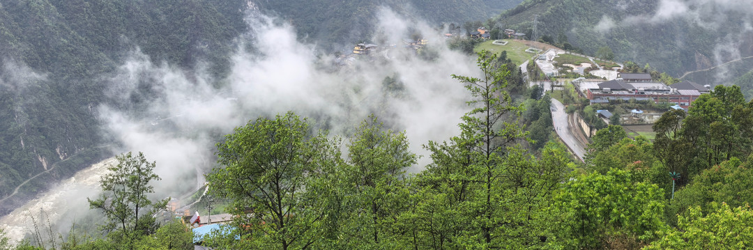
China on Wheels: Self-Driving G219, A Journey Through the Parallel Rivers Wonderland
Prologue: Where a Dream Begins
"Travel across all of China, journey through every mountain and river"—this is perhaps the most primal urge buried in the heart of every travel enthusiast. And when that urge collided with the free highway tolls of the May Day holiday, everything fell into place naturally. On the morning of April 30, 2026, I finally locked in our destination: Dulong River in Yunnan, a self-driving expedition through the Three Parallel Rivers Protected Area. No lengthy planning, no cumbersome preparations—just a campervan, a family of three, and we were off on the G219 National Highway.
This wasn't just a road trip; it was a dialogue with three great rivers—the roar of the Nu River, the depth of the Lancang River, the grandeur of the Jinsha River, and the isolated tranquility of the Dulong River. If you too dream of such a journey, then follow my wheels as we venture into this secret realm tightly bound by the Hengduan Mountains.
Chapter One: What Are the "Three Parallel Rivers"?—The Wonder of a Geographic Marvel
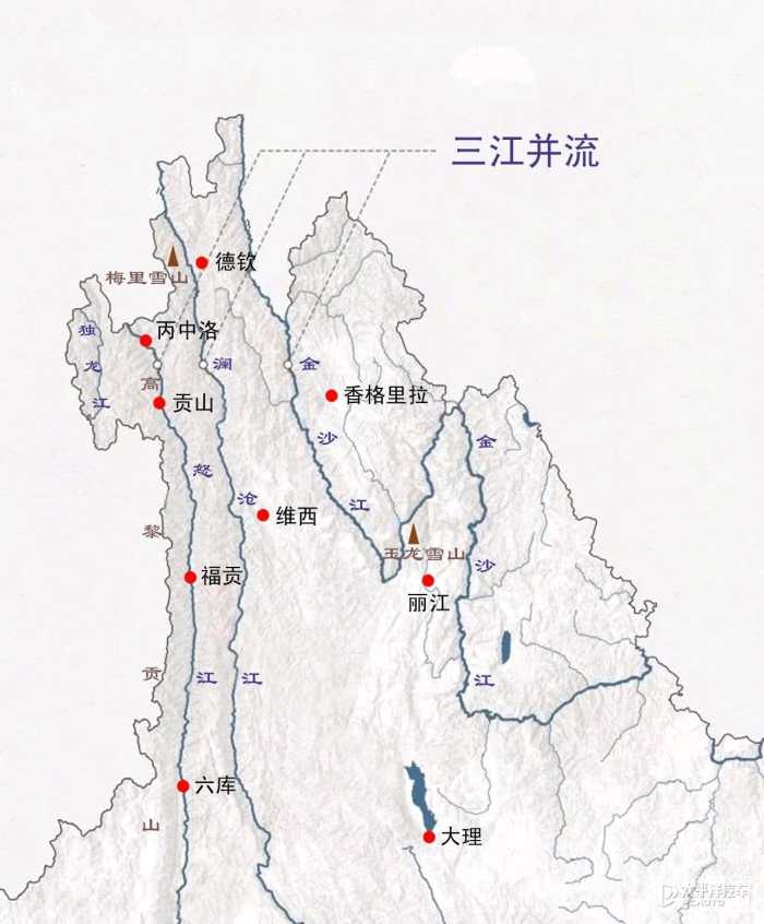
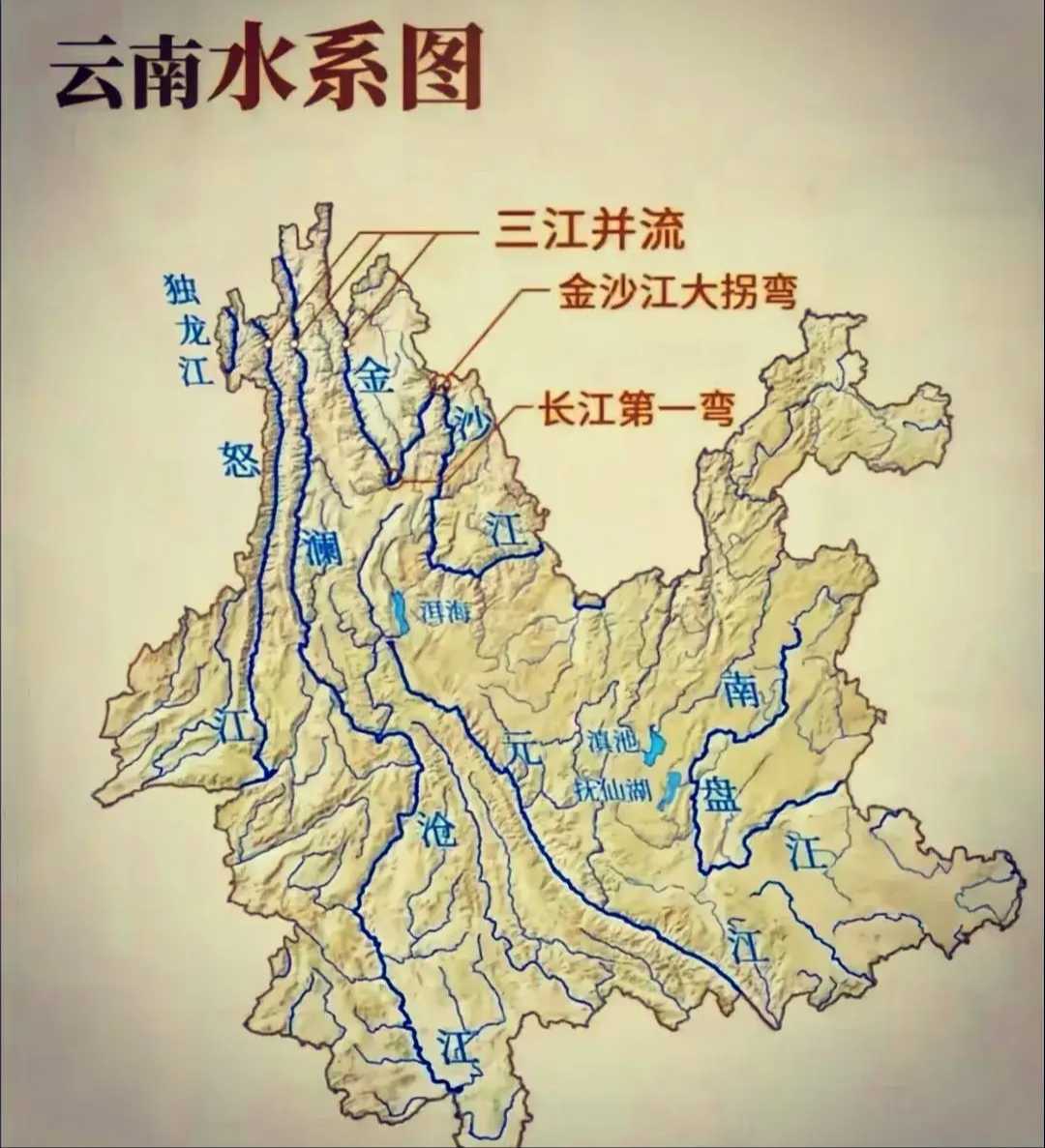
Before setting off, it's worth understanding what we were about to face. The "Three Parallel Rivers" refers to the Jinsha, Lancang, and Nu Rivers—all originating from the Qinghai-Tibet Plateau—which, within Yunnan Province, are tightly confined to a narrow corridor just 60 to 100 kilometers wide, flowing parallel southward for over 170 kilometers. The towering, north-south trending Hengduan Mountains block any connection between the three rivers, creating a rare geographic spectacle: "rivers flowing side by side yet never converging."
You might be astonished by how close they are: the shortest straight-line distance between the Lancang and Jinsha Rivers is just 66 kilometers, while between the Lancang and Nu Rivers, it's less than 19 kilometers. This "so close yet never meeting" configuration has earned the Three Parallel Rivers area a UNESCO World Natural Heritage designation—and made it an irreplaceable pilgrimage site for self-driving enthusiasts.
Chapter Two: From Guiyang to Liuku—A Warm-Up on the Expressway
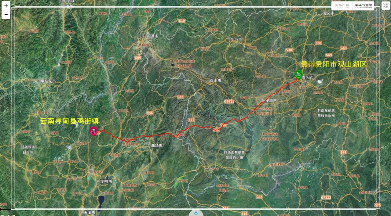
Day 1: Guiyang, Guizhou → Jijie Town, Kunming (April 30)
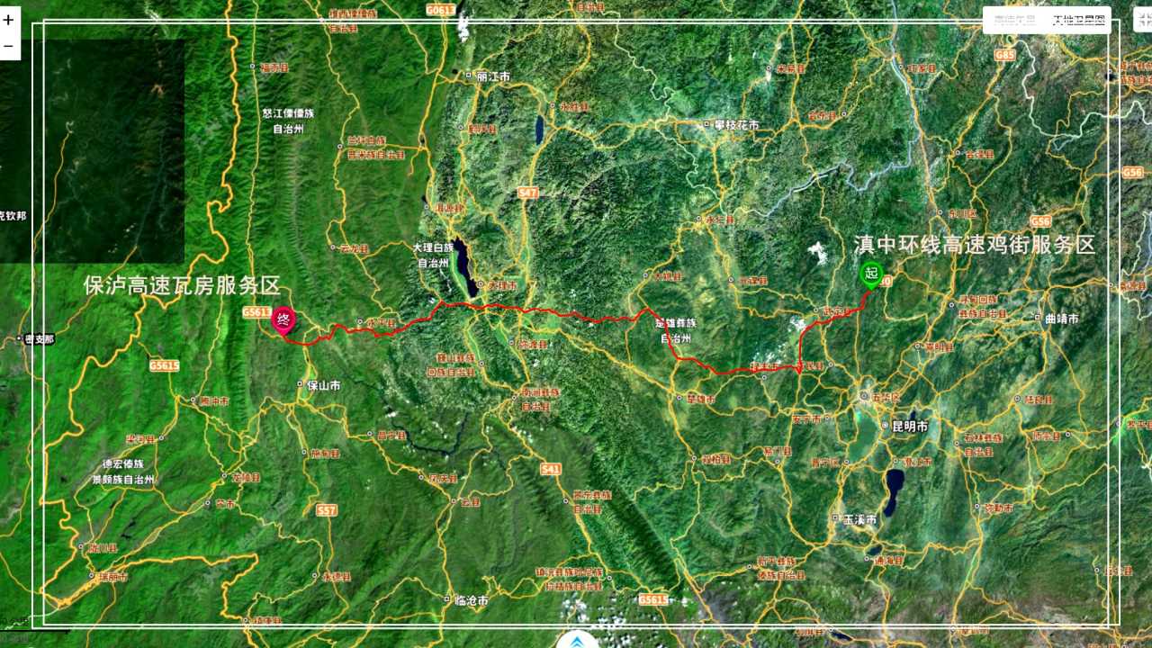
We set off from Guiyang at noon, all on expressways, heading straight for Yunnan. A 490-kilometer drive, 7 hours and 51 minutes total, with actual driving time under 6 hours. The scenery on the expressway was monotonous, but our minds were already in the upcoming Nu River Gorge. We spent the night at the Jijie Service Area on the S91 Central Yunnan Ring Expressway—quiet, with easy access to water, an ideal spot for campervan overnight stays.
Day 2: Jijie → Wafang Township, Baoshan City (May 1)
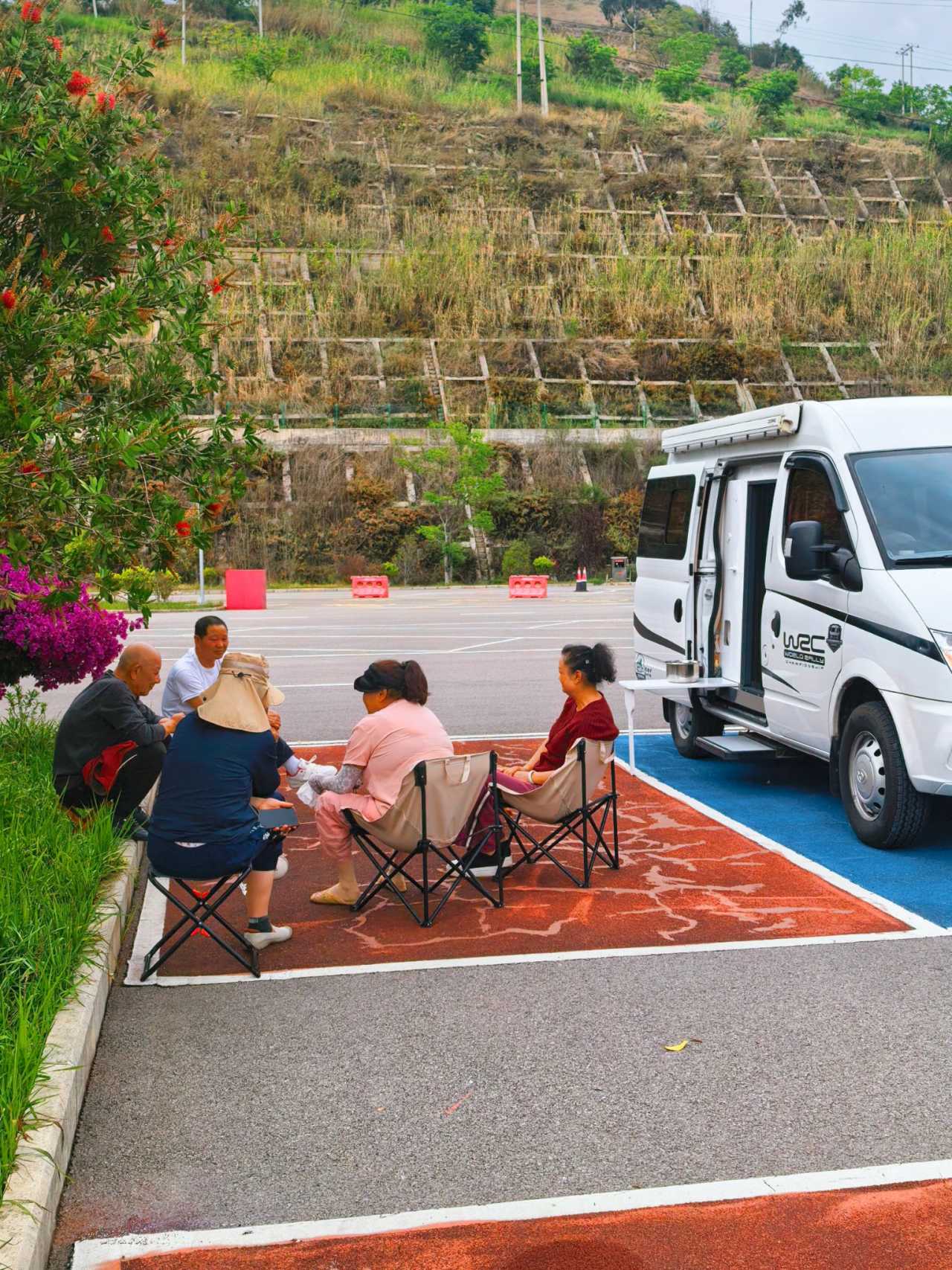
The next day, we continued westward: 494 kilometers, 12 hours and 27 minutes. At 3 p.m., while resting at the Wafang Service Area on the Baoshan-Lushui Expressway, we ran into a group of overlanding travelers from the "Guizhou Outdoor Camping Group" heading to Tibet. We had planned to push straight to Liuku, but seeing them set up tents and cook over open fires, we made a spontaneous decision to join them. What started as a two-person road trip instantly became a "temporary convoy" of four vehicles and eight people. The magic of travel often lies in these unexpected encounters.
Day 3: Wafang Township → Liuku Town, Lushui City (May 2)
After sleeping at the Wafang Service Area, we exited the expressway and pulled into the Liuku toll station. Gaode Maps showed we had saved over 700 yuan in tolls—a genuine reason to feel grateful for the national holiday benefit.
Liuku is the capital of the Nujiang Lisu Autonomous Prefecture and the official starting point of our self-driving journey. After restocking vegetables and food at the local farmers' market, we headed straight for our first stop: Pianma Port.
Chapter Three: Pianma Port—Echoes of History on the Border
Pianma Town, located in western Lushui City, borders Myanmar on three sides and is the only provincial-level port open to foreign trade in the Nujiang region. Formally returned to China in 1961, this land carries a heavy historical legacy.
Fengxue Yakou (Snowy Wind Pass)
At an altitude of 3,150 meters, Fengxue Yakou is a strategic throat point on the China-Myanmar border. With an average annual temperature of -4°C, maximum wind speeds of 25 meters per second, and snow cover from December to April, it was once a key node on the Southern Silk Road. Remains of Japanese bunkers and trenches still scar the landscape. The Japanese occupied this pass in 1942; Chinese military and civilians jointly recaptured it in 1944. Today, it serves as a provincial-level patriotic education base. Standing at the pass, you can almost hear the echoes of history.
Nujiang Hump Route Memorial Museum
In Pianma Town, the "Two Museums and One Monument"—the Hump Route Memorial Museum, the Anti-British Victory Memorial Museum, and the Anti-British Victory Monument—record the bloody struggles of those years. If you have any interest in World War II history, this place is well worth a stop.
Chapter Four: The Nu River Grand Canyon—The Grandeur and Tenderness of the Eastern Grand Canyon

Leaving Pianma, we officially merged onto G219 National Highway, heading north along the Nu River. This highway, known as the "Nu River Scenic Road," runs from Liuku to Bingzhongluo, stretching 268.68 kilometers and connecting all the hidden gems within the Nu River Grand Canyon.
The Nu River Grand Canyon
The Nu River Grand Canyon is the longest, most mysterious, and most pristine of the Eastern Grand Canyons. Within Yunnan, it extends over 300 kilometers, with an average depth of 2,000 meters and a maximum depth of 3,500 meters near Gongshan's Bingzhongluo area. Look up, and you see towering snow-capped peaks; look down, and you see deep chasms. The Nu River, like a sword, has cleaved through the Gaoligong and Biluo Snow Mountains, rushing toward you head-on.
Laomudeng and Zhiziluo
Branching off G219, we climbed about ten kilometers up to an elevation of 1,800 meters on the mid-slope of Biluo Snow Mountain, and there was Laomudeng. In the Nu language, the name means "a place that especially welcomes everyone." The village is framed by the undulating Gongshan Mountains and lifted by the Nu River Gorge below. Here stands the largest Christian church in the Nu River basin—Laomudeng Church, its red-and-white structure strikingly vivid against the green mountains and blue waters.
Higher up lies the "ghost town" of Zhiziluo. In 1986, because the county seat sat atop a massive landslide zone, Zhiziluo was dissolved as a county, half its buildings demolished, and it became a mere village in Fugong County. Today, it's poignantly called the "City of Memory." Every crumbling wall and broken beam seems to freeze the passage of time. Walking through its empty streets, you can almost hear history sigh.
First Bend of the Nu River and Bingzhongluo
On May 4, we arrived at Bingzhongluo. As the Nu River flows near Ridan Village, it is blocked by the sheer cliff of Wangqing, forming a semicircular bend—this is the famous First Bend of the Nu River. From the viewing platform, the river looks like a jade-green silk ribbon, curving around Peach Blossom Island before flowing slowly southward.
Bingzhongluo was in the midst of the "Gongshan Fairy Festival," with crowds filling the streets. We didn't linger. Instead, we headed straight for the most anticipated stop of our trip—the Dulong River.
Chapter Five: Dulong River—A Secluded Jade Sanctuary
The Dulong River region is one of the best-preserved original ecosystems in China. Entering the Dulong River National Park requires advance reservation through the official WeChat account "Dulong River Tourist Area," with a daily visitor cap. After I registered and showed my reservation, the staff simply reminded me about fire prevention and driving safety, then waved me through.
Dulong River Gorge
If the Nu River Gorge is a hidden realm, then the Dulong River Gorge is a world unto itself. The Dulong River only makes a brief detour through Yunnan before being squeezed out between the Gaoligong and Dandanglika Mountains, flowing into Myanmar as one of the headwaters of the Irrawaddy River. The gorge is thick with vegetation, and in the drifting mist, it feels like a fairyland.
Pukawang—Flowing Jade
Six kilometers south of Kongdang Village lies Pukawang. "Wang" in the Dulong language means "river." The Pukawang River, rich in minerals, takes on a unique emerald-jade color, crystal clear, earning it the nickname "flowing jade." A rustic suspension bridge spans the river; from it, you can gaze at snow-capped peaks and dense primeval forest. Walking the circular boardwalk along the gorge or descending to the riverbank via the water-level platform, you can soak in the profound isolation from the world.
Dulong Ethnic Museum
In Kongdang Village, the Dulong Ethnic Museum is the only museum dedicated to the Dulong people in all of China. It systematically presents their history and culture, with the most striking displays being photographs of 64 tattooed-faced women—an ancient custom that has now nearly vanished, leaving these images as the last "living fossils" of Dulong culture.
Chapter Six: Practical Guide and Travel Tips
Best Time to Travel
- September to November: The rainy season ends, the climate is stable, and vegetation is lush—this is the optimal season.
- April to June: A good secondary choice, but be aware of the rainy season from May to August and the snow-blocked period from December to March.
Route Suggestions
- Liuku to Bingzhongluo: Follow the G219 Scenic Road, approximately 268 kilometers in total, with good road conditions.
- Dulong River Tour: Requires advance reservation with a daily visitor cap. Allow at least 1–2 days.
Camping Recommendations
- Jijie Service Area: On the S91 Central Yunnan Ring Expressway, quiet with easy water access.
- Wafang Service Area: On the Baoshan-Lushui Expressway, light traffic, suitable for overnight stays.
- Bangdang Service Area: On G219 National Highway, free parking with restrooms and water.
- Pukawang Parking Lot: 50 yuan for 24 hours, though sometimes unattended and free.
Important Notes
- The Dulong River scenic area prohibits RVs from entering; campervans should inquire in advance.
- When visiting Longyuan Village to meet the tattooed-faced women, be aware of road repairs and landslide risks.
- Respect local ethnic customs; always ask for permission before taking photos.
Epilogue: Three Great Rivers, One Soul-Cleansing Experience
Eleven days on the road, from Guizhou to Yunnan, from Liuku to Bingzhongluo, from the Nu River to the Dulong River. We traversed the magnificent gorges of the Hengduan Mountains, touched the scars of history along the border, and stepped into the Dulong people's last Shangri-La.
The Three Parallel Rivers are not just a geographic wonder; they are a baptism for the soul. When you stand at the viewing platform of the First Bend of the Nu River, watching the water curve around Peach Blossom Island and flow slowly south; when you walk across the suspension bridge at Pukawang, watching the jade-green river flow beneath your feet; when you stand at Fengxue Yakou, feeling the wind of history whistle past your ears—you understand why some say that traveling across all of China is a lifelong dream for every wanderer.
And the G219 National Highway is the key to that dream.
Wheels rolling, mountains and rivers vast. See you on the road, at the next stop.
You should also read:
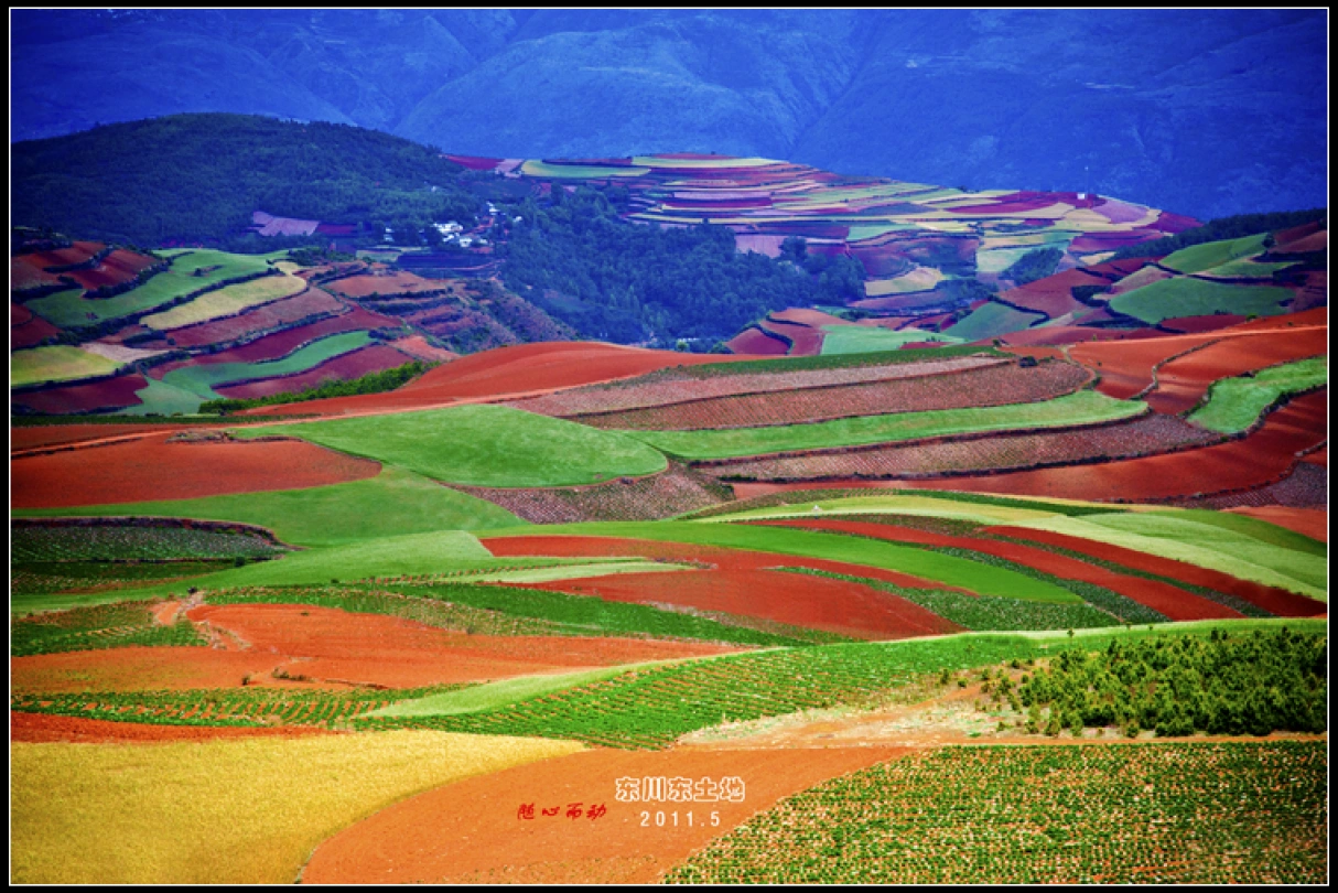
God’s Abandoned Palette: A Self-Drive Journey Through Yunnan’s Dongchuan Red Land
God’s Abandoned Palette: A Self-Drive Journey Through Yunnan’s Dongchuan Red Land Travel has never been about reaching some distant geographic coordinate. It’s about encountering, along the way, the version of yourself buried beneath the rubble of daily routine. During this May Day holiday, I finally…
Continue reading...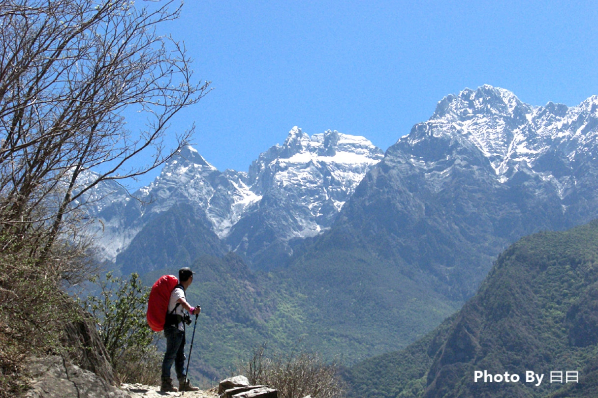
Body in Hell, Heart in Heaven: A Pilgrimage Through Tiger Leaping Gorge — A Dialogue Between Heaven and Earth
Body in Hell, Heart in Heaven: A Pilgrimage Through Tiger Leaping Gorge — A Dialogue Between Heaven and Earth Introduction: When the Gorge Splits Open Beneath Your Feet Some say Tiger Leaping Gorge is the closest place on Earth to the border between "hell" and…
Continue reading...
Cloud Travelogue · Dali of Wind, Flowers, Snow, and Moon: A Three-Day, Two-Night Journey of a Free Spirit
Cloud Travelogue · Dali of Wind, Flowers, Snow, and Moon: A Three-Day, Two-Night Journey of a Free Spirit I am a cultured female foodie with a touch of rogue charm. I slung on my backpack, took my lover's hand, and set off on a spontaneous…
Continue reading...