In the Folds of the Hengduan Mountains, Time Writes Its Poetry
In the Folds of the Hengduan Mountains, Time Writes Its Poetry
Prologue: When Mountains Begin to Speak
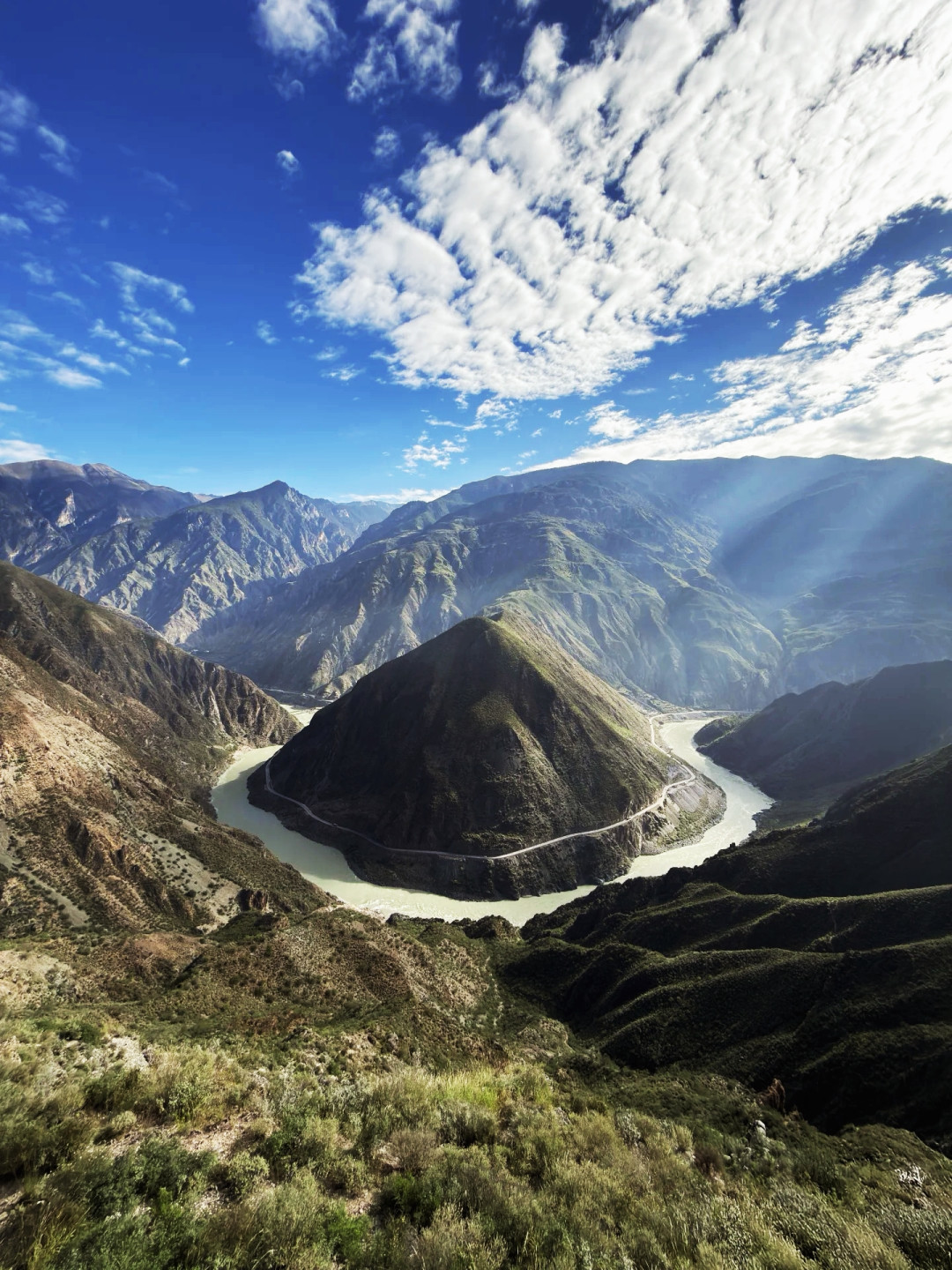
If mountains had a language, the Hengduan range would surely be whispering something—the brittle crunch of hooves crushing millennia-old gravel, the gentle lift of a cloud skirt along the Gaoligong ridge, the furious roar of the Nu River (Salween) as it cleaves through gorges, the sinuous silk-like grace of the Lancang River (Mekong), and the dramatic backward glance of the Jinsha River (Yangtze) at its fateful turning point.
In the autumn of 2025, using the National Day and Mid-Autumn Festival holidays, I dodged the crowds and chose the "Three Parallel Rivers Meili Grand Loop"—entering through Tengchong and exiting via Kunming. Twelve days, crossing the vertical mountains and rivers of northwestern Yunnan, searching for verses carved by time in the folds of the Hengduan range.
My only regret: Yunnan's rainfall was unusually generous this year, so I didn't capture too many "photographs of a lifetime." But the travel experience itself was still well worth savoring.
Pre-Trip Preparation: Turning the Unknown into the Manageable
Altitude Sickness and Health
This route spans a huge altitude range—from dry-hot river valleys to plateaus above 3,000 meters. Apart from Deqin and Shangri-La, most areas are below 2,000 meters. I recommend starting anti-altitude-sickness medication two weeks before departure and continuing after arrival. Adequate sleep and caloric intake are equally important.
Bring motion sickness pills and cold medicine based on your personal needs.
Dressing Philosophy: The Sandwich Method
From short sleeves to down jackets, from windbreakers to thermal layers, you'll need a "wardrobe" to handle the climate shifts. I recommend the sandwich dressing method—easily removable and addable layers for flexibility. A cold doesn't just ruin your travel experience; it also increases the risk of altitude sickness.
Sunscreen! Sunscreen! Sunscreen!
Saying it three times isn't enough—don't forget behind your ears and the backs of your hands. Combine physical protection (hats, sunglasses, sun-protective clothing) with chemical protection (sunscreen).
Transportation Tips
Shanghai → Tengchong: Transfer in Kunming, with two connecting flights. There's a saying in Tengchong: "You can't just come and go as you please." Due to weather conditions, flight punctuality isn't great, and cancellations happen. Luckily, everything went smoothly for us.
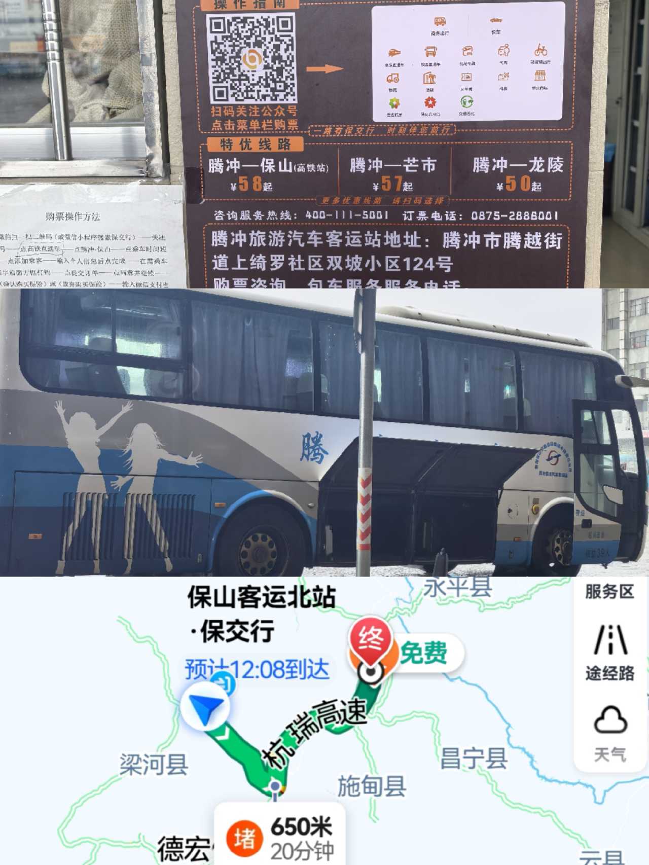
Tengchong → Baoshan: Only by road—you can choose a private car or intercity bus. Book tickets in advance on the "Baoxing" mini-program. The expressway takes about 2.5 hours.
Baoshan → Shangri-La: We booked a private car through Ctrip, with a local driver driving a Volkswagen Tiguan L. The mountain roads are tricky, with mudslide-damaged pavement everywhere. Novice drivers, be careful—the roads in northwest Yunnan aren't easy to handle.
Shangri-La → Kunming: We originally wanted to take the train to see Tiger Leaping Gorge along the way, but tickets sold out instantly. We later found out you can first go from Shangri-La to Lijiang—the expressway now takes just one hour. We were still stuck in the old mindset of "five hours on mountain roads."
Camera Gear
- DJI Mini 4 Pro
- DJI Pocket 3
- iPhone 16 Pro
- Huawei Pura 8 Ultra
Hands-on verdict: The P8U's telephoto and zoom capabilities are genuinely impressive—its professional mode rivals entry-level DSLRs. But video quality falls slightly short; the Pocket 3 can fully replace it.
The Journey: 12 Days Threading Through the Folds of the Hengduan Mountains
DAY 1|The Frontier's First City: Dusk at Heshun Ancient Town
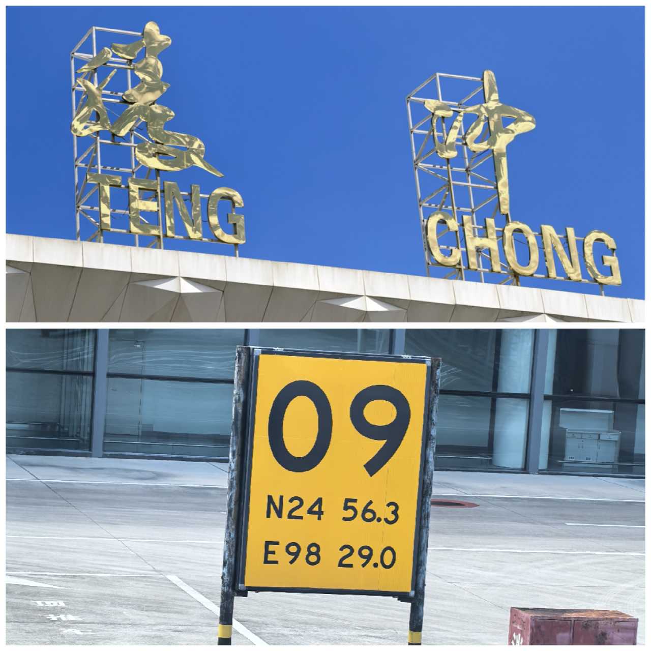
Tengchong's airport is very small—just 15 minutes to the city center. We chose to stay on the edge of Heshun Ancient Town rather than its center, for the sake of peace and quiet. That decision proved absolutely right—several photo spots were within walking distance of our guesthouse.
Heshun Ancient Town is large, with terrain as undulating as Chongqing's. A 9-minute walk according to navigation took us 29 minutes. The "attraction" of Wild Duck Lake was just a park, but on our first evening, we stumbled upon a blazing sunset—the most beautiful sky of the entire trip.
Accommodation recommendation: Heshun Eleven Luxury Panorama Hotel. The room came with a semi-enclosed balcony connected to a private hot spring bath fed by underground thermal waters—you can soak while enjoying the view. The guesthouse's own pour-over coffee was actually better than at the trendy cafés. The biggest surprise: we had a plate of 干巴菌炒饭 (dried porcini mushroom fried rice) for just over ten dollars—apparently it starts at 300 yuan (around $40) in Shanghai.
DAY 2|The Pulse of the Earth: Poems of Volcanoes and Black Stone
It was raining in the morning, and by the time we reached the Tengchong Volcanic Geological Park, the downpour was heavy.
As one of China's four major volcanic clusters and the country's youngest, most concentrated volcanic-geothermal group, the park contains 97 volcanic cones and multiple levels of lava platforms. You only need to climb one of the two main cones—Big Kongshan or Small Kongshan. If you can't make the climb, you can ride a horse (remember to haggle).
I don't recommend the hot-air balloon—it's up and down in just 10 minutes. The real highlight in the park is the powered paraglider.
Important note: Drones are banned inside the park, but after 11 a.m. when the balloon operations stop, you can fly outside the park.
As we drove away from the park and navigated to County Road M74, we could capture the full panorama of the volcanic cluster from the air. People say Tengchong has "ten mountains, nine without heads"—those rounded hills aren't mountains; they are veins of the earth frozen in time. Crater mouths that once spewed lava are now covered in green fuzz, as if the earth is rewriting poetry on its own ruins.
Off-the-beaten-path recommendation: Navigate to the edge of Fengjia Village in Qushi Town, Tengchong, then follow the lower reaches of the Heiyu River to Xiaotang Dam. The black rocks formed when volcanic lava met cold water. The waterfall is small, but the crowds are thin and the scenery is unique. During low-water periods, the water takes on a blue-green hue, creating a stunning contrast against the black volcanic rock.
The Beihai Wetland Park was a letdown—55 yuan (around $7.50) for entry, and any random park in Shanghai has more to offer.
DAY 3|From Border Town to Prefecture Capital: Coffee, the Frontier, and a Long Street Feast
The rain was heavy, and reportedly no flights could land at Tengchong Airport. We left this border town by intercity bus.
Arriving in Baoshan—China's first coffee city. If you're not driving or visiting during harvest season, the Bituo Coffee Cultural Center in the city center is a solid choice. The ground floor sells coffee and merchandise, the second floor is a café, and the third floor has private rooms. The retro-elegant decor is photogenic, and the coffee selection is extensive.
Later, as I sampled coffee all over Yunnan, I found the local beans shine brightest with light to medium roasts—layers of floral, fruity, and wine-like notes, best appreciated as a cold brew.
A border checkpoint anecdote: At security, the officers kept scrutinizing our IDs and even made us get out of the car to "introduce our travel plans." The driver later explained—this route has no group tours; it's usually self-driving tours by locals. With one ID from Dali and two from Shanghai, we apparently looked suspicious, like we might be "trafficked to northern Myanmar." The officers' questioning was just a test to see if we were being coerced. After the realization, we were both annoyed and touched.
From Baoshan, we took the Baoshan-Lushui Expressway, passed through border inspection, and arrived in Lushui City an hour later. This is the capital of the Nujiang Lisu Autonomous Prefecture and a必经之路 (must-pass point) on National Highway 219 into Tibet. It's flanked by the Biluo Snow Mountains to the east and the Gaoligong Mountains to the west, with the Nu River running through its center.
It happened to be National Day, and the pedestrian street near our hotel was hosting a long street feast celebration—passersby could sit down and eat hand-grabbed rice. If you're visiting Yunnan in October, don't miss this kind of experience.
DAY 4|Stone Moon and Sea of Clouds: Finding Poetry in the Fog
Before leaving Lushui, we stopped at the Frontier Bookstore in the Nu River Grand Canyon. Thick fog—my drone flew a full circle and came back covered in moisture. But my phone and Pocket 3 captured the sea of clouds. Sometimes, unexpected disappointments bring unexpected surprises.
The winding mountain road to the Frontier Bookstore in Yangpo Village is a serious test for novice drivers. We saw an accident along the way—a car had slid off the main road. Beginners, be cautious.

The rainbow markings on the road mark the famous section of National Highway 219, the "Beautiful Road." Many marathons and cycling events are held here.
We passed Tiger Leap—a spot where the Nu River suddenly narrows, reportedly to just 10 meters at its tightest point. A massive black reef sits in the middle of the river, forcing the raging waters into a constrained channel. It's smaller in scale than Tiger Leaping Gorge, but each has its own character.
Laomudeng and Zhiziluo—visit them according to your own taste. We got out for a quick photo, but the road was being dug up and repaired along the way, so the experience wasn't great.
Shiyueliang Mountain Lodge: Good wine needs no bush—but this "bush" was deeper than expected. Still, Crown Mountain under the night sky was worth every bump in the road.
DAY 5|Bingzhongluo, Where Gods and Humans Dwell: Time on the Ancient Tea Horse Road
I woke up before 7 a.m. to shoot the morning mist—actually, I could have gotten up even earlier for richer cloud layers. A photography enthusiast chasing that perfect shot truly needs no sleep.
We drove 40 minutes along Highway 219 to the Shiyueliang (Stone Moon) viewing platform in Fugong, then another 3 hours to reach the First Bend of the Nu River. As the Nu River flows past Ridan Village near Bingzhongluo, it's blocked by the sheer cliff of Wangqing Grand Rock, forming a nearly 360-degree U-shaped bend. The river wraps around a horseshoe-shaped peninsula, topped with flat terraces dotted with farmhouses and fields.
I flew my drone up 400 meters—the difference from the viewing platform was minimal, except that the road was also visible in the frame. Personally, I think the Nu River's water is too murky this season; it would be more beautiful in late autumn or winter when the water runs clear blue.
Bingzhongluo: A place where gods and humans dwell. It's the starting point of the Bingzhagala route into Tibet. Its beauty isn't captured in a few photos—it lies in every turn along the way, in the snow-capped mountains hidden in the clouds, in the rushing Nu River, and most of all, in those villages untouched by the world.
In the afternoon, we did a light hike along the Ancient Tea Horse Road: starting from the camp → Stone Gate Pass → suspension bridge → Tea Horse Road → Wuli Village → suspension bridge → Wuli Camp. The entire loop was less than 6 kilometers—an entry-level scenic hiking trail.
Starting from Stone Gate Pass, a narrow, chiseled path is embedded into the cliff face—this is one of the best-preserved sections of the Ancient Tea Horse Road. The path is barely wide enough for one person and one horse. Beneath your feet lies the ancient road, while moss seeps from the cliff walls—a uniquely immersive experience.
Important reminder: Take all your trash with you on the hike, and don't discard any open flames. An hour after we returned to camp, a large plume of smoke rose from Wuli Village—we later learned it was caused by a tourist's cigarette butt.
DAY 6|The Degong Highway and Meili: A Pilgrimage Over Mountains and Passes
Setting out from Bingzhongluo, navigation showed less than 4 hours to Deqin County and Meili Snow Mountain.
The Degong Highway is only 95 kilometers long, but it took 12 years to build. Fill up your gas tank before you set out—there are basically no refueling points once you're on the road.
We climbed steadily, with the road built into the mountainside. It happened to be raining, with rockslides随处可见 (everywhere to be seen). As the altitude rose, we passed through one tunnel after another, the vegetation thinning and the temperature dropping sharply.
After crossing the Peacock Mountain Tunnel (damaged by mudslides, we had to take a detour), we passed the pass and reached Yongzhi Village as the weather cleared—one mountain pass, one kind of weather.
From the Degong Highway, we turned onto the Dewei Line, bidding farewell to the Nu River and running parallel to the Lancang River. Unlike the lush greenery along the Nu River, the mountainsides along the Lancang are barer, with reddish soil and even more landslides.
We arrived at Jixiashan Meili just in time for afternoon tea. At over 3,000 meters in altitude, we decided to just hang around the hotel, eat, and acclimatize.
DAY 6 (Continued)|Meili: No Golden Sunrise, but a Silver Moonlit Mountain
It started raining at Wunongding, and the forecast showed the view at sunrise would be nothing but clouds. Despite all the apps predicting golden-hour lighting on the mountain, we were simply unlucky. They say the sunrise over Meili Snow Mountain is even rarer than over Namcha Barwa—and after this experience, I believe it.
Today's itinerary was a hike through the Baima Snow Mountain U-shaped Valley. A local Tibetan young man served as our guide. We set out from Wunongding and followed Highway 214 to Baima Snow Mountain Tunnel No. 2.
The round trip was 10 kilometers, with an elevation gain of 300 meters. The challenge was the high starting altitude—suitable for those without altitude sickness or who can handle increased oxygen demand during exercise.

We started in a primeval dense forest, following a trail basically trampled out by footsteps. The slope was steep, requiring shoes with good grip. Climbing to around 4,200 meters, we emerged from the trees to an open vista. High-altitude rhododendrons grow here as low shrubs—in June, the entire mountainside is covered in white blossoms.
Crossing the ridge line, we reached the second viewing platform at over 4,300 meters. The wind was strong and the air bitingly cold. From here, we could see the U-shaped valley—a glacial relic from the Quaternary Ice Age. It's now a protected area, so you can't descend from the platform into the valley floor.
From the drone's perspective, as clouds drifted and light shifted, the U-shaped valley took on an oil-painting texture. Our guide was skilled at framing shots and capturing moments—I even got a few "photographs of a lifetime" from the hike.
Hiking Tips: 1. Beginners should definitely hire a local guide for safety. My guide carried all my camera gear—the difference with and without that weight is huge. 2. Stay hydrated—bring water and keep drinking. You can bring snacks but you might not eat them (on a 4-hour round trip, eating too much makes climbing harder). 3. Stay warm—removing layers carelessly can easily lead to a cold. 4. Pack out all your trash—the high-altitude ecosystem is fragile. 5. Don't go if you already have altitude sickness or feel unwell. Descend immediately if you feel discomfort along the way. There are no oxygen or medical facilities on the trail.
By afternoon, the clouds thinned, and we could vaguely see other peaks of Meili. That night, we captured the even rarer moonlit silver mountain—besides seasonal requirements (October to April), you need a clear or mostly clear sky and a bright moon phase. It happened to be the night before the Mid-Autumn Festival—we were incredibly lucky.
DAY 7|Moonlit City: Farewell to Meili, Toward the Jinsha River
Before dawn, buses and cars kept streaming up the mountain to wait for the golden sunrise. But today, luck still wasn't on our side—the clouds were so thick we couldn't even see the mountain. I had to fly my drone up to 450 meters just to catch a glimpse; from the ground, there was nothing but fog.
After 9 a.m., the clouds parted unexpectedly. The full panorama of Meili's Thirteen Peaks emerged—no golden sunrise, but seeing the main peak was still a journey well worth taking.
Leaving Wunongding, we bid farewell to the Lancang River and drove toward the Jinsha River. About 2 hours later, we arrived at the Jinsha River Big Bend viewing platform.
The Jinsha River originally should have flowed south like the Lancang and Nu rivers, but geological movements caused stronger headward erosion on the eastern river system, cutting through the watershed and eventually becoming the upper reaches of the Yangtze, flowing east into the sea. This is a landmark spot marking the transition from China's second-highest topographic step to the first—from here, the Jinsha River leaves the deep gorges of the Hengduan Mountains and enters the relatively gentle Sichuan Basin.
Standing on the viewing platform at 3,000 meters, we looked down at the Jinsha River as it was embraced by the Rizhui Peak, forming a nearly perfect "Ω"-shaped bend. The river roared and coiled like a dragon, its surface shimmering with broken gold under the sunlight—as if you could hear the pulse of the earth thundering.
DAY 8|Shangri-La: The Heart of the Moon, and Unexpected Surprises
We didn't make a special trip to Songzanlin Monastery. At the Songtsam hotel, we caught a glimpse of its back while viewing an exhibition. If you want to photograph it in morning mist, come in winter.
A pleasant surprise: we discovered a shop in the old town that combines a guesthouse, a photography studio, and a café—Sangzhu Coffee. It started raining in the afternoon, and we ducked inside to take shelter, only to be captivated by the modern Tibetan aesthetic of the interior.
We spent the last two days of the trip resting in Kunming, visiting museums and exhibitions—that will be covered in a separate article.
Accommodation and Food: The Scenery as Part of the Journey
All the hotels we booked on this trip were located within scenic areas—the views themselves were part of the experience.
Heshun Eleven Luxury Panorama Hotel, Tengchong: The room and guesthouse terrace offered panoramic views of the ancient town and surrounding mountains and water. For two evenings, the viewing platform was ours alone. The room had a private hot spring bath connected to underground thermal waters, perfect for soaking while enjoying the view. The guesthouse's own pour-over coffee was better than at the trendy cafés. The 干巴菌炒饭 (dried porcini mushroom fried rice) cost just over ten dollars—in Shanghai, it starts at 300 yuan (around $40).
Shiyueliang Mountain Lodge: Deep in the mountains, but worth it. Crown Mountain under the night sky was unforgettable.
Jixiashan Meili: At over 3,000 meters, afternoon tea was the perfect time to acclimatize. Though we missed the golden sunrise, the moonlit silver mountain more than made up for it.
Epilogue: In the Folds of the Hengduan Mountains, Hearing the Voice of Time
Twelve days, from Tengchong to Meili, from the Nu River to the Jinsha River, from dry-hot river valleys to high-altitude snow mountains—in the folds of the Hengduan Mountains, time writes its poetry.
Those black rocks solidified by volcanic lava, those V-shaped gorges carved by rushing rivers, those snow-capped peaks wrapped in clouds, those ancient roads shattered by horse hooves over millennia—every place is a stroke of time's brush, every scene a verse in the earth's poem.
Some landscapes require luck to witness; some experiences require courage to embrace. But no matter what, when you stand in the folds of the Hengduan Mountains, you understand—the mountains speak without words, yet they say everything.
Finally, a few suggestions for those who come after:
- Timing: Late autumn or winter, when the water runs clear blue and sunlight is more reliable, makes for better photography.
- Transportation: Novice drivers shouldn't blindly attempt self-driving—the roads in northwest Yunnan aren't easy.
- Altitude sickness: Don't underestimate it. Adequate sleep and caloric intake are key.
- Environmental protection: Take your trash with you, don't discard open flames, and protect this fragile ecosystem.
- Mindset: Not every dawn brings a golden sunrise over the mountain, but every turn might bring a surprise.
In the folds of the Hengduan Mountains, time writes its poetry. And you are becoming part of that poem.
You should also read:
Complete Guide to Fuxian Lake: A Yunnan Hidden Gem I've Visited Three Times – Ask Me Anything!
Complete Guide to Fuxian Lake: A Yunnan Hidden Gem I've Visited Three Times – Ask Me Anything! Why Fuxian Lake? If you ask me which place in China is worth visiting again and again, my answer isn't Lijiang or Dali – it's Fuxian Lake. In…
Continue reading...
Dali Shuanglang: Meeting Your Laziest Self in the Slow Time by Erhai Lake
Dali Shuanglang: Meeting Your Laziest Self in the Slow Time by Erhai Lake Prologue: A Name, A Journey Some places, just by hearing their name, make your heart yearn. Shuanglang is like that for me. I can't remember when I first heard the name "Shuanglang."…
Continue reading...
Before the Tongue: Discovering Nuodeng, the Ancient Salt Town Time Forgot
Before the Tongue: Discovering Nuodeng, the Ancient Salt Town Time Forgot There’s a peculiar magic in places that have been left behind by history. They don’t try to impress you. They don’t have polished welcome centers or laminated maps. They just are—worn, quiet, and utterly…
Continue reading...