Racing to Colorful Yunnan: A Self-Drive Journey Through Western Yunnan's Secret Loop — A Dance with Mountains and Rivers
Racing to Colorful Yunnan: A Self-Drive Journey Through Western Yunnan's Secret Loop — A Dance with Mountains and Rivers
Introduction: As Far as Your Heart Goes, Your Wheels Will Follow
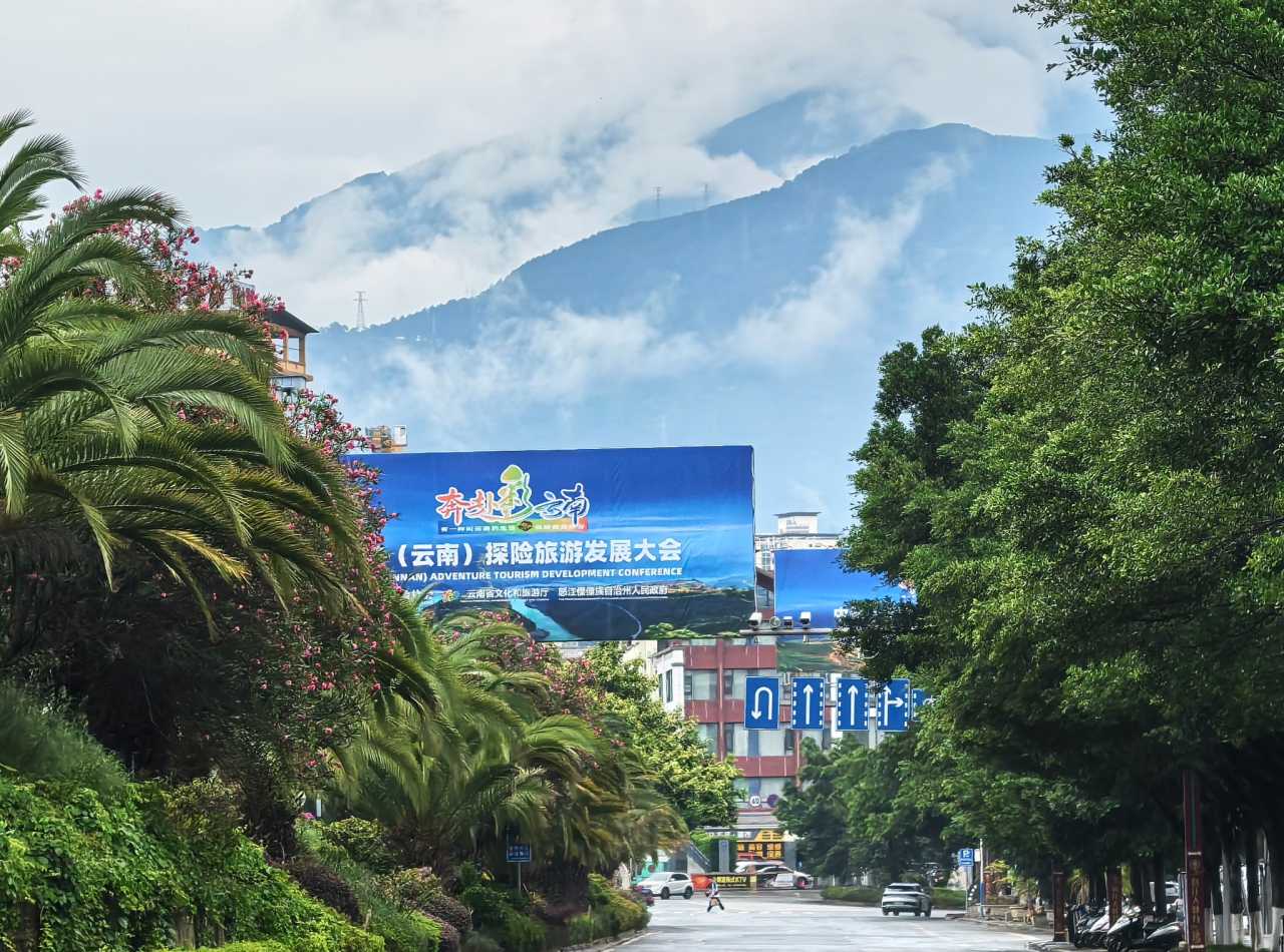
When the plane touched down at the foot of Cangshan Mountain, and the warm early-summer breeze of Dali wrapped around me, I knew that this self-drive journey through Western Yunnan — three months in the making — had finally transformed from lines on a map into the road beneath our feet. We happened to arrive just as the "Racing to Colorful Yunnan" outdoor adventure tourism conference kicked off, as if fate had a hand in it — not that we had chosen Yunnan, but that the land of colorful clouds was calling us.
The Western Yunnan Loop (Dianxi Loop) is still a relatively niche self-drive route, gradually gaining attention among travelers thanks to the completion of the Degong Highway. It doesn't have the fame of the Sichuan-Tibet Highway, but it hides landscapes more breathtaking than you'd imagine. Our group of six, two cars, nine days on the road — we didn't buy a single entrance ticket, yet we traveled through scenery every single day. That, perhaps, is the most luxurious experience of a road trip: the scenery is always on the road.
Pre-Trip Preparation: The Ritual of a "Huaqiao Summit"
Three months before departure, I posted a callout in our Southern Xinjiang self-drive group chat. Soon, six like-minded friends responded. We had traveled together through Southern Xinjiang back in 2019 — a tight-knit team of three families and six people, already well-attuned to each other. This time, everyone was entrusted with a key role: one handled navigation, another managed finances, one served as the team medic, and another was the dedicated photographer — team spirit was established before we even set off.

Before leaving, we gathered in Huaqiao, Kunshan. The reason for choosing this spot? Both Shanghai and Suzhou have direct metro lines to Huaqiao, making it convenient for everyone to meet up. The crew jokingly called this pre-trip gathering the "Huaqiao Summit" — which, to be honest, was just an excuse to get together and eat a good meal. After a toast to boost our spirits, everyone was itching to go, as if the wheels were already turning.
Practical Tips: - Road conditions: Excellent — basically no special requirements for your vehicle. We rented a Tank 300 and a Toyota RAV4, which were more than enough. - Scenery: Stunning natural landscapes — high mountains (Gaoligong Mountain, Biluo Snow Mountain, Meili Snow Mountain, Jade Dragon Snow Mountain), gorges (Nu River Grand Canyon, Lancang River Grand Canyon, Jinsha River Grand Canyon). The Nu River Grand Canyon offers the best views, while Erhai Lake has the most laid-back, charming atmosphere. - Food: The cuisines of different ethnic groups are each unique, completely overturning our previous perceptions of Yunnan food. "Mind-blowing" became a recurring word during our trip. - Weather: Be prepared for the "four defenses" — rain, sun, cold, and heat. May marks the start of the rainy season in the Nu River basin. The weather forecast showed rain every day, but in reality, it alternated between clear and rainy, completely unpredictable. On the day we drove the Degong Highway, we cycled through all four defenses within a single day. - Altitude sickness: Feilai Temple (Flying Temple) and Shangri-La have the highest altitudes, around 3,400 meters (11,155 feet). Take precautions. It's advisable to choose hotels with oxygen supply equipment. - Costs: Compared to our trip to Yili (in Xinjiang) around the same time last year, expenses were about half — great value for money.
Day 1: From Shanghai to the Nu River — A 3,000-Kilometer Dash
Our early morning flight from Pudong landed in Dali by noon. As we exited the airport, we spotted the counter for a car rental company. We were too early — the cars hadn't arrived yet. Following the staff's suggestion, we headed to the airport employee cafeteria — a place few travelers ever visit. The food was cheap and surprisingly good. Our friends from Suzhou brought some seasonal Dongshan white loquats — sweet, juicy, and refreshing.
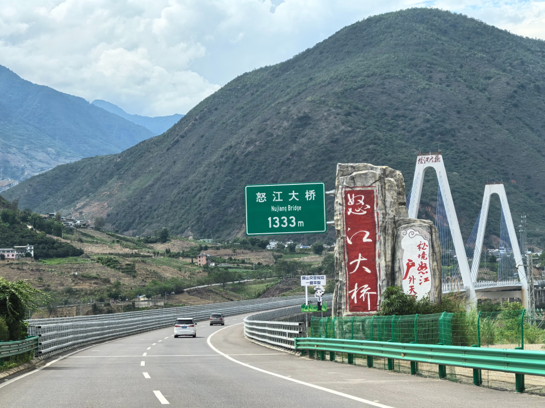
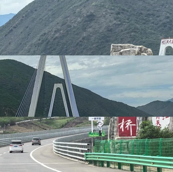
Picking up the cars was quick and easy, all done through a mobile app. The two vehicles parked side by side; the Tank 300 looked especially imposing, its rugged style perfect for photo ops. From Dali to Lushui, it was highway all the way — 250 kilometers (155 miles), about three hours. After crossing the Nu River Bridge, we entered the Nu River Gorge and headed north.
The weather cleared up — the forecasted rain didn't materialize. We arrived in Lushui just after 4 p.m., still hours before dark. At first, we were confused about the relationship between Lushui and Liuku. We later learned that Liuku Town is both the seat of the Nujiang Prefecture government and the Lushui city government — the central hub of the region, far more developed than we had imagined.
We checked into the Hilton Garden Inn Nujiang, right on the banks of the Nu River. The river-view rooms offered spectacular scenery, with a panoramic view of the Nu River Grand Canyon. This hotel is Hilton's third Garden brand property in Yunnan and the first international brand hotel in Nujiang. The room rates were surprisingly affordable — we initially suspected it might be a knock-off, but a quick check confirmed it was genuine. The hotel is located in the "Nu River West Bank" area, the central district, with plenty of dining and entertainment options nearby.
For dinner, we chose the Nu ethnic group's hand-grab rice platter at the hotel's first-floor restaurant. When it arrived, everyone was stunned — it was enormous! The grilled meat was fragrant, and eating it with your hands felt just right. Delicious and unique, it instantly made us fall in love with Nujiang.
As night fell, a stunning sunset painted the sky crimson, dyeing the Nu River as well. We strolled along the riverbank, a gentle breeze blowing, soaking in the peace and beauty of this city nestled in the grand canyon.
Day 2: The Nu River Grand Canyon — A 300-Kilometer Scroll of Mountains and Rivers
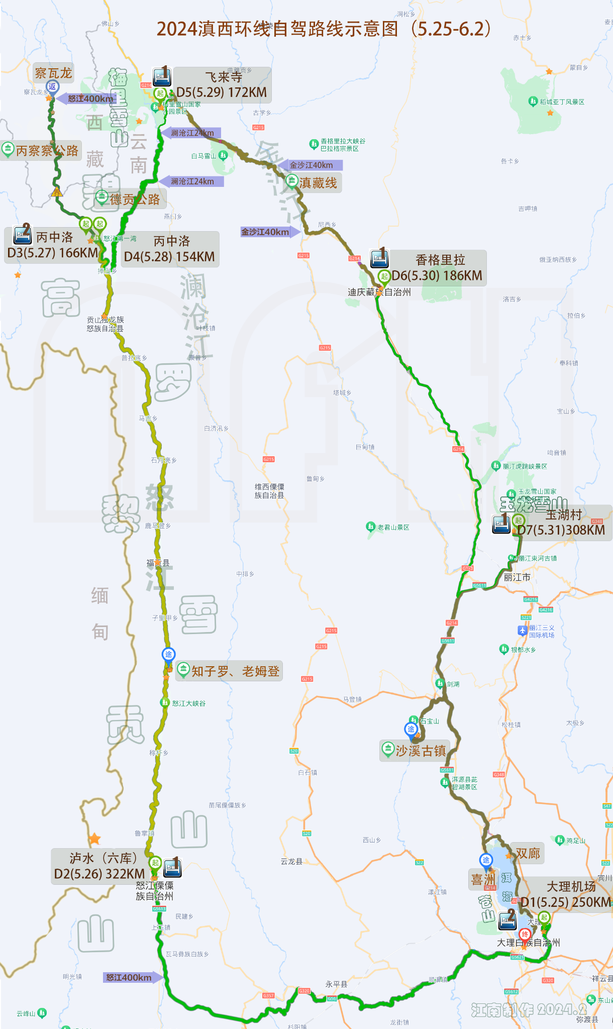
This was the longest driving day of the trip — 320 kilometers (200 miles) alongside the Nu River, heading north along National Highway G219 through the Nu River Grand Canyon. The expressway only reaches Lushui; beyond that, it's G219, with a detour on a winding mountain road to Zhiziluo (Old Bijiang County). We were initially worried about the tight schedule, but with stops along the way, we made it to Bingzhongluo with ease. Credit goes to the stunning beauty of the Nu River Grand Canyon, the excellent condition of G219, cooperative weather, and the non-stop laughter of our group.
Breakfast was at a street-side shop specializing in lamb noodle soup. One word: incredible. Stumbling upon such a delightful meal got everyone chatting excitedly.
It had rained the night before, and the misty mountains looked like ink-wash paintings, adding an air of mystery and beauty. The local government has invested heavily in the "Nu River Beautiful Highway," complete with nearly 300 kilometers (186 miles) of fitness trails and highway rest stops — a truly ambitious project. When we saw the sign reading "Nu River Beautiful Highway Greenway — Total Length 279 km," we were astonished — this is the longest canyon greenway in the world! It's a pity the trail seemed underutilized; we barely saw anyone cycling or walking along it.
Zhiziluo: A "Ghost Town" Frozen in Time
Zhiziluo, meaning "good place" in the Lisu language, is now known as the "City of Memory" or "Ghost Town." Years ago, experts predicted a major natural disaster here, so the population was relocated. The county government became a village committee, and time seemed to stand still — everything remained as it was in the 1980s. Walking through the streets felt like traveling back to that revolutionary era.
In truth, Zhiziluo's abandonment was historically inevitable. Perched on a ridge of Biluo Snow Mountain at 2,023 meters (6,637 feet) in the middle of the Nu River Grand Canyon, it was once an important post on the ancient Tea Horse Road. But its location on the mountainside limited development, and the construction of the riverside road along the Nu River sealed its fate. In 1974, the Nujiang Prefecture government moved down to Liuku; in 1986, Bijiang County was dissolved, split between Lushui County and Fugong County. The once-prosperous Bijiang vanished from the map, leaving only this ghost town behind.
Today, a few residents still live in Zhiziluo, running small restaurants and selling local products. Tourists are scarce, and business is tough. We had hoped to find lunch in the village, but the empty storefronts discouraged us. We ended up heading down to Fugong County for a meal.
The Stone Moon and the First Roar of the Nu River
At the peak of the central Gaoligong Mountain range, at 3,300 meters (10,827 feet), there is a massive穿透洞 (through cave) formed by limestone erosion, known as the "Stone Moon." Eighty-two years ago, after the Chinese Expeditionary Force suffered defeat in Myanmar, 30,000 soldiers were forced to retreat through the "Wild Man Mountains," returning to China via this very route. The heroes are gone, but their spirits remain.
The First Roar of the Nu River is a rapid and turbulent stretch of the river in Gongshan County. The river narrows abruptly from over 100 meters (328 feet) to just over 50 meters (164 feet), with massive boulders blocking the flow. The water surges, crashing against the rocks, sending spray flying and roaring like thunder — showcasing the wildest side of the Nu River.
As we neared Bingzhongluo, the First Bend of the Nu River came into view. The greenway served as an excellent viewing platform, and from a drone's perspective, it was even more spectacular. Due to a landslide a month earlier, the Bingzhongluo tunnel was still closed, but fortunately, there was a detour road near the viewing platform.
Bingzhongluo — the name itself sounds poetic. It's known as "the place where humans and gods coexist." We checked into the Gongshan Yilamila Yunju Hotel for two nights, slowing down our pace. The view rooms were like private observation decks. Dinner was at the hotel, where we were recommended bamboo-leaf vegetables and wild mushrooms — the seasonal specialties worth trying. The bamboo-leaf vegetable looked unassuming but had an impressive pedigree; we had arrived at just the right time.
Day 3: The Morning Mist of Bingzhongluo and the Reality of Bingzhacha
In the early morning, I pulled back the curtains to find a light drizzle falling. Mist hung like layers of gauze, wrapping around distant mountains and nearby forests, painting Bingzhongluo into an enchanting scroll. Perhaps this is exactly what "the place where humans and gods coexist" should look like. At that moment, the scene perfectly matched the hotel's name: Yunju (Cloud Residence).
From Bingzhongluo, we set out to experience a section of the "Bingzhacha" route into Tibet. In the outdoor adventure community, "Bingzhacha" is legendary — a name that commands respect. Our plan was to drive as far as Chawalong and then turn back, passing through attractions like the Stone Gate Pass, Wuli Village, Qiunatong, the Yunnan-Tibet Border, Tiger's Mouth, and the Great Sand Flow.
Wuli Village: A Paradise on the Tea Horse Road
When we reached the Stone Gate Pass, it felt like bursting through a giant mountain gate. The Nu River surged out from between the cliffs, with walls of rock rising vertically on both sides — truly a "one man can hold the pass against ten thousand" kind of atmosphere. All the good scenic spots along G219 have designated parking areas, making viewing both safe and convenient.
Our first glimpse of Wuli Village was from a viewing platform on the Nu River's edge. The village sat on the opposite bank, with houses scattered across the hillside and fields, nestled among green trees and mist — a scene so beautiful it was intoxicating. To actually enter Wuli Village, you have to cross the Nu River and walk along a cliffside section of the ancient Tea Horse Road — a mix of fear and excitement.
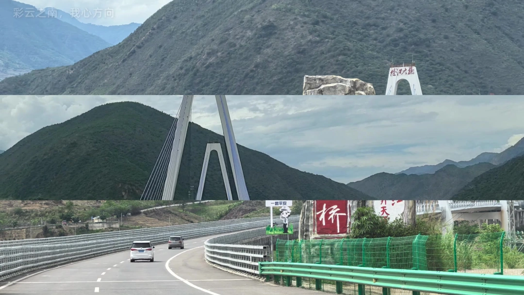
The bridges over the Nu River have "generations" — they are witnesses to historical change. The reinforced concrete bridge on G219 was only completed in 2017. Before that, a steel suspension bridge built in 2004 served as the main access point to Wuli Village. Even older is the somewhat famous "Zhaohong Bridge" — you can guess its construction era from the name — now deemed unsafe and abandoned, it has become a cultural relic in its own right. Beneath the Zhaohong Bridge, there seems to be an even older suspension bridge, now dilapidated and barely recognizable.
Wuli Village has little commercial development — it remains largely in its original state. Although tourism is being developed, the overall preservation is commendable.
The "Surprise" of Qiunatong and the "Shock" of Bingzhacha
Qiunatong is the last village at the northern end of the Nu River Grand Canyon. One of our companions had visited over a decade ago and had fond memories. But when the navigation led us to Qiunatong, we were dumbfounded — was this really the Qiunatong we had been dreaming of? Even our returning friend was confused: where was the old Qiunatong?
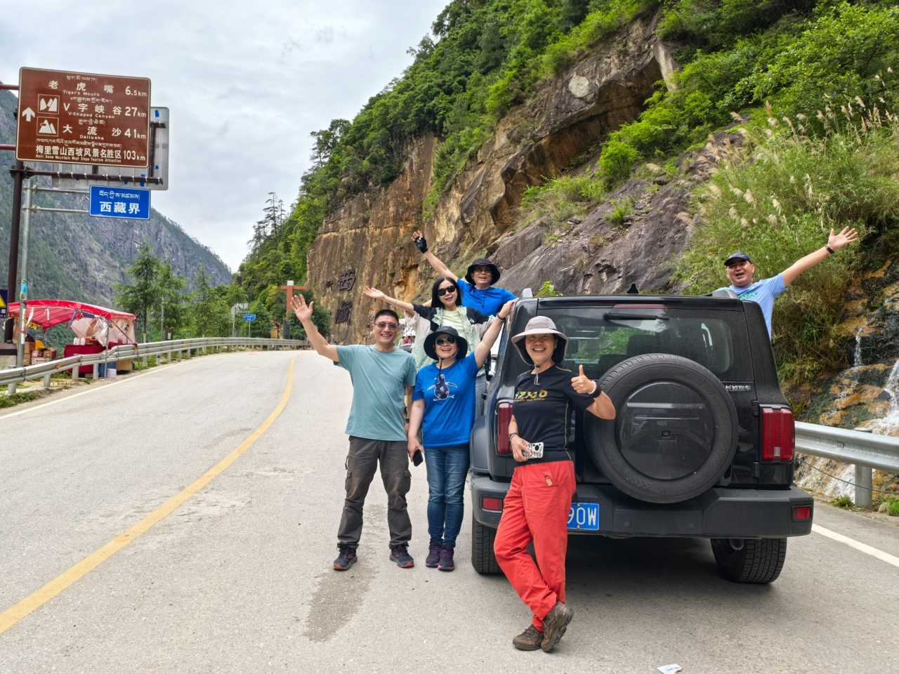
This version of Qiunatong felt more commercialized, suitable for a quick rest and supplies. We wandered through the village but eventually ended up at a bustling restaurant. We ordered a few dishes, and the cooking turned out to be excellent — affordable and flavorful, with the standout being a pot of chicken and wild mushroom soup.
After lunch, we continued north. Passing through the Bingzhongluo border checkpoint, we soon reached the Yunnan-Tibet border. The moment we crossed into Tibet, the road conditions changed dramatically — the smooth asphalt turned into a bumpy, gravel-strewn track. The road narrowed significantly, making it difficult for two cars to pass in some places, and we had to worry about falling rocks and landslides.
We had mentally prepared ourselves for the notorious conditions of Bingzhacha, but we didn't expect the road to deteriorate so immediately upon entering Tibet. Everyone was taken aback. Ideals are one thing, reality another — forget Chawalong. Everyone unanimously demanded we turn back.
Peach Blossom Island: The Joy and Anxiety of Crossing the Bridge
Back in Bingzhongluo, we still had time, so we decided to visit Peach Blossom Island (Zhanatong). It's very close to the First Bend of the Nu River, and the two look so similar on a map that it's easy to confuse them.

Getting to and from Peach Blossom Island was a mix of joy and anxiety. Crossing the Nu River on this type of bridge for the first time was a challenge — it required courage from both the driver and passengers. The clanking, rattling sounds were nerve-wracking; we barely dared to breathe. There are two bridges to the island — the older one is still in use. From Peach Blossom Island, a section of the Tea Horse Road leads to the First Bend of the Nu River, but we didn't have time to take that route. Perhaps another time.
Dinner was once again at the Yunju Hotel — we loved the dining atmosphere and the variety of unique dishes. The combination of fish and lamb was a revelation — the Chinese character for "fresh" (鲜) is composed of the characters for "fish" (鱼) and "lamb" (羊). The lamb was local Dulong black goat. The Nu ethnic group's mixed hotpot was also very authentic.
Day 4: The Degong Highway — The "Artery of Western Yunnan" in the Clouds
The sky outside was overcast, with a light drizzle. Driving the Degong Highway in such weather meant thick fog obscuring the views. It was a pity, but we were also fortunate — no heavy rain meant we could travel safely. During the rainy season, the Degong Highway is prone to landslides and closures, and we had already prepared backup plans for adjusting our route and schedule.
After breakfast, we headed to the Gongdang Sacred Mountain viewing platform. As we climbed the winding mountain road, the fog grew thicker, and Bingzhongluo appeared and disappeared. We had given up hope of seeing anything from the platform — we just wanted to get there, turn the car around, and leave. But when we arrived, a surprise awaited us: a breathtaking, fairy-tale landscape unfolded before our eyes. Everyone was instantly thrilled.
At Pengdang, we crossed the Nu River, left G219, and began our journey on the Degong Highway. This was supposed to be a highlight of the trip, but the weather wasn't cooperating. A light rain fell, and heavy fog filled the mountains, obscuring the grand vistas. All we could see was a dreamlike world of drifting clouds and mist.
The Kongque Mountain (Peacock Mountain) Tunnel is the highest point of the Degong Highway, at 3,400 meters (11,155 feet). It cuts through Biluo Snow Mountain and was the most challenging section to build. With the tunnel, the Degong Highway can bypass snow-covered and icy sections, allowing year-round passage under normal winter conditions. However, it also means missing out on many of the more spectacular views on Biluo Snow Mountain — you win some, you lose some. Fortunately, the old road section still exists. If the weather permits, it's worth taking, provided your vehicle is reliable.
Once through the Kongque Mountain Tunnel, we had crossed Biluo Snow Mountain. A long descent brought us to the Lancang River Gorge, and the weather shifted from rain to partly cloudy. Compared to the Nu River Grand Canyon, the Lancang River Gorge had a completely different character: less delicate, more rugged.
Ninong: When Twelve-Year-Old Memories Collide with Reality
I had visited Yubeng (a famous hiking destination) over a decade ago, exiting through the Ninong Gorge. I had very strong memories of Ninong. Since we were passing by, I made a point to stop and revisit it. Ninong sits right on the banks of the Lancang River, just across the Ninong Bridge. The small village was nearly empty. It was lunchtime, so we found a roadside eatery run by local Tibetans.
Ninong only became accessible by car in recent years. Twelve years ago, when I hiked out from Ninong, there were hardly any places to buy supplies, and the only bridge across the Lancang River was a pedestrian suspension bridge. Today, Ninong is no longer so pristine. That old suspension bridge still stands, a lonely sentinel, but no one crosses it anymore. Back then, we wobbled and trembled our way across the Lancang River; now, the bridge deck is so dilapidated it's unusable.
Leaving Ninong, we reached Deqin County and then climbed up to Feilai Temple (Flying Temple). We checked into the Deqin View Paradise Hotel, where the rooms themselves are excellent viewing platforms for Meili Snow Mountain. On my previous trip to hike Yubeng, I had stayed at the same hotel and was lucky enough to witness the "sunrise golden glow" on the mountain. This time, luck wasn't on our side — the cloud cover was too thick. The shifting clouds hung like heavy curtains over Meili Snow Mountain, only occasionally parting to reveal a glimpse of its beauty.
Dinner was at the hotel; the home-style cooking hit the spot.
Day 5: From Meili to Shangri-La — A Game of Hide-and-Seek with the Clouds
Early morning, I pulled back the curtains to find a white expanse outside, with a light drizzle still falling. The sunrise golden glow on the mountain was out of the question. Mist drifted among the peaks, and Meili Snow Mountain occasionally peeked through, like a game of hide-and-seek. Some devout visitors waited in the rain, hoping for a miracle — but wishes are just wishes. We let it be.

From Feilai Temple to Shangri-La, our route passed through Baima Snow Mountain, Dongzhulin Monastery, and the First Bend of the Jinsha River. There are two ways to cross Baima Snow Mountain: the new road, which goes through several long tunnels — good conditions, fast and convenient, which is the one we took — and the old road, which climbs over a high-altitude mountain pass. In good weather, the old road offers spectacular views of the snow-capped peaks. But the weather was bad — heavy rain and fog, very poor visibility, and the road was poorly maintained. Taking the old road would have meant seeing nothing and facing considerable danger.
The new and old roads ran side by side. With the new road in place, the old one seemed abandoned, its surface deteriorating from years of neglect. This former section of the Yunnan-Tibet Highway was badly damaged, living up to its nickname as the "bumpy, gut-wrenching line" (a play on the Chinese name "Dian-Zang Line").
We passed Dongzhulin Monastery, parked by the roadside, and sent up the drone for a quick reconnaissance. When we reached the First Bend of the Jinsha River, we were surprised to find it was a free scenic area, with excellent facilities and views.
Benzilan: From "Way Station" to "Town"
We stopped in Benzilan for lunch. Returning after more than a decade, I was struck by how much it had changed — it finally looked like a proper town. Benzilan sits on the banks of the Jinsha River. A bridge crosses the river to Derong County in Sichuan Province. Looking back at Benzilan from the Sichuan side offered a different perspective.
In the age of the internet, finding good food is easy, and you rarely get it wrong. This roadside restaurant served excellent home-style cooking, taking simple dishes to a new level — flavorful, beautifully presented, and great value for money.
From Benzilan, roads run along both sides of the Jinsha River to Shangri-La. We first drove a section on the Sichuan side — this was the route taken by the Red Second Army Corps, led by He Long, when they passed through Derong and fought their first battle in Ganzi Prefecture. It became a small "red tourism" journey for us.
When we spotted Napahai Lake, we knew Shangri-La was close. We arrived around 3 p.m. This time, we didn't stay in the old town of Dukezong. Instead, we chose the Anxin Tangchen Oxygen-Enriched Grand Hotel — given Shangri-La's high altitude, we opted for a room with an in-room oxygen generator.
For dinner, we chose Tibetan cuisine at a restaurant near the hotel. It was very unique and satisfying. After dinner, we took a taxi to Dukezong Old Town. The old town still had a decent crowd. But the fire ten years ago destroyed the core area of Dukezong, and the rebuilt district has lost the patina of age. Two years before that fire, on my Yubeng hiking trip, I had stayed in the old town for two nights. Returning now, I felt a sense of loss — the fond memories I had were gone, impossible to find again. Sifang Street (the central square) still looked the same, but the traditional Guozhuang dance was even livelier than before.
Day 6: From Shangri-La to Lijiang — A Symphony of Flower Fields and Ancient Towns
This was the best weather day of the trip. We set off from Shangri-La for Lijiang in the morning, taking the national highway first, passing through Xiaozhongdian. This is the season for beautiful flower fields — small-leaf rhododendrons, which bloom from May to June. It's a wild, roadside scenic area.
An accident happened: while catching the drone mid-air with my bare hand, my finger got hit by the propeller blades. It cut the skin, a bit deep, and it took a while to stop the bleeding. Fortunately, our team medic was on hand to dress the wound properly, which was reassuring.
After enjoying the flower fields at Xiaozhongdian, we turned from the national highway onto the expressway. Exiting the expressway at Tiger Leaping Gorge, we were surprised by the number of tourists. There was a long line of cars waiting to enter the scenic area. We had planned to just use the drone for some aerial shots of the gorge, not intending to hike down to the river. Seeing how time-consuming it would be, we gave up. We parked by the roadside and sent up the drone for a quick look.
Arriving in Lijiang, we headed straight to Shuhe Ancient Town. It was past noon, so we first found a place for lunch. What a coincidence — this restaurant was one I had visited over a decade ago. Although the name had changed slightly (it used to be called "Shuhe Sunshine"), the interior layout and atmosphere were basically the same. We asked, and sure enough, it was the same owner. A restaurant that can operate in the same place for many years has earned its reputation. It had good reviews on Dianping (China's Yelp), so we chose a 6-person set meal, which was very affordable. When the owner learned we were returning customers from years ago, they gifted us a pot of wine...
Conclusion: The Western Yunnan Loop — A Spiritual Practice Dancing with Mountains and Rivers
Nine days on the Western Yunnan Loop. We didn't buy a single entrance ticket, yet we traveled through stunning scenery every single day. From the majestic vastness of the Nu River Grand Canyon to the mist-wrapped tranquility of Bingzhongluo; from the treacherous, breathtaking Degong Highway to the elusive beauty of Meili Snow Mountain; from the Tibetan charm of Shangri-La to the leisurely pace of Lijiang's ancient towns — this route strings together not just landscapes, but a collection of memories, a dance with mountains and rivers.
The Western Yunnan Loop is worth recommending not only for its niche appeal and uniqueness, but because it allowed us to rediscover Yunnan. This is a place with more than just Dali's romantic "wind, flower, snow, and moon" or Lijiang's artsy, laid-back vibe. There's also the wildness of the Nu River Grand Canyon, the challenge of the Degong Highway, the serenity of Bingzhongluo, and the solemn majesty of Meili Snow Mountain. Every kind of landscape is another face of Yunnan.
If you also long for a trip unbound by entrance tickets, if you believe that "the scenery is always on the road," then the Western Yunnan Loop is worth racing toward.
As far as your heart goes, your wheels will follow.
You should also read:
Cloud Travelogue · Dali of Wind, Flowers, Snow, and Moon: A Three-Day, Two-Night Journey of a Free Spirit
Cloud Travelogue · Dali of Wind, Flowers, Snow, and Moon: A Three-Day, Two-Night Journey of a Free Spirit I am a cultured female foodie with a touch of rogue charm. I slung on my backpack, took my lover's hand, and set off on a spontaneous…
Continue reading...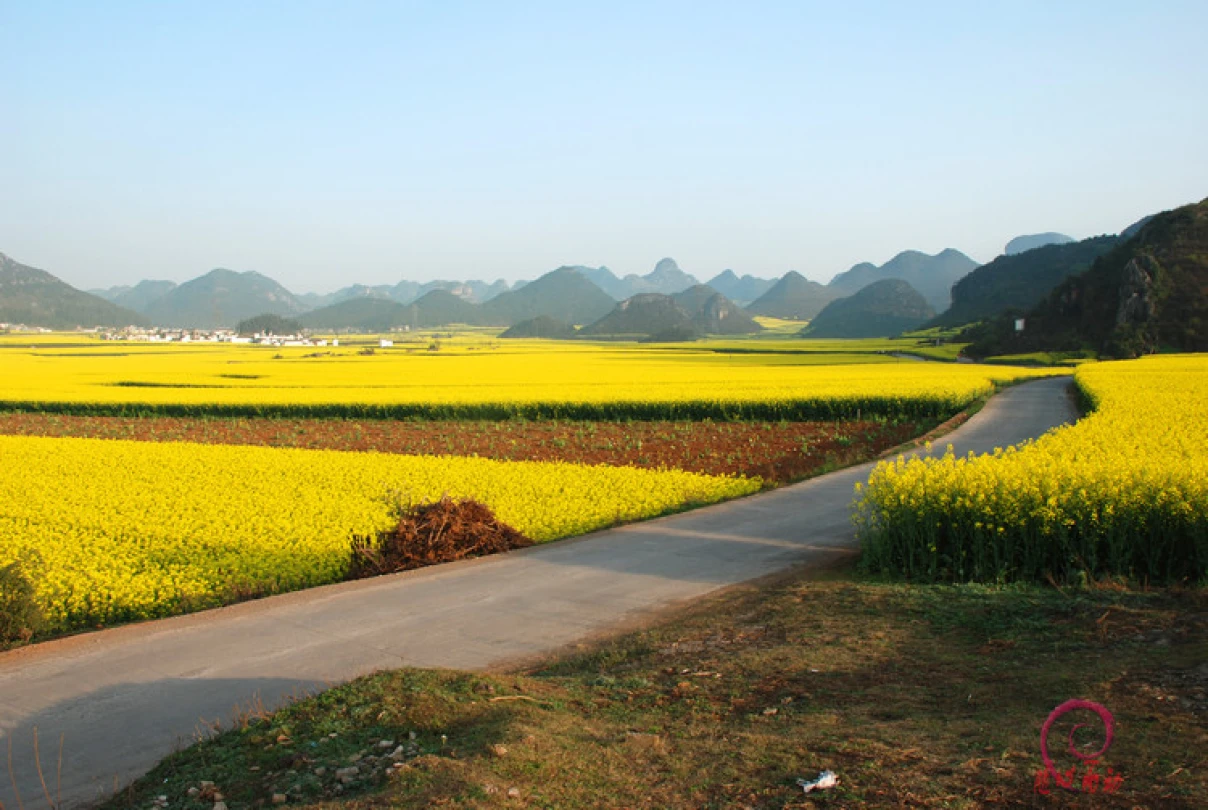
Golden Luoping: A Romantic Encounter with Sunshine and Seas of Flowers
Golden Luoping: A Romantic Encounter with Sunshine and Seas of Flowers Introduction: The Third Time's the Charm Some landscapes are destined to be seen at the right moment. For me, that was exactly the case with Luoping's rapeseed flowers. On February 22, 2011, the Luoping…
Continue reading...
The Meaning of Travel – A Tengchong Story: A Journey of the Heart and Personal Growth
The Meaning of Travel – A Tengchong Story: A Journey of the Heart and Personal Growth Setting Out, Only to Return a Better Self Some say travel is nothing more than leaving a place you're tired of, only to go to a place where others…
Continue reading...