The Three Parallel Rivers: A Seven-Day Epic Through the Jinsha, Lancang, and Nu Rivers

The Three Parallel Rivers: A Seven-Day Epic Through the Jinsha, Lancang, and Nu Rivers
Confucius once said, "Require much from yourself and little from others, and you will keep resentment at a distance." But on this journey, my only regret was this: why hadn't I set out sooner? When the magnificent tapestry of the Three Parallel Rivers unfolded before my eyes, I understood that some landscapes must be experienced in person to be truly appreciated.
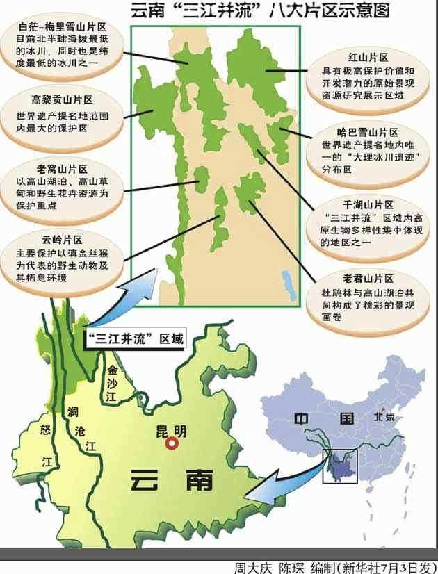
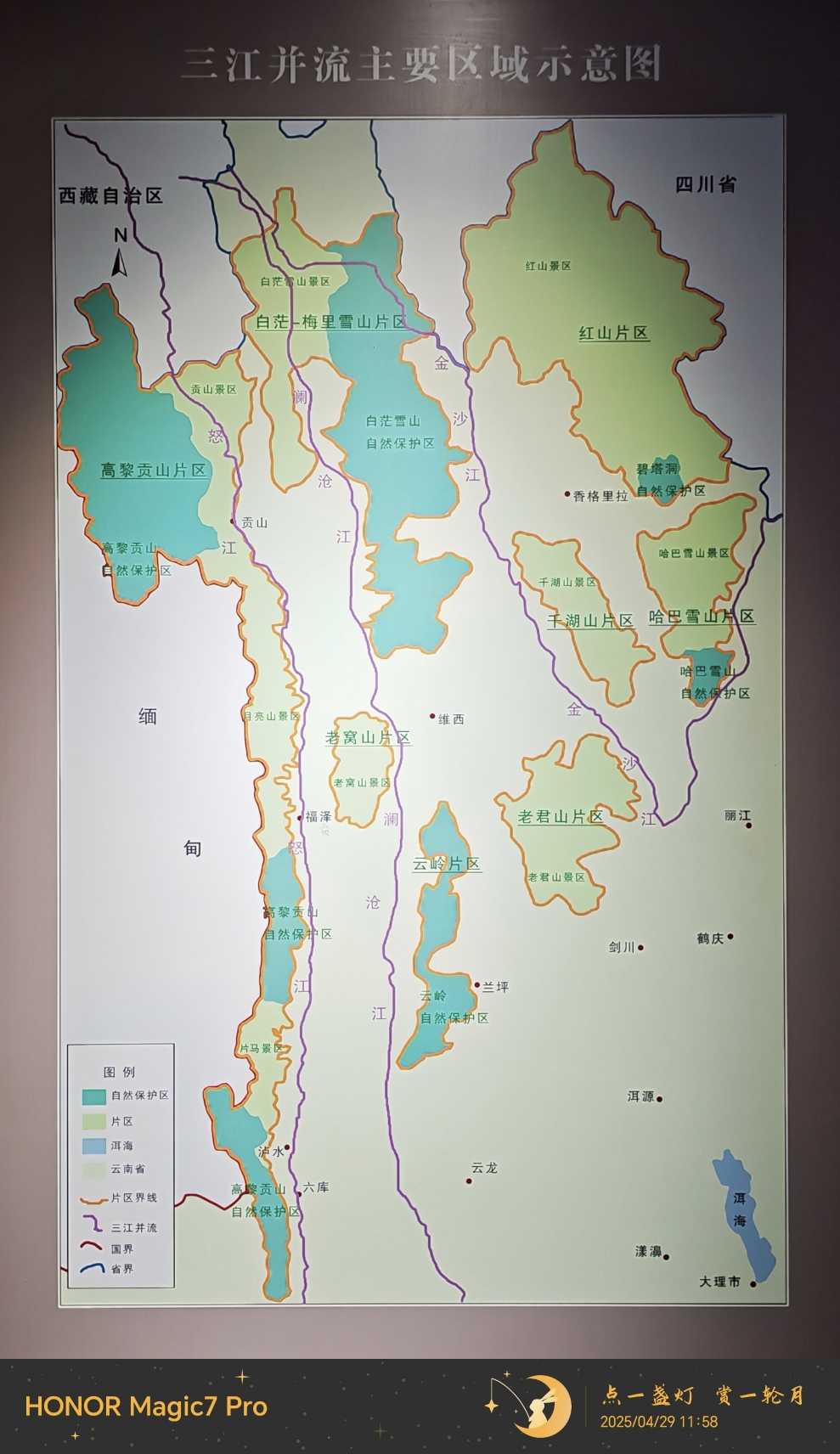
250 million years ago, the cataclysmic collision between the Indian subcontinent and the Eurasian continent carved the tightest geological folds on Earth into the Hengduan Mountains. The Nu River, Lancang River, and Jinsha River—three colossal waterways born on the Tibetan Plateau—surge side by side for over 170 kilometers through the towering peaks of northwestern Yunnan. They connect the regions of Lijiang, Diqing, and Nujiang, threading together nine nature reserves and ten scenic areas. This vast expanse of roughly 17,000 square kilometers was inscribed on the UNESCO World Heritage List in July 2003, making it the largest World Natural Heritage site in China.
To cover this immense territory in just seven days would be pure fantasy. Our strategy was simple yet clever: follow the Jinsha and Lancang Rivers upstream to Deqin, then trace the Nu River downstream to Lushui City. The itinerary was tight, but careful planning made it feel effortless.
Preview: A Glimpse of the Three Rivers' Hidden Wonders
- Along the Jinsha River: In April, the catalpa blossoms dazzle the eye.
- Tongle Village in Weixi: A living fossil of Lisu architecture.
- Cizhong Church: A testament to the collision of Chinese and Western cultures.
- Meili Snow Mountain: Golden sunlight bathing thirteen peaks—a reunion once again.
- First Bend of the Nu River: Nature's masterpiece.
- Dulong River: A miracle spanning a thousand years in a single step.
- Gongshan County Town: Facing the Nu River, backed by the Gaoligong Mountains.
- Nu River Gorge: Shrouded in mist, alive with wind and water.
- Librairie Avant-Garde: A cultural landmark atop the mountains of Lushui.
- Dahuaqiao Hydropower Station: The sixth gem on the Lancang River.
Day One: Lijiang to Weixi—The Gentleness and Power of the Jinsha River
The First Bend of the Yangtze: A Turning Point in History
On April 19, our group of four siblings set out from Lijiang, officially embarking on our Three Parallel Rivers journey. Our first stop was the "First Bend of the Yangtze" on the Jinsha River.
The Jinsha River roars down from the Tibetan Plateau, only to make a sudden turn of over 100 degrees at Shasongbi Village in Shangri-La, forming a rare "U"-shaped bend. Here, the waters slow their pace, as if waiting for something.
This spot is not only breathtakingly beautiful but also steeped in history. During the Three Kingdoms period, Zhuge Liang crossed the river here in the fifth month on his campaign to pacify the southern tribes. In 1253, Kublai Khan led his army across on leather rafts, striking directly at the Dali Kingdom. In 1936, He Long and Ren Bishi led the Red Second Front Army northward from this very point to resist the Japanese invasion. Today, the intake for the Central Yunnan Water Diversion Project is also located here, poised to write a new chapter in history.
Standing before the monument to the Red Army's Long March ferry crossing, the statues on the hillside carry countless revolutionary stories. But what concerned me most on this trip was the progress of the Central Yunnan Water Diversion Project. This massive water resource project—the largest and most expensive in southwestern China—has, since breaking ground in 2017, captured the hopes of millions across Lijiang, Dali, Chuxiong, Kunming, Yuxi, and Honghe. Standing before the intake, I could see the impressive scale of the construction already taking shape, filling me with reassurance. The ecological restoration of Dianchi Lake, which I have long dreamed of, now has a real chance with the living waters of the Jinsha River.
Catalpa Blossoms: A Journey Adorned with Flowers
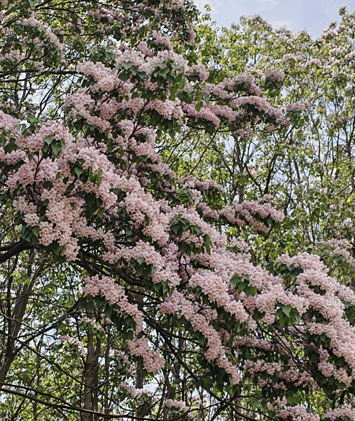
Crossing the Jinsha River Bridge at Shigu and heading north along the river, the roadside catalpa trees were in full, glorious bloom. Their pale purplish-pink flowers spread like clouds and rosy mist, an overwhelming spectacle. I begged my cousin at the wheel to stop the car, just so I could admire those trees draped in blossoms.
The catalpa is a tree native to China, with hard wood and elegantly shaped flowers—a true combination of beauty and utility. The Jinsha River valley is warm, and April is the peak of its flowering season. "The catalpa blooms with unique charm, pale purple hues in layered array," as the ancient poet wrote—a line perfectly realized in this moment. With such floral companionship all along the way, my heart was already soaring.
Missing the Yunnan Golden Monkeys: An Unexpected Serenity
At 3 p.m., we passed through Tacheng Town in Weixi County. Here lies the only national park in China where you can observe wild Yunnan golden monkeys up close—but word had it you could only see them before 10 a.m. We took a chance and went in, only to find it was a private operation. Apart from the morning shuttle to see the monkeys, there was nothing else to do at other times.
Still, the staff allowed us to rest on the terrace. Under a blue sky with white clouds drifting by and a gentle breeze on my face, I closed my eyes and imagined the golden monkeys sitting in the trees, their bright red lips glowing in the sunlight, enjoying the beauty of nature just as I was. Sometimes, missing out can be a different kind of encounter.
Weixi New Town: The Modern Face of the Borderlands

We arrived in Weixi County town at 5 p.m. This is China's only autonomous county for the Lisu people, located in the heart of the Three Parallel Rivers region. The new town is built on a gentle slope, with clean roads and grand public facilities, but it lacks distinctive local character—at first glance, it looks much like any county town in inland China. This very fact reflects the Party and government's substantial investment in the border minority regions: modernization is reshaping this land in its own way.
Day Two: Weixi to Deqin—The Tranquility and Surge of the Lancang River
The Picturesque Lancang: The Secret Behind Its Calm
Leaving Weixi town, we traveled north along the Lancang River. The river's surface was as calm as a windless lake, with mountains and trees reflected in it, forming a series of natural landscape paintings. I wondered: why are the waters of the Lancang so placid?
By the riverbank stood a few fringe trees, their branches laden with white flowers like tassels, light and ethereal, echoing the distant snowy peaks—a scene so beautiful it took my breath away.
Tongle Lisu Village: The Persistence of a Living Architectural Fossil
Today's highlight was Tongle Lisu Village, located in Yezhi Town, Weixi County. This is one of the best-preserved and most distinctive traditional Lisu villages in China.
According to historical records, in 794 AD, the Nanzhao king Yimouxun captured the Shenchuan Prefecture, and most of the Shi Man people migrated to the Weixi area, settling along the upper Lancang River. They became the ancestors of the Weixi Lisu. In 1548, some Lisu, unable to bear oppression, crossed the river and mountains under the leadership of a Tongle chieftain and migrated to live along the Nu River.
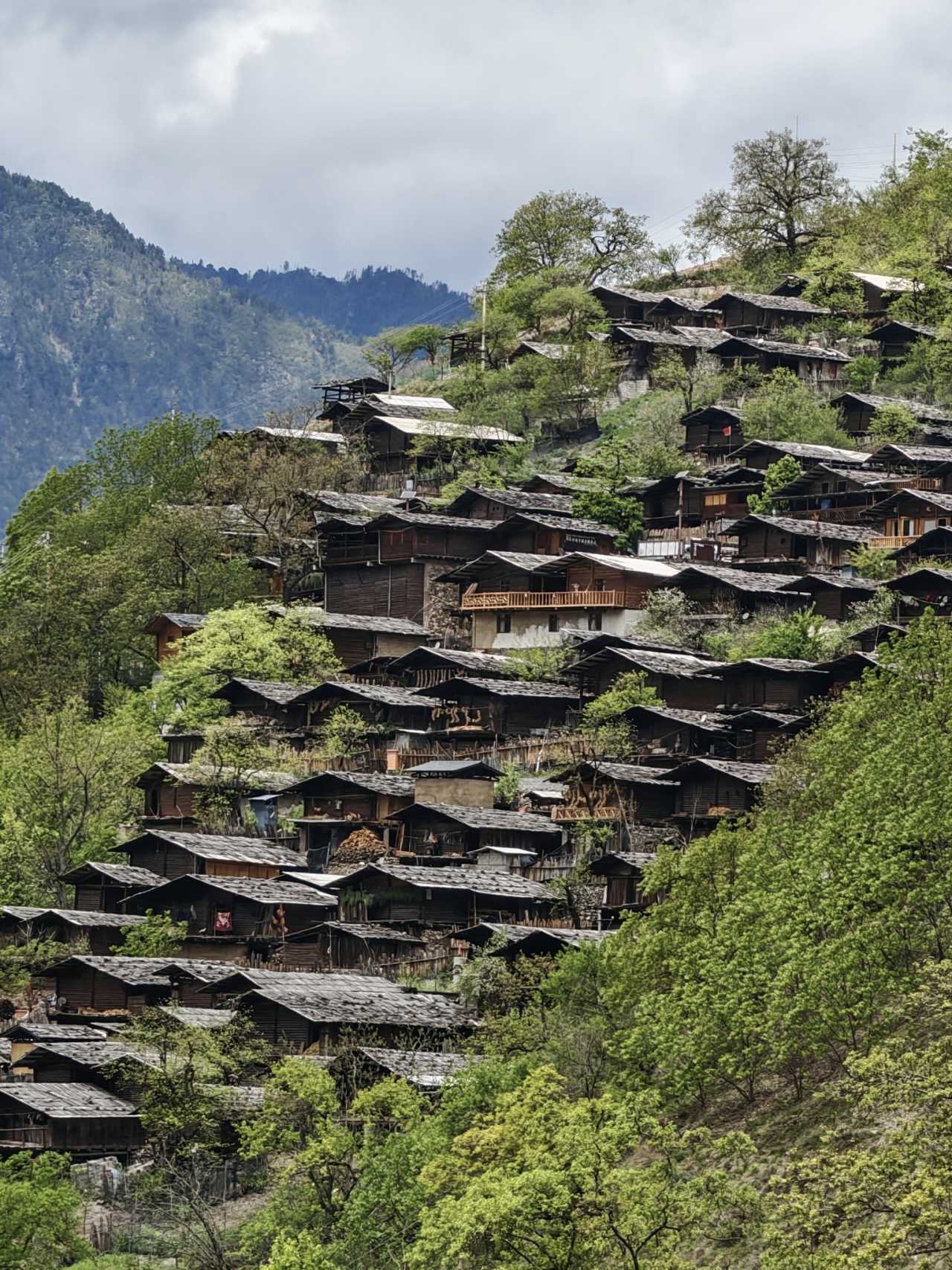
In 2019, the Tongle Lisu residential buildings were designated by the State Council as a National Key Cultural Relics Protection Unit. The houses are built on steep slopes, stacked layer upon layer, tightly arranged, creating a labyrinthine village landscape. The village is backed by snow-capped mountains, facing forests and terraced fields, surrounded by pristine woodland—a scene both magnificent and raw.
The most striking feature is the log houses: peeled logs are notched at both ends and stacked crosswise to form four walls, creating a "well-frame" structure. The roofs use no tiles but are covered with layers of locally quarried natural shale, which from a distance looks like fish scales or armor, giving off a unique texture in the sunlight.
Elderly villagers still prefer to live in traditional houses with fire pits, despite the smoke and soot, because they are full of life. The younger generation's rooms, however, are no different from those in the city, equipped with all modern conveniences. This interweaving of tradition and modernity is the true face of Tongle Village.
Unfortunately, we arrived during the busy farming season, and most villagers were up in the hills planting corn. Fortunately, the village's Lisu customs exhibition hall gave me a deeper understanding of the Lisu people. This is also the birthplace of "Achimugu" (meaning "goat song and dance"), a national intangible cultural heritage—but since it wasn't a festival, we couldn't witness it.
An ancient tree in the village had sprouted tender new blossoms. Old tree, new flowers—it seemed to hold some metaphor for the place.
Cascade Hydropower Stations on the Lancang: A Monument to Human Engineering
Driving along the Deqin-Weixi highway, we encountered the third stage of the Lancang River cascade hydropower stations: the Lidi Hydropower Station. At this point, the mystery of the Lancang's calm waters was solved: the river has been developed into eight cascade stations, and the placid lake downstream must be the next dam!
Nineteen kilometers further on, we came across the Wunonglong Hydropower Station, the second stage in the cascade. The station presents a magnificent sight, flanked by mountains with a backdrop of continuous snowy peaks. The fringe trees by the river, covered in white blossoms like snow, created a delightful contrast with the distant snowcaps.
The Lancang River is an international waterway. After leaving China, it becomes the Mekong River, flowing through Myanmar, Laos, Thailand, Cambodia, and Vietnam before emptying into the South China Sea—earning it the nickname "the Danube of the East." These cascade stations have a total installed capacity equivalent to 1.1 times that of the Three Gorges Dam, generating over 100 billion kilowatt-hours annually, providing massive amounts of clean energy to Yunnan and the entire southern power grid.
Cizhong Church: A Fusion of Chinese and Western Cultures
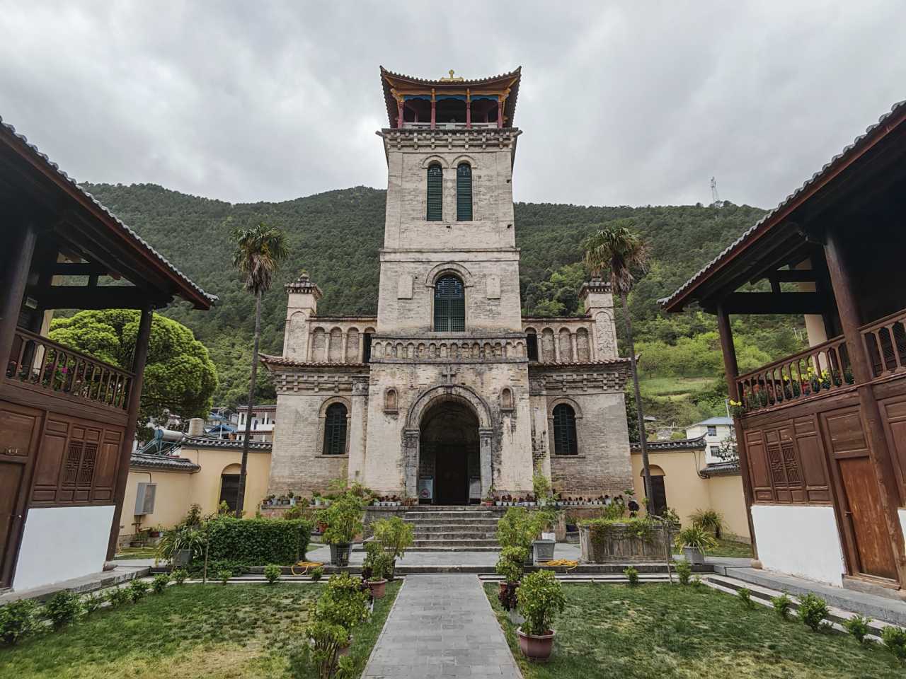
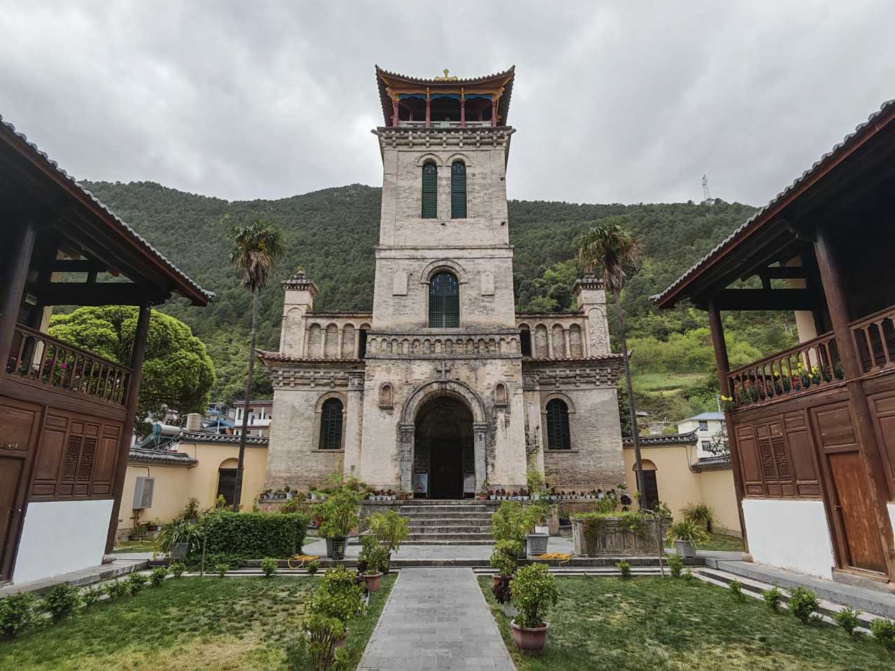
Cizhong Church is located in Cizhong Village, Yanmen Township, Deqin County, at an altitude of just 1,968 meters. It is the only surviving church building in China's Tibetan-influenced areas.
In 1862, French missionaries arrived in the Lancang River Gorge. They built the Cigu Church in 1878. In 1905, the church was burned down during the "Weixi Religious Incident." After the Qing government paid substantial compensation, the church was rebuilt on a new site in Cizhong. Construction began in 1907 and took ten years, finally completing in 1917.
The main building is a brick-and-stone structure combining Chinese and Western styles. Its overall form is Western arched architecture, but the bell tower's upper section features a traditional Chinese four-cornered pyramidal roof with a spire, while decorative elements incorporate Gothic features. The walls and ceiling are adorned with exquisite patterns in Han, Tibetan, and Bai ethnic styles, and the eaves and window lintels absorb Tibetan architectural characteristics. This church stands as a witness to the collision, exchange, and coexistence of multiple faiths and cultures from East and West.
The winemaking techniques brought by the missionaries have been passed down to this day. Around the church, all you can see are wine workshops.
Day Three: Deqin to Bingzhongluo—The Sacredness of Meili and the Wildness of the Nu River
Viewing Meili Snow Mountain from Feilai Temple: The Fortune of Golden Sunlight
Arriving at the Feilai Temple scenic area in the evening, I could hardly wait to reach the large viewing platform to take in Meili Snow Mountain in the twilight. Evening clouds shrouded the "Thirteen Peaks of the Prince," with the main peak, Kawagebo, hidden deep in thick clouds. Only the Mingyong Glacier glistened with crystalline white light.
I stood before the eight white stupas lined up in a row, facing the sacred mountain, and bowed in reverence, praying that I might witness the spectacle of golden sunlight bathing the peaks at sunrise the next day.
At 6:30 the next morning, before dawn had broken, the viewing platform was already crowded with silhouettes. The peaks opposite lay dormant like silent beasts beneath a deep blue sky, their tips occasionally appearing through thick clouds. In late April, the cold was biting. I wrapped my coat tighter, held my breath, and silently prayed.
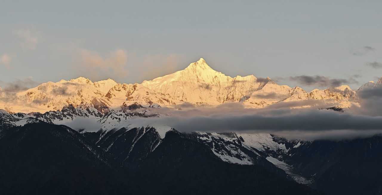
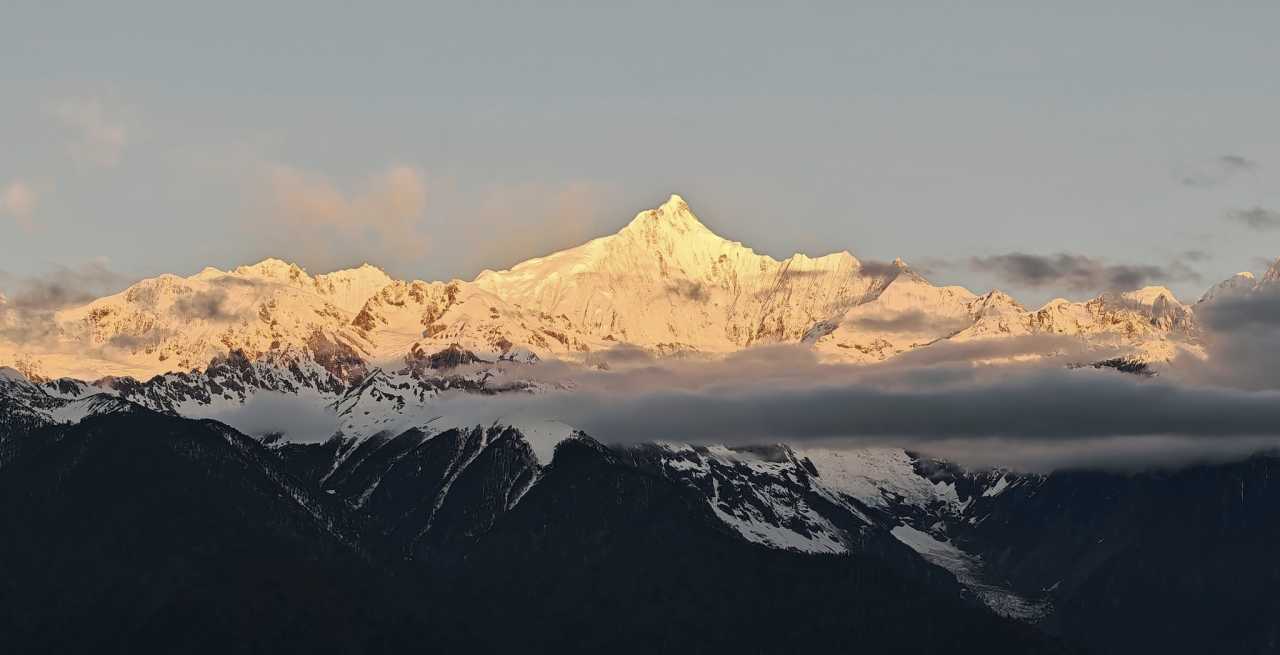
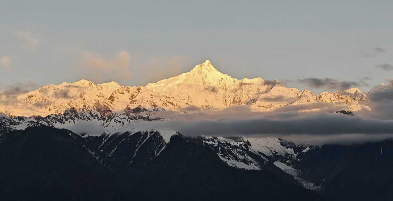
At 6:48 a.m., Kawagebo Peak, at 6,740 meters, finally broke through the clouds and welcomed the first ray of sunlight right on schedule. A speck of gold appeared at the summit, quietly tearing a hole in the dark sky. The golden light spread downward rapidly, flowing and bleeding like molten gold poured from the heavens. First the peak was ignited, then the ridge lines brightened in succession, until finally the entire mountain was set ablaze. In an instant, the snow-covered peak transformed into a giant golden pagoda, blazing with radiant light, majestic beyond words.
The young man next to me was ecstatic: "So beautiful! My wish has come true! I finally saw the golden sunrise on Meili!" My joy was equally evident—after 27 years, I had seen the golden light on Meili once more. No disappointment, no regret. I am a person blessed by Meili Snow Mountain.
Crossing Peacock Mountain: From the Lancang to the Nu River
Leaving Deqin, we took the Degong Highway toward Bingzhongluo. To travel from the Lancang River basin to the Nu River basin, we had to cross Peacock Mountain. As the altitude rose, snow covered the roadsides on both sides—seeing snow in April was an exhilarating surprise.
The Peacock Mountain Pass, at 3,882 meters, marks the boundary between two prefectures. The snow on the summit, the snow-covered pines on the slopes, and the rhododendron blossoms formed a magnificent landscape painting. Forgetting to put on extra clothes, I jumped out of the car and quickly pressed the shutter to capture this unexpected delight.
After crossing Peacock Mountain and descending all the way, we arrived at the banks of the Nu River. The Nu River stretches 3,240 kilometers in total, with 2,013 kilometers within China and 650 kilometers in Yunnan. It flows between the Nu Mountains and the Gaoligong Mountains, running almost parallel to the Lancang, before entering Myanmar (where it is called the Salween River) and eventually emptying into the Andaman Sea of the Indian Ocean. The Nu River is the only major river in China without any hydropower stations built on it.
Seeing a suspension iron bridge spanning the Nu River for the first time filled me with both wonder and admiration. Later, I discovered that such bridges on the Nu and Dulong Rivers are as common as fish in a stream—every few kilometers, wherever there are people, there is one of these iron bridges. This speaks volumes about the state's targeted poverty alleviation efforts in the border regions.
The First Bend of the Nu River: Nature's Masterpiece
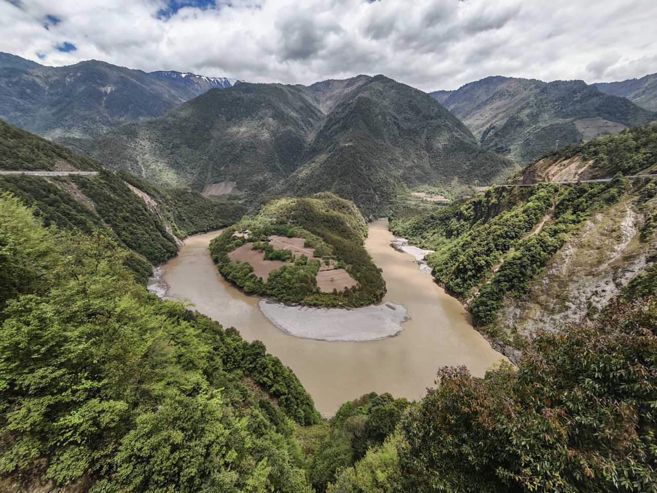
Entering Bingzhongluo, the first thing we encountered was the "First Bend of the Nu River." As the river flows near Ridan Village in Bingzhongluo Township, Gongshan County, it is blocked by the sheer cliffs of Wangqing. The water changes course from north-south to east-west. After flowing more than 300 meters, it is again blocked by the Danla Mountains, forcing it to turn sharply from west to east, forming a semicircular bend.
The next day, we climbed to the viewing platform on Mount Gongdang to overlook the First Bend. The mountain opposite looked like a giant green turtle stretching its head into the river to drink, with its shell raised high in a relaxed posture. The river gently encircled it—a scene both奇特 (peculiar) and heartwarming.
Through Stone Gate to Qiunatong: The Serenity of the First Nu River Village
We arrived in Bingzhongluo in the afternoon, settled in, and headed straight for Qiunatong. Passing through Stone Gate Pass, the cliffs on both sides of the Nu River suddenly narrow, forming a massive stone gate.
Qiunatong Village lies at the northernmost end of the Nu River Grand Canyon in Yunnan, earning it the title "First Nu River Village" at the Yunnan-Tibet border. The word "tong" in the village's name means "village" or "peace" in the Nu language. Before liberation, the social development of this area was still at the stage of primitive society, earning it the label of a "living fossil" of human civilization. Today, the village's appearance has changed dramatically, but many traditional wooden houses remain.
The Catholic church in the village bears witness to the wonder of Bingzhongluo: in this small area, indigenous religions, Tibetan Buddhism, Catholicism, and Christianity coexist harmoniously. Different ethnic groups follow different faiths, and even members of the same family may practice different religions—yet everyone respects one another and lives together in peace.
Qiunatong at sunset was heartbreakingly beautiful. I stood there for a long time, and despite my companions calling me repeatedly, I could barely move my feet.
Day Four: Bingzhongluo to the Dulong River—A Hidden Realm Where Humans and Gods Dwell Together
Mount Gongdang Viewing Platform: Witness to a Land of Gods and Men
Bingzhongluo is known as "a place where humans and gods dwell together." The Gaoligong and Biluo Snow Mountains flank the Nu River, with deep gorges and towering snowy peaks. From the viewing platform, the Nu River winds gently around the Bingzhongluo flatlands, where people of all ethnic groups live and work in peace.
At the platform, we happened to meet a retired senior official from Jiangxi. Traveling alone with his car, camera, and calligraphy brush, he would stop wherever he went, write out classic phrases from the places he visited, and take commemorative photos with his scrolls. Holding his handwritten calligraphy, our group photo became the most treasured memory of this trip.
Zhanatong—Peach Blossom Island: A Hermit's Paradise on Earth
Zhanatong, also known as "Peach Blossom Island," is a traditional Nu ethnic village. By this time, the peach blossoms had already fallen, and there were very few visitors. The island was quiet and peaceful. With over 200 mu (about 33 acres) of farmland, lush vegetation, ancient trees sheltering the houses, and extensive peach groves, it is a truly idyllic scene. In early spring, the blossoms blaze with color, petals falling in profusion—a hermit's retreat on earth, a paradise in the mortal world.
Journey Summary: Lessons from Seven Days
In seven days, we followed the Jinsha and Lancang Rivers upstream and then descended along the Nu River, traversing the very heart of the Hengduan Mountains. From the historical weight of the First Bend of the Yangtze to the natural beauty of the catalpa blossoms; from the architectural living fossil of Tongle Village to the cultural fusion of Cizhong Church; from the golden sunrise on Meili Snow Mountain to the masterful First Bend of the Nu River; from the serene tranquility of Qiunatong to the otherworldly Peach Blossom Island—every scene spoke of the unique charm of the Three Parallel Rivers.
This journey taught me that the Three Parallel Rivers are not just a geographical concept. They are a living epic woven from history, culture, and nature. They show us that on this land, different ethnic groups, religions, and cultures can coexist in harmony. They also remind us that, amid the tide of modernization, protecting these precious natural and cultural treasures is a challenge we all must contemplate.
If you too long for such a journey, my advice is this: slow down and feel with your heart. The magic of the Three Parallel Rivers lies not in ticking off sights in a hurry, but in immersing yourself, in conversing with nature, and in resonating with history. After all, some landscapes can only be truly understood when you have walked through them yourself.
You should also read:
A Journey Through Shuanglang's Guesthouses: Finding Life as It Should Be on the Shores of Erhai Lake
A Journey Through Shuanglang's Guesthouses: Finding Life as It Should Be on the Shores of Erhai Lake Prologue: When Life Hits the Pause Button Have you ever had one of those moments? When the city's towering buildings press down on your chest, when you're swept…
Continue reading...
A Journey Through Time: The Earthen Forest of Yuanmou — April 2011 Chuxiong & Yuanmou Self-Drive Guide
A Journey Through Time: The Earthen Forest of Yuanmou — April 2011 Chuxiong & Yuanmou Self-Drive Guide Some journeys are destined to take root in your memory. In April 2011, I set out from Shuhe in Yunnan, heading north toward the Chuxiong Yi Autonomous Prefecture,…
Continue reading...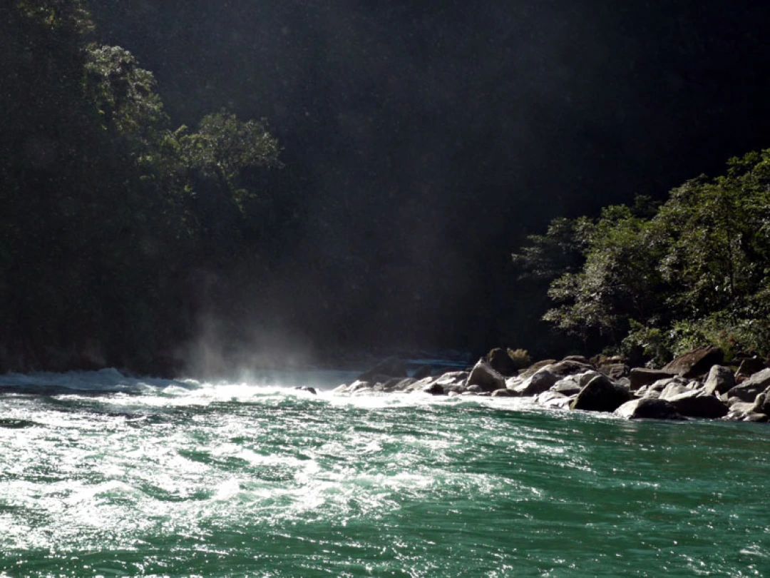
Into the Hidden Valley: A Solo Journey Through the Mysterious Dulong River
Into the Hidden Valley: A Solo Journey Through the Mysterious Dulong River Deep in the northwestern corner of Yunnan Province, tucked away from the modern world, lies a place that feels like a secret whispered among mountains. The Dulong River Valley is not just a…
Continue reading...