From Tibetan Hidden Lands to the Wind's Homeland: The Ultimate Romance of Northwest Yunnan Lies in These Lesser-Known Treasures
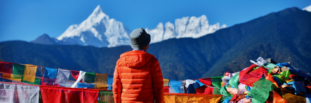
From Tibetan Hidden Lands to the Wind's Homeland: The Ultimate Romance of Northwest Yunnan Lies in These Lesser-Known Treasures
When the autumn wind paints the highland meadows gold, when the snow-capped peaks don their golden cloaks in the morning light, I know it's time to set off again. Last year, I was lost in the autumn colors of Daocheng Yading; this year, I decided to return to Shangri-La — a place I had only briefly glimpsed twenty years ago.
The highlands possess a certain magic that haunts your dreams. Whether it's the grandeur of snow-capped mountains and glaciers, the tranquility of forests and meadows, or the simple smiles on the faces of mountain villagers, it all feels like a call, drawing you back time and again.
Twenty years ago, I spent three days and two nights in Shangri-La. My memories from then were nothing more than the flocks of sheep and cattle dotting the hills around the county town, and the racks of highland barley — the most ordinary of highland scenes. But some wishes, once planted, take root and grow. Meili Snow Mountain was the name that lingered in my mind.
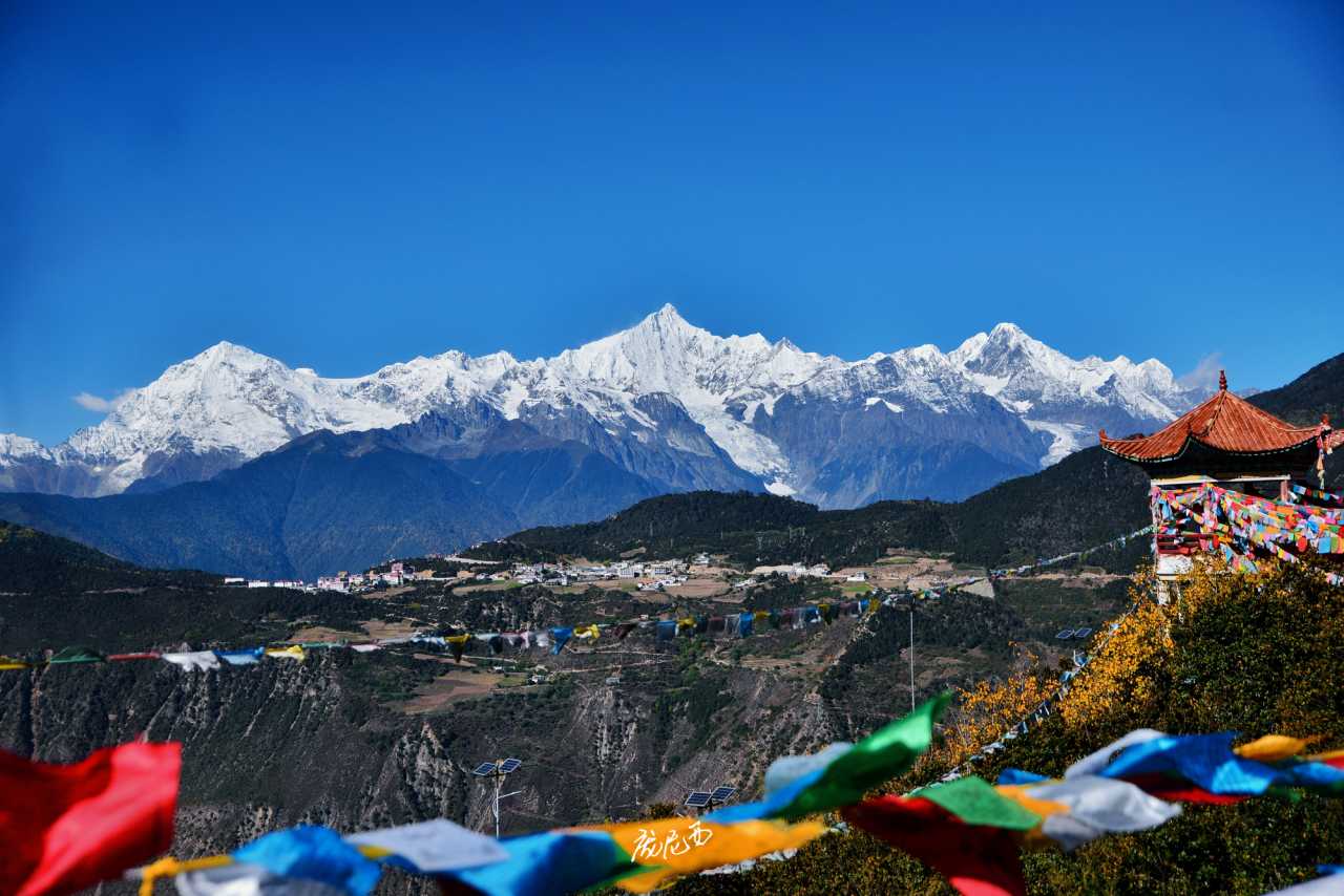
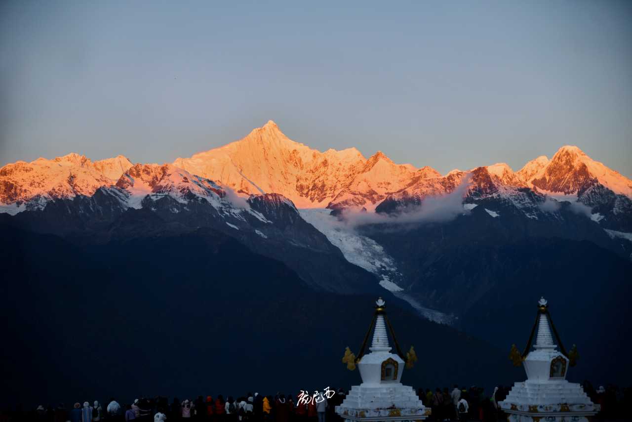
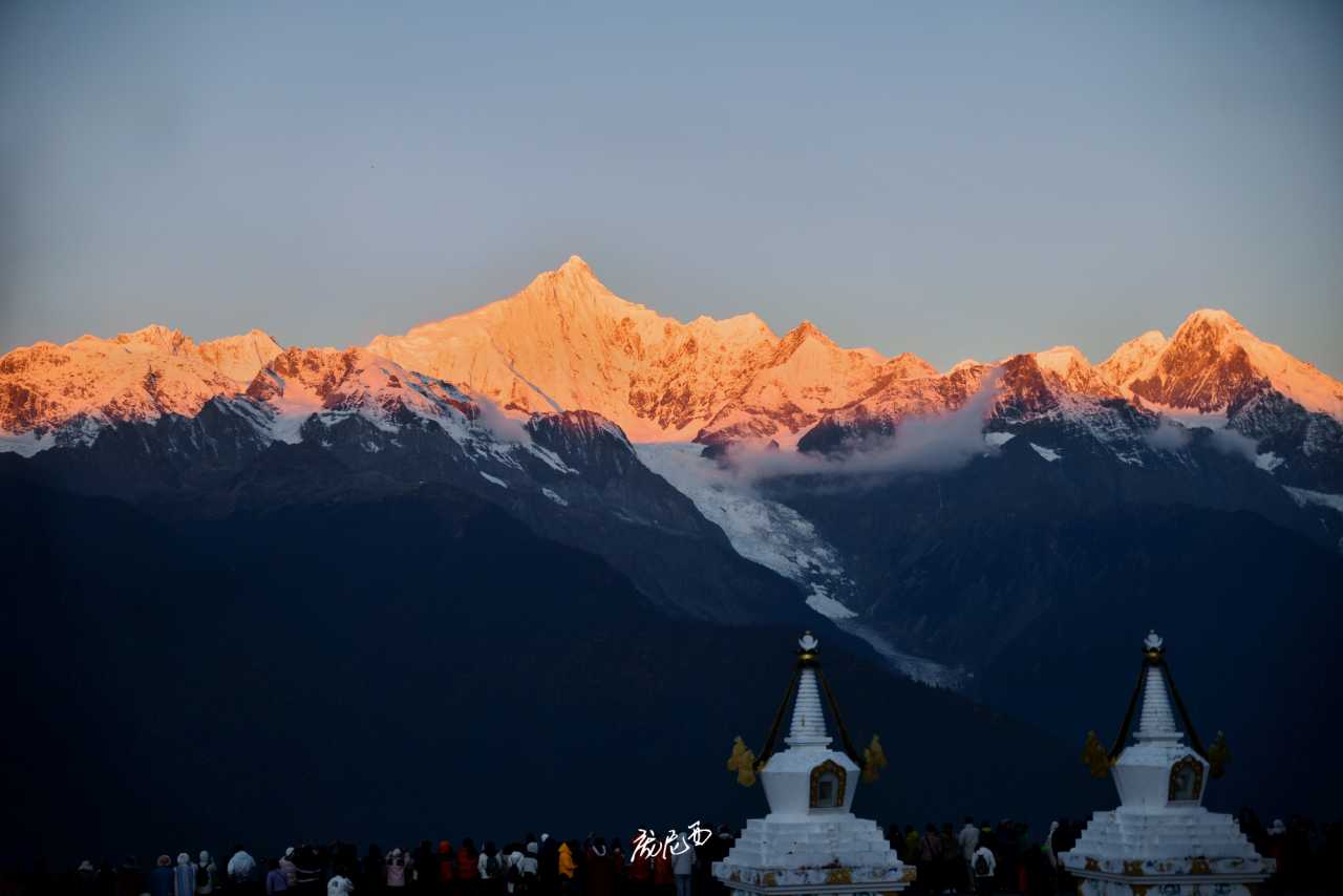
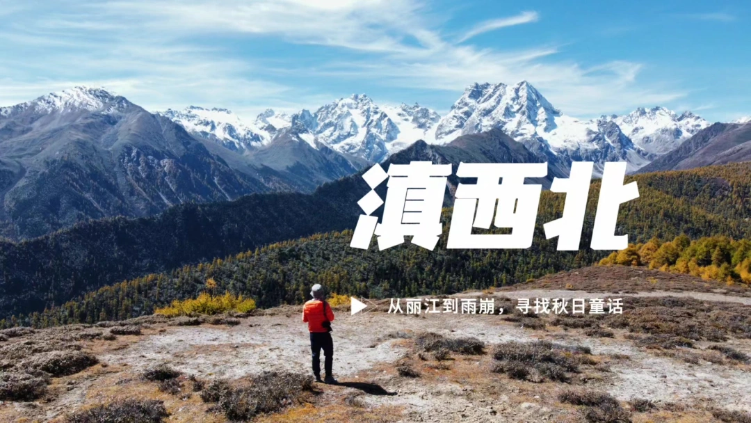
In my view, Meili Snow Mountain is not just Yunnan's highest peak and the foremost of the eight sacred mountains in Tibetan regions; it's more like a visual feast — thirteen snow-capped peaks standing shoulder to shoulder, stretching for dozens of kilometers. The overwhelming impact hits you like a wave, making you feel as if you could reach out and touch them.
To be honest, I've never been enthusiastic about the name "Shangri-La." It's nothing more than a utopia depicted in a foreign novel. I prefer to call this place the Tibetan region — beautiful, bright, and tranquil. It's a spiritual sanctuary that everyone spends a lifetime searching for.
This time, I gave myself a week. I rented a car in Lijiang and set off, both to save money and to make up for the scenery I had missed all those years ago.
My Itinerary Overview
- DAY 1: Chengdu → Lijiang
- DAY 2: Lijiang → Tiger Leaping Gorge → Haba Snow Mountain → Shangri-La
- DAY 3: Shangri-La → First Bend of the Jinsha River → Dongzhulin Monastery → Baima Snow Mountain → Feilai Temple
- DAY 4: Feilai Temple → Yubeng Village → Divine Waterfall → Yubeng Village
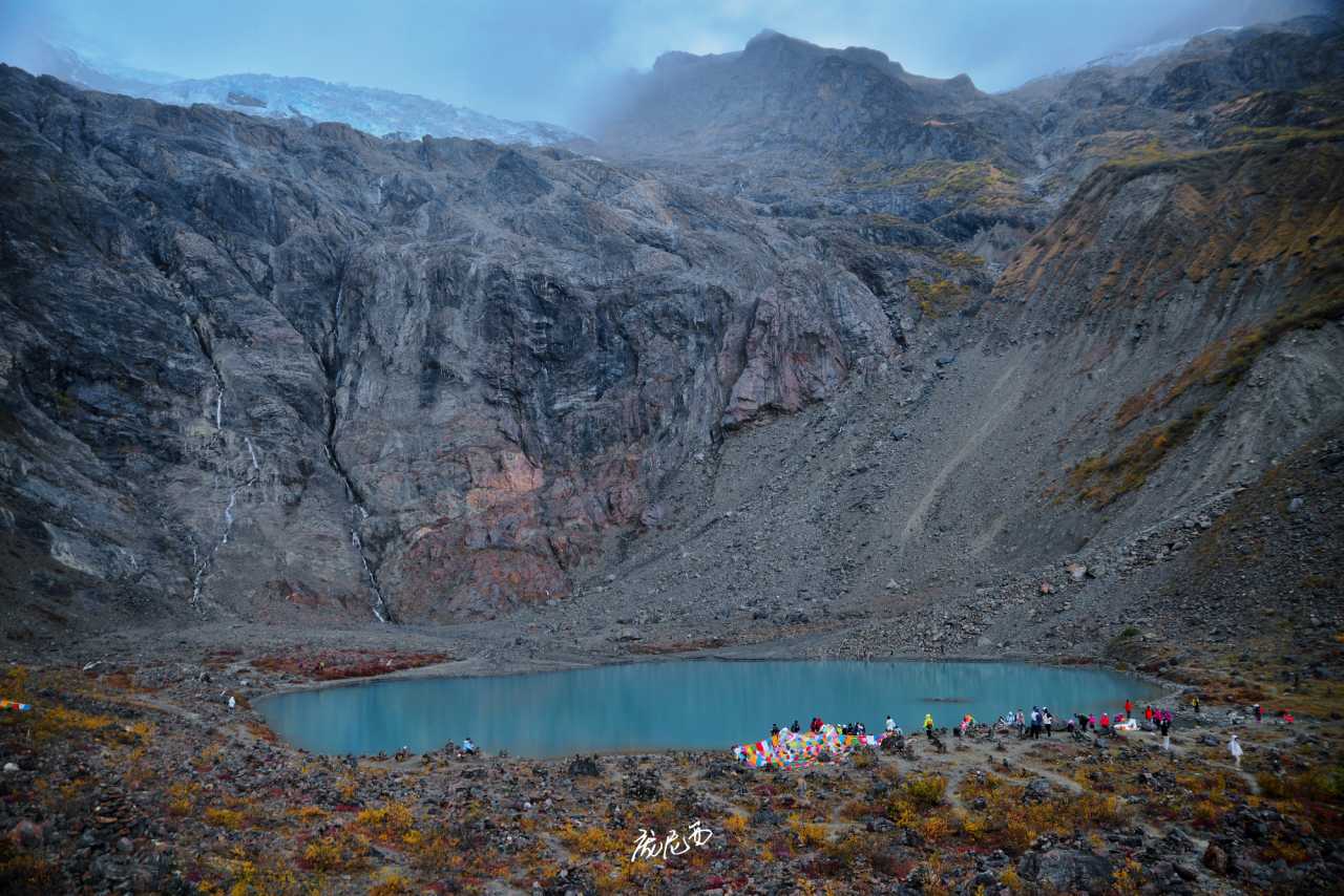
- DAY 5: Yubeng Village → Ice Lake → Yubeng Village
- DAY 6: Yubeng Village → Baima Snow Mountain → Dukezong Ancient Town
- DAY 7: Dukezong Ancient Town → Napahai Lake → Songzanlin Monastery → Dukezong Ancient Town
- DAY 8: Dukezong Ancient Town → Shibao Mountain → Shaxi → Lijiang → Chengdu
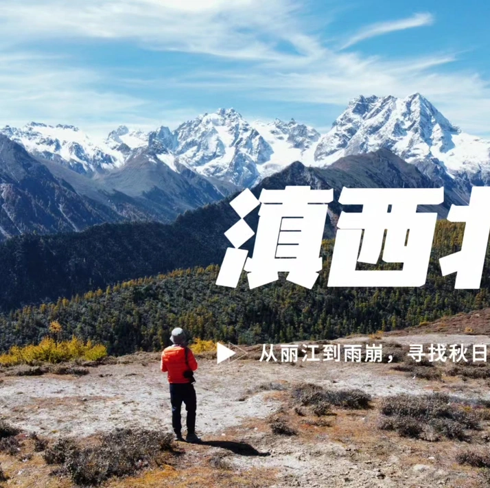
From Lijiang to Shangri-La, Don't Miss the Stunning Eastern Ring Road
Twenty years ago, I took the Western Scenic Route from Lijiang to Shangri-La. Though the distance was short, the scenery was unremarkable. This time, I deliberately chose the Eastern Ring Road — the legendary Tiger-Leaping-to-Shangri-La Highway (Huxiang Highway).
This 170-kilometer road was only fully paved in August 2022. Along the way, you'll find gorges, snow-capped mountains, colorful forests, and villages — and very few people. You can have the entire landscape to yourself. There are plenty of viewpoints along the roadside, so parking is never a problem. It's perfect for taking an entire day to explore at a leisurely pace.
I landed in Lijiang late on the first night, picked up the car, and headed straight to a hotel near the airport. The next day, I woke up before dawn, buzzing with excitement like I'd had a shot of adrenaline.
The drive from Lijiang to Tiger Leaping Gorge was all highway, with excellent road conditions. I planned to grab breakfast at the Lashihai service area, only to find there was no food sold there at all. But that turned out fine — I took the chance to fly my drone and capture a shot of nearby Lashihai Lake.
Continuing on, I couldn't resist getting off the highway early at Xionggu and turning onto the old national road. Why? Because from this old road, you can capture both Haba Snow Mountain and Jade Dragon Snow Mountain in the same frame — once you get closer to Tiger Leaping Gorge, Haba Snow Mountain disappears from view.
Just before reaching Tiger Leaping Gorge, you'll pass the scenic area toll booth. If you're not entering the scenic area, make sure to say "not going to the scenic area." I simply said I was heading to Baishuitai (White Water Terrace), and they let me through without forcing me to pay. Shortly after entering the Tiger-Leaping-to-Shangri-La Highway, you'll come across the Twin Bridge Viewpoint. The bridge, the gorge, and Jade Dragon Snow Mountain all in one frame is spectacular, though the morning light wasn't great.
I had visited Tiger Leaping Gorge before, so this time I skipped Lower Tiger Leaping and headed straight for Middle Tiger Leaping. Honestly, driving through the heart of Tiger Leaping Gorge felt more intense than being inside the scenic area back then. The gorge walls are incredibly narrow on both sides, with a massive drop — it's absolutely top-tier scenery in China. I had originally planned to hike Tiger Leaping Gorge on my way back, but I ended up damaging my car at Baima Snow Mountain and had to miss it — but that's a story for later.
Middle Tiger Leaping isn't a formal scenic area, but there are plenty of viewpoints. My favorite was the Wangtianpu (Sky-Gazing Waterfall) Viewpoint — on one side, you can photograph a waterfall; on the other, the gorge. Both are stunning. The waterfall is a bit far, though, so a telephoto lens works best.
Since I hadn't found any food, breakfast didn't happen until I reached Middle Tiger Leaping — there was a vendor selling corn by the viewpoint, so I had to make do. Even after all these years, Northwest Yunnan in the off-season is still this inconvenient.
After Middle Tiger Leaping comes Lower Tiger Leaping. There are plenty of viewpoints, but almost nothing worth seeing — I'd recommend skipping it. Don't ask me how I know.
Once past Tiger Leaping Gorge, you enter the Haba Snow Mountain area. Haba Snow Mountain is quite famous — for many, it's their "first snow mountain" — but to be honest, its shape isn't particularly memorable. There are a few viewpoints along the way where you can photograph Haba Snow Mountain, though the snow-capped summit isn't very prominent. My favorite was the viewpoint with a village in the foreground — a perfect blend of humanity and nature.
After Haba Snow Mountain, you're not far from the Eastern Ring Road's most important attraction: Baishuitai (White Water Terrace). Personally, I think Baishuitai falls into the "since you're here anyway" category. The natural landscape is good, but there's too much man-made clutter that gets in the way.
Beyond Baishuitai, the scenery along the Eastern Ring Road becomes ordinary, except for the Jiuxian Peak (Nine Immortals Peak) Viewpoint. This viewpoint is incredible — besides capturing the steep Jiuxian Peak, you can also look back at Haba Snow Mountain from an angle even better than the Haba viewpoints.
Just before reaching Shangri-La, you'll pass the Xilianpen (Face-Washing Basin) Pass — the highest point on the Eastern Ring Road. It's a good place to rest, but there's really nothing worth photographing around it.
This Isn't Turkey's Pamukkale — It's Shangri-La's Baishuitai (White Water Terrace)!
Baishuitai had been on my wish list for a long time. It's very similar to Huanglong in Sichuan and is one of the birthplaces of the Naxi people. But after several visits to Lijiang and Shangri-La, I had never made it there due to the long distance and inconvenient transportation. This time, driving the Eastern Ring Road, Baishuitai was one of the most important stops.
To be honest, the experience wasn't great. Baishuitai itself is a rare natural wonder, but it's been ruined by all sorts of unnecessary man-made development. I arrived around noon, parked at the foot of the mountain, and started climbing. The parking lot is at an altitude of about 2,300 meters, and it takes half an hour with a 200-meter elevation gain to reach the halfway point where you can see the main body of Baishuitai.
Just a short way up, I was stunned — the scenic area had actually built a large area of pools out of cement, mimicking Baishuitai. Not only was it incredibly tacky, but it also severely damaged the natural landscape.
Even funnier, locals along the way kept asking if I wanted to ride a horse, all saying it was only 10 yuan. It was obviously a scam — once you get on, they'll definitely jack up the price. Sure enough, I later saw tourists and horse handlers arguing loudly up on the mountain.
The first glimpse of Baishuitai was even smaller than I had imagined. Although it's touted as China's largest travertine terrace, its scale is nowhere near Huanglong's. It's only slightly better than Kangding's Quanhuatan (Hot Spring Terrace).
Still, the photos from the viewing platform look good. The spring water, rich in calcium bicarbonate, flows slowly downward, with carbonates gradually precipitating. Over the years, this has formed layered terraces that stack up like rice paddies, earning it the nickname "the Immortal's Abandoned Fields."
The stone steps on the calcified pools let you get up close and personal with the "Immortal's Abandoned Fields." The drone's perspective is even more stunning — from above, you can see pools in various shades of blue.
Exploring toward the source of Baishuitai, you'll find larger pools in different shades of green, somewhat reminiscent of Erdao Sea in Mouni Valley.
But the scenic area's flaws are everywhere — most notably, the red boardwalk next to the main Baishuitai body, and the stone walkways built on top of the travertine for visitors. These directly cut off the natural environment and clash completely with the surroundings.
If you try to get close to Baishuitai for close-up shots of the colored pools, you'll find construction sites all over the hillside below. Most photos of Baishuitai you see are just partial views — if you want to capture a wide shot, you can't avoid these man-made obstacles.
From Shangri-La to Deqin: 95% of People Miss These Treasures
Heading from Shangri-La to Deqin, I finally embarked on the journey to Meili Snow Mountain, which I had missed twenty years ago. Luck was on my side — another clear, sunny day. The national road along the way was much better than I had expected, with almost no rough patches. But it was mostly mountain roads, so I couldn't drive too fast.
My first stop was the "Napahai Lake Viewpoint," just outside Shangri-La. Many cars were parked there — it's located on a high hill behind Napahai Lake, making it the best spot to photograph the entire lake. The only downside was the number of tourists.
From there, I headed toward Benzilan. "Benzilan" means "beautiful sandbar" in Tibetan, and it's located on the banks of the Jinsha River at the foot of Baima Snow Mountain. Once I entered the gorge area, the scenery began to grow magnificent — I was about to officially cross Baima Snow Mountain.
The most famous attraction near Benzilan is the First Bend of the Jinsha River. It used to be a paid scenic spot, but now it's free to visit. As one of the iconic landscapes of the UNESCO World Heritage site "Three Parallel Rivers," the Jinsha River makes a 180-degree turn through the towering mountains, forming a perfect omega (Ω) shape. The view is awe-inspiring. But the wind at the viewpoint is fierce — be careful if you're flying a drone.
This is also the natural boundary between Yunnan and Sichuan — the viewpoint belongs to Benzilan Town, Deqin County, Diqing Prefecture, Yunnan, while the road across the river on the opposite mountain is in Zigeng Township, Derong County, Garze Prefecture, Sichuan. No wonder my phone signal kept switching between Yunnan and Sichuan.
My visit to Dongzhulin Monastery was a last-minute decision — I saw a sign on the road and remembered reading about it long ago in a book about Yunnan. Back then, Northwest Yunnan was still an off-the-beaten-path destination, and Dongzhulin Monastery, as one of the birthplaces of Tibetan Buddhism in the region, had always seemed mysterious. I guess I had been intrigued ever since, so I turned onto a small road to explore.
Dongzhulin Monastery sits on the eastern slope of Yonggan Peak in Shusong Village, not far from the First Bend of the Jinsha River. It marks the starting point of the road crossing Baima Snow Mountain. Although the altitude is nearly 3,000 meters, the area has a dry, hot valley feel, and it's said to rarely snow even in winter.
Dongzhulin Monastery was first built in the sixth year of the Kangxi reign of the Qing Dynasty (1667), originally named "Chongchongcuogang Monastery," meaning "Temple by the Crane Lake." Today, it looks more like a mountain town, densely packed into the river valley.
Tourists mainly visit the Grand Prayer Hall — a large courtyard. When I went, there wasn't a single tourist, just a few monks lounging in the corridor, soaking up the sun.
You need to put on shoe covers to enter the main hall. The ground floor is a huge prayer hall, surrounded by exquisite murals (likely recent works), with numerous Buddha statues at the front — as resplendent as any Tibetan Buddhist monastery.
I thought that was all I could see, but I was lucky — a young monk invited me to go up to the upper floors. There were three more floors, connected by very narrow staircases. Between floors were small Buddha halls, prayer halls, and quiet rooms for chanting and daily life.
Once I went up, I discovered that all the monastery's treasures described in guidebooks were here — precious cultural relics and ritual implements. What impressed me most were three three-dimensional golden mandalas, enormous in size and intricately carved. It was the first time I had seen such a vivid representation of the cosmic world. There was also a mummified saint (similar to those on Mount Jiuhua) and a stupa that rivaled those in the Potala Palace — things you don't usually see in ordinary Tibetan Buddhist monasteries.
After Dongzhulin Monastery, there's one more lesser-known viewpoint not to be missed — looking back at Balagezong Snow Mountain, which stands at 5,545 meters and is the highest peak in Shangri-La City.
My Friends Were Going Crazy Asking Where This Was — It's Really Not Switzerland
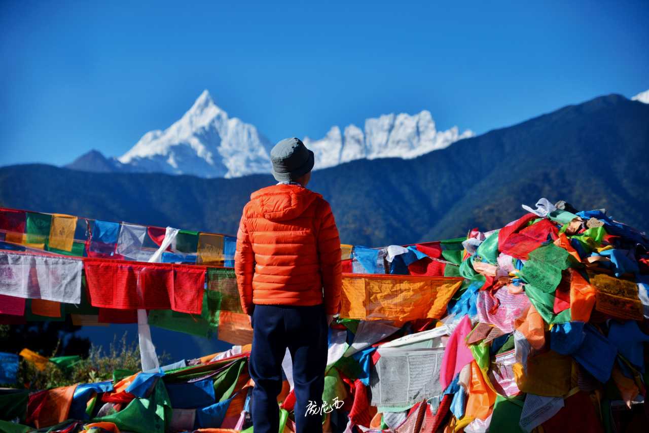
The fame of Meili's Thirteen Peaks is so overwhelming that people often overlook Baima Snow Mountain next door. As Yunnan's second-highest peak, the main summit — Zhalaqueni Peak at 5,640 meters — may not be as tall and majestic as Kawagebo, but its steep, towering snowy peaks are equally breathtaking.
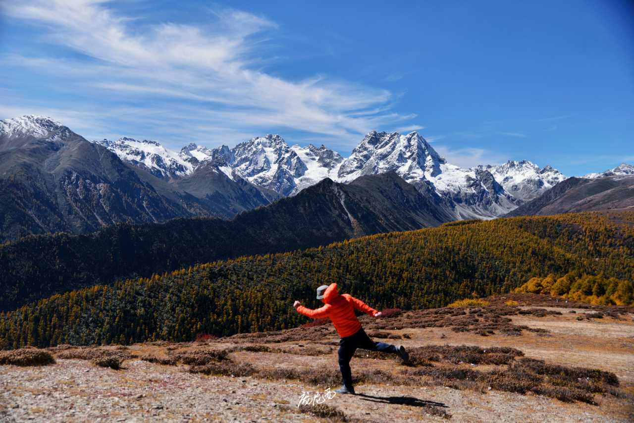
Most importantly, come autumn, this place is unreal — the perfect pairing of snow-capped mountains and colorful forests makes even Meili Snow Mountain pale in comparison. Baima Snow Mountain is known as the "Kingdom of Cold-Temperate Highland Plants and Animals," with forests dominated by fir, pine, and big-fruited red spruce. In autumn, the forests beneath the连绵 snow-capped mountains display various shades of yellow, creating a brilliant memory that comes only once a season.
When heading to Baima Snow Mountain, make sure to navigate to "Baima Snow Mountain Pass." This way, shortly after entering the Baima Mountain area, you'll turn onto the old National Road 214 that leads to the pass. Most vehicles traveling between Shangri-La and Deqin now use the Baima Snow Mountain Tunnel, catching only a few seconds' glimpse of the mountain as they exit. Taking the old national road allows you to drive alongside Baima Snow Mountain the entire way, with few other cars and plenty of spots to pull over.
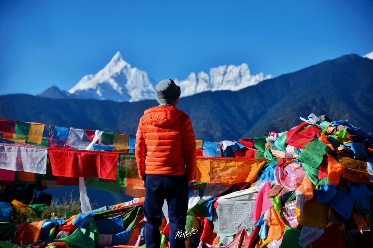
The best place to view Baima Snow Mountain isn't the navigation destination of the pass itself, but along the old national road before the pass. Parking is tricky along this stretch — you can only stop briefly by the roadside. Shortly after spotting the main peak, you'll first see a green cabin framed with the snowy mountain — it looks very Swiss.
Continuing on, there's a stretch of road that leads straight toward the mountain, creating a strong sense of depth. Near the main peak, there's a wide slope close to the road — this is the best spot to photograph the main peak and the colorful forests, especially the U-shaped grand canyon, which looks like a glacier flowing into an autumn fairy tale. You can park by the roadside and hike in. Here, you can capture some lifetime photos and feel incredibly close to the snow mountain.
Further ahead is the Baima Snow Mountain Pass at 4,292 meters. From here, you can only see a small portion of the main peak. It's a good spot for a photo with the altitude marker and prayer flags.
I Saw the Golden Sunrise on the Snow Mountain! A Comparison of Four Main Viewing Spots for Meili Snow Mountain
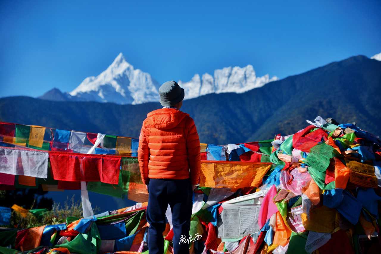
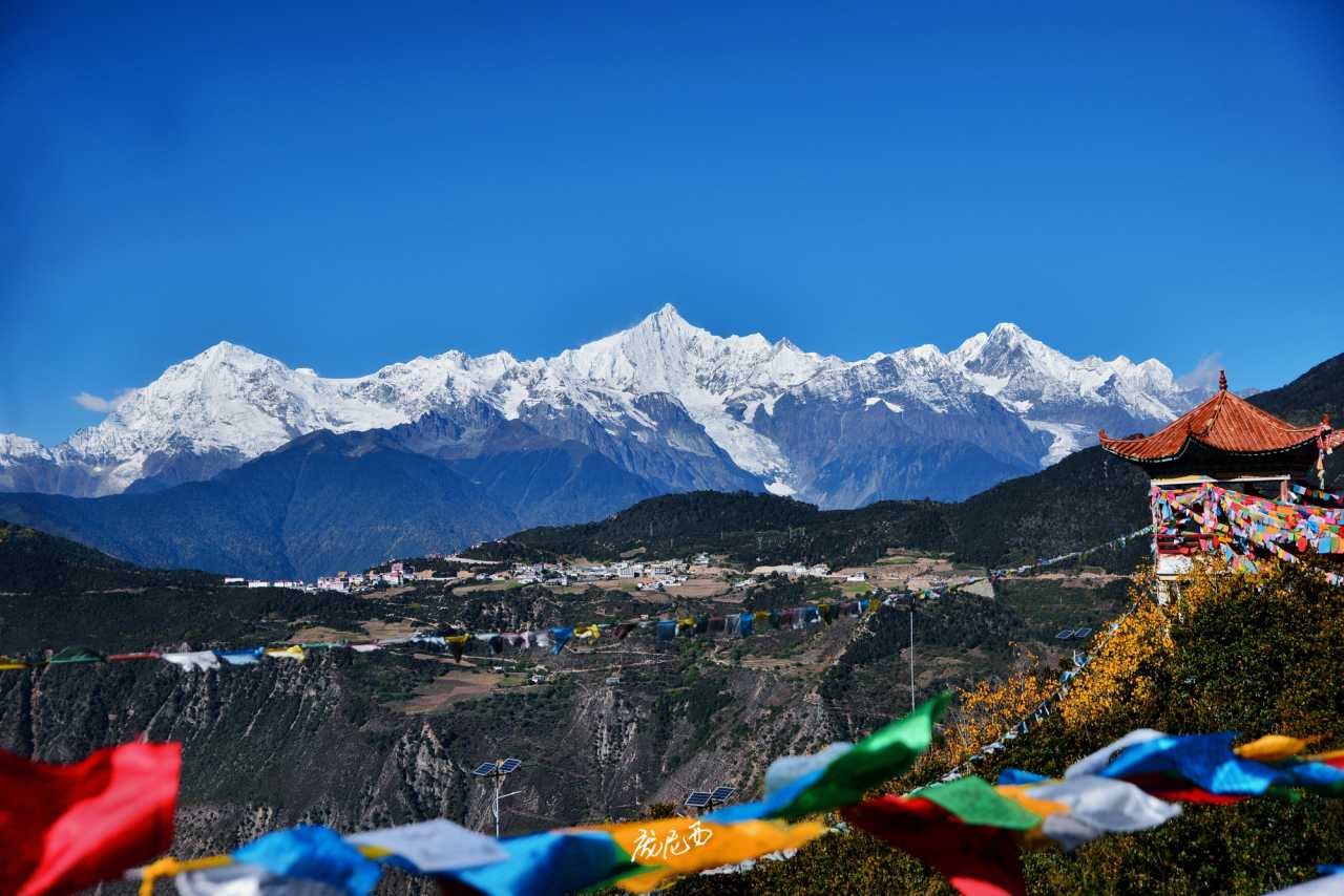
After Baima Snow Mountain came the most anticipated sight of the trip: Meili Snow Mountain. Meili is probably the most spectacular snow mountain I've ever seen — even more stunning than gazing at five 8,000-meter peaks including Everest from the Gyawu La Pass.
There are three reasons for this. First, Meili isn't a single peak — it's thirteen snow-capped peaks lined up side by side, stretching for dozens of kilometers, something no snow mountain in western Sichuan can match. Second, Meili has a high relative elevation difference, and you can view it from a relatively close distance, giving you a sense of being able to reach out and touch it. Third, there's its religious status — it's the foremost of the eight sacred mountains in Tibetan regions.
Currently, there are four main viewing platforms for Meili Snow Mountain, in order: the National Road 214 Meili Viewpoint, Wunongding, Feilai Temple, and the Kawagebo Viewpoint.
National Road 214 Meili Viewpoint: The first viewpoint where you can see Meili after coming down from Baima Snow Mountain. It's right by the roadside, but there's very little parking. The advantage is that it's your first glimpse of Meili; the disadvantage is that the angle isn't great, and the mountain is a bit far. If parking is inconvenient, it's fine to skip.
Wunongding: Near Deqin County town. Personally, I think this offers the best view of Meili Snow Mountain. The signs here mostly say "Welcome Pavilion." You need to leave the national road before reaching the Deqin Tunnel. Wunongding is farther from Meili than Feilai Temple, so the Thirteen Peaks appear more grand and majestic. The foreground is rich — you can use Feilai Temple village and the river valley as foreground, and use a medium-to-telephoto lens to photograph individual peaks. I even captured a shot of Goddess Peak with a paraglider in the frame — it really looked like Switzerland. The downside is that this place is often shrouded in clouds and fog, so the chance of seeing Meili is lower than at Feilai Temple. Also, the area is full of high-end guesthouse construction sites, so accommodation costs in the future might be prohibitive.
Feilai Temple: The most famous viewing platform for Meili Snow Mountain, and the place where I photographed the golden sunrise. I stayed overnight specifically for this. This spot has been developed for many years. It used to charge an entrance fee but is now free. The advantage is that the distance is just right — it's easy to fit all Thirteen Peaks into your frame. The viewing platform has railings, so you can set up your camera equipment even without a tripod. Feilai Temple has well-developed surrounding facilities, making it a lively mountain town with plenty of hotel options at all price levels. The disadvantage is that it's crowded in the morning, and you have to fight for good spots.
Kawagebo Viewpoint: A wild, undeveloped viewpoint on the road from Feilai Temple to Yubeng. There are many prayer flags by the roadside, and local villagers have set up a glass "sky mirror" — something female visitors might like. The advantage is that there aren't many people, and you're directly opposite Kawagebo, with a clear view of the entire Mingyong Glacier. The disadvantage is that it's too close, so the angles for other peaks aren't good.
A Clear Guide to Yubeng's Several Hiking Trails
I had been thinking about Yubeng for a long time, and I finally made it this time. Although I saw the best golden sunrise at Feilai Temple in recent days, the weather during my two days of hiking in Yubeng was just average — from overcast to light rain, experiencing all four seasons on one mountain. Fortunately, Yubeng's hiking isn't too dependent on weather. Even if the clouds and fog obscure the full view of the snow mountains, it doesn't affect the hiking and sightseeing experience.
If you're driving to Yubeng, you have to park at Xidang Village and then take a local off-road vehicle into the village. It's about a 40-minute drive from Feilai Temple to Xidang Village, and about the same from Deqin County town via the Lancang River valley road.
Yubeng is divided into Upper Village and Lower Village. The off-road vehicle fare from Xidang to Upper Village is 200 yuan per person, and to Lower Village is 260 yuan per person. If you have a lot of luggage and are staying in Lower Village, I recommend taking the vehicle to Upper Village first, then asking your guesthouse to arrange a car to take you directly to your accommodation in Lower Village for 60 yuan per person — this way, you get door-to-door service. If you take the vehicle directly to Lower Village, you'll face a long uphill walk from the drop-off point to your guesthouse, which is painful with heavy luggage.
Yubeng currently has five hiking trails open. Due to time and weather, I only did two this time:
Divine Waterfall Trail (Shenpu Line): Starts from Lower Yubeng. Round trip is about 14 kilometers, entirely on cement and stone paths. It lacks a bit of wildness but is suitable for beginners. There are two uphill sections, but the difficulty is low. With stops for photos, it took us 4 hours round trip. The Divine Waterfall itself isn't much to look at; the scenery along the way is more rewarding, especially the autumn colors near the Nainong Base Camp.
Ice Lake Trail (Binghu Line): Starts from Upper Yubeng. We started from Lower Yubeng, making the round trip about 20 kilometers. It's more difficult than the Divine Waterfall Trail, with most of the hike through forest. It's suitable for intermediate hikers. The challenging parts are the climb over the Xiaonong Pass — a full uphill section with an elevation gain of over 500 meters, some steep sections, and extra caution needed in rainy weather — and the final climb from Xiaonong Base Camp to Ice Lake. Xiaonong Base Camp is the last supply point, where you can have lunch and rest. Our round trip took 8 hours.
Nise Trail (Nise Line): Starts from Upper Yubeng, partially overlapping with the Ice Lake Trail. I didn't do this one. There are almost no signs along the way, and it's in an undeveloped state. It's recommended to hire a guide or follow navigation apps. It's said to be less difficult than the Ice Lake Trail.
Divine Lake Trail (Shenhu Line): Starts from Lower Yubeng. This is the most difficult of the five trails, almost entirely uphill. The Divine Lake itself isn't much to see; the highlight is the "Divine Lake Plus" snow mountain route, where you can get close to Goddess Peak and Five Crown Peak. It's very weather-dependent. I didn't go because of the rain. If the weather is good, you might consider choosing between this and the Ice Lake Trail.
Nong Trail (Ninong Line): Starts from Lower Yubeng. This is a downhill-only route for exiting Yubeng. It's suitable for those with little luggage who want to save money. If you have suitcases, just take the vehicle out of the village.
For accommodation, I strongly recommend staying in Lower Village! Let me say this three times: Lower Village! Lower Village! Lower Village! Because the must-do Divine Waterfall Trail and the most scenic Divine Lake Trail both start from Lower Village. Although the Ice Lake and Nise Trails start from Upper Village, after a day of hiking 10 to 20 kilometers, returning to the village is all downhill — a huge relief. If you stay in Upper Village, after finishing the Divine Waterfall or Divine Lake Trail, you'll have to climb the "Despair Slope" from Lower Village to Upper Village — and you'll be exhausted.
Hiking to Yubeng's Divine Waterfall, I Captured a Lifetime Photo
I arrived at Lower Yubeng in the afternoon, and we chose to do the Divine Waterfall Trail on the first day — it's also the traditional inner circumambulation route of Meili Snow Mountain.
From Lower Yubeng to the Divine Waterfall, the round trip is about 14 kilometers with a 600-meter elevation gain, entirely on cement and stone paths. It lacks a bit of wildness but is suitable for beginners or as an acclimatization hike on the first day. With stops for photos, it took us 4 hours round trip.
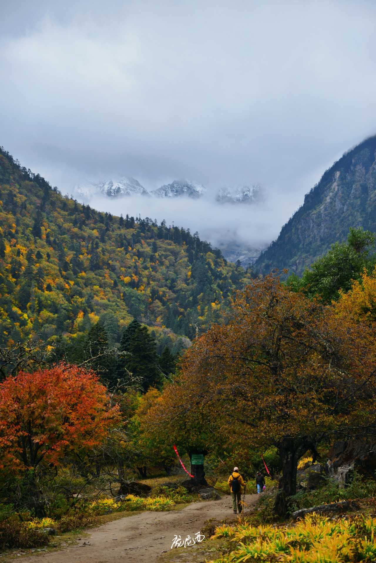
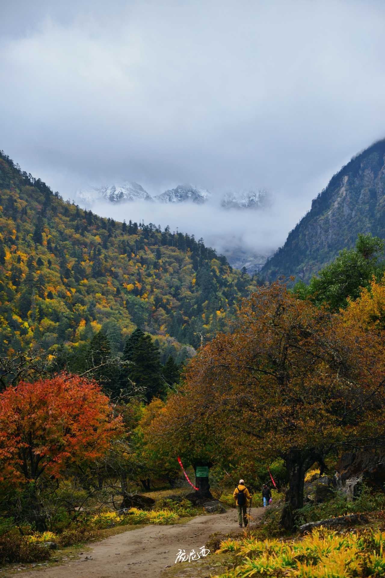
The first section, from Lower Yubeng to the rest pavilion, was very easy. The entire way follows a stream, lined with prayer flags and mani stone piles. Luck was on our side — although it was overcast, we could see Goddess Peak and Five Crown Peak before entering the forest.
The second section, after the rest pavilion, goes uphill all the way to Nainong Base Camp at 3,330 meters. I might not have rested well, so I was a bit out of breath, but the climb was still relatively gentle — much easier than the Ice Lake Trail the next day. This section mostly winds through the forest, with some small waterfalls along the way.
Near Nainong Base Camp, the view suddenly opens up — Goddess Peak and Five Crown Peak enclose a small mountain basin. This is the most photogenic spot on the entire trail, where you can easily capture a lifetime photo.
The final section, from the supply point to the Divine Waterfall at over 3,600 meters, is almost entirely uphill. It's more physically demanding and the most difficult part of the trail — know your limits.
The endpoint is the Divine Waterfall. Below the mountain, you can see the terminal moraine of the glacier, somewhat reminiscent of Hailuogou, but the glacier itself is more beautiful than Hailuogou's. The Divine Waterfall is a matter of personal opinion — its religious significance far outweighs its scenic value. The water flow isn't large, and if you're not paying close attention, you might not even notice it.
Going downhill was relatively easy, but the distance was still considerable. By the time I returned to the village, my legs were already trembling.
Final Thoughts: The Ultimate Romance of Northwest Yunnan Is Worth Savoring Slowly
Over eight days, I traversed the steep cliffs of Tiger Leaping Gorge, the surreal terraces of Baishuitai, the tranquility of Dongzhulin Monastery, the grandeur of Baima Snow Mountain, the awe-inspiring majesty of Meili Snow Mountain, and the pristine purity of Yubeng Village. Every landscape felt like a gift from the highlands to the traveler.
But what I want to say is this: the romance of Northwest Yunnan isn't about how many scenic spots you check off. It's about those unexpected moments — driving alongside the snow-capped peaks on the old national road of Baima Snow Mountain, watching a paraglider glide past Goddess Peak at Wunongding, and experiencing all four seasons on one mountain in the forests of Yubeng.
If you too want to seek this ultimate romance, here are a few suggestions:
- Give yourself enough time: At least a week. Don't rush the journey; feel the road.
- Self-driving is best: The Eastern Ring Road and the old national road at Baima Snow Mountain are treasures you can only truly experience by car.
- Travel in the off-season: Fewer people, more beautiful scenery, and a doubled experience — even if some places might be less convenient.
- Be prepared: Highland hiking is no joke. Have the right gear and build up your stamina.
- Keep an open mind: The most beautiful scenery often lies beyond your plans.
The highlands always have this effect — they make you want to go back, again and again. Not because the scenery is absolutely stunning, but because there, you can find your own purest sense of peace and romance.
Next time, I want to stay in Yubeng for a few more days and hike all the trails. Maybe I'll also stay an extra night at Feilai Temple, waiting for an even more perfect golden sunrise on the snow mountain.
After all, once a wish is planted, you'll want to fulfill it even more.
You should also read:
Escaping Nanning, Falling Under Lijiang's Spell: Our Four-Person, Ten-Day Yunnan Dream
Escaping Nanning, Falling Under Lijiang's Spell: Our Four-Person, Ten-Day Yunnan Dream Before We Set Off: No Pain, No Obsession Have you ever had that impulse—suddenly tired of the office fluorescent lights, the crush of the subway, the endless parade of identical takeout boxes, and just…
Continue reading...
Solo in Yunnan: A Wanderer’s Guide to the Land of Eternal Spring
Solo in Yunnan: A Wanderer’s Guide to the Land of Eternal Spring There’s something magical about traveling alone. No compromises, no schedules to keep, no one to please but yourself. I’ve been on the road for nearly three months now, and not once have I…
Continue reading...
Into the Hidden Valley: A Solo Journey Through the Mysterious Dulong River
Into the Hidden Valley: A Solo Journey Through the Mysterious Dulong River Deep in the northwestern corner of Yunnan Province, tucked away from the modern world, lies a place that feels like a secret whispered among mountains. The Dulong River Valley is not just a…
Continue reading...