Standing on the Border of Grandeur and Distance: My Xinjiang Journey (Serialized)
Standing on the Border of Grandeur and Distance: My Xinjiang Journey (Serialized)
Departure: From Words to the Land
In college, during a long train ride, I happened to flip open a magazine and came across the writing of Liu Liangcheng. His descriptions of Xinjiang—the vast grasslands, the bountiful pastures, the dust kicked up by migrating herds of cattle and sheep, and his profound insights into life and language—moved me to tears in that creaky sleeper carriage at the age of twenty. At that moment, I immediately searched for train tickets to Xinjiang, but that distant and expansive place seemed out of reach.
Years later, I finally set foot on this land, carrying Liu Liangcheng's book In Xinjiang with me. I know this won't be the last time. I'll keep coming back, journey after journey, until I've seen every last trace of its long, drifting winds and smoke.
For my first trip to Xinjiang, I chose the Northern Xinjiang Yili route, along with Kuqa and Turpan in Southern Xinjiang. This travelogue starts with Northern Xinjiang, and in mid-to-late August, I'll be leading a photography tour group back to Northern Xinjiang, then heading south to explore more hidden landscapes.
As the saying goes: "Without seeing Xinjiang, you don't know how vast China is; without seeing Yili, you don't know how beautiful Xinjiang is." In summer, Yili offers Swiss-like snow-capped mountains, spectacular canyons, gentle alpine lakes, pristine vertical grasslands, endless fields of lavender, wildflowers blanketing the hills, herds of cattle and sheep, and scattered yurts dotting the landscape. This time, I finally made it.
Everything You Want to Know About Xinjiang

Before starting the journey, I have to answer a few questions everyone asks. Xinjiang is indeed a special place.
Is Xinjiang Safe?
Everyone asks this. My answer: There's probably no safer place than Xinjiang. It's too unique. In cities, you see police booths every hundred meters. You go through security checks to enter hotels, scenic spots, and shops. Every time you enter or leave a city, you need to show your ID, and sometimes even have your face scanned. The most distinctive experience: passengers aren't allowed into gas stations. Whether it's windy or rainy, the driver goes in alone to refuel, while all passengers must get out and walk around to the exit from outside the station. That's a unique Xinjiang experience.
Are the Locals Friendly?
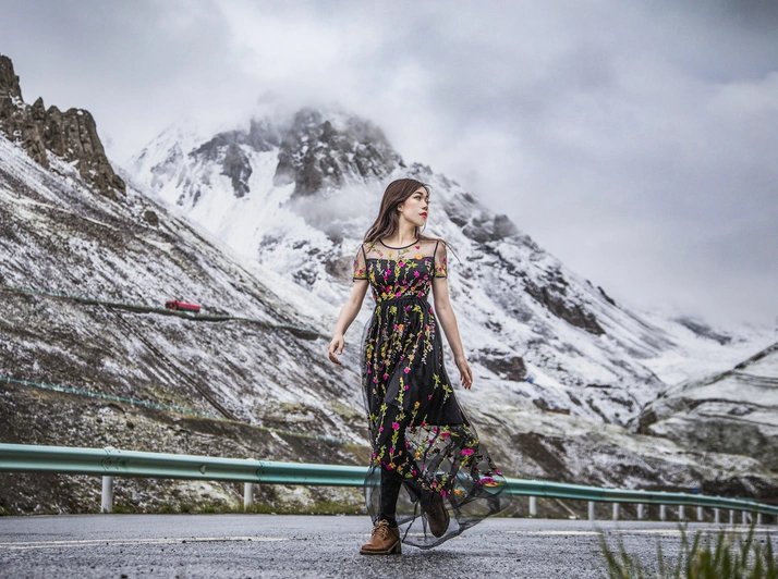
Every place has both friendly and unfriendly people, but overall, the people here are lovely. There was an aunt who let me into her shop to avoid the rain, a guesthouse owner who invited us to stay for dinner, and a lady who stared at my dress and complimented me. Of course, there was also a security guard who deliberately said the parking lot had no restroom (but another group member had already gone in). Some ethnic minorities don't speak Mandarin well, but they always greet you with a smile. Remember to respect their customs, and everything will go smoothly.
Does the Sun Really Set at 10 PM?
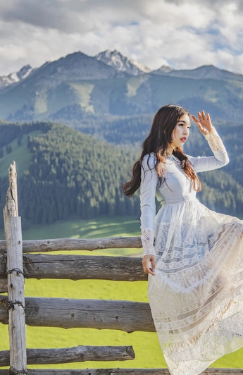
Yes. Due to longitude differences, Xinjiang is 2 to 3 hours behind Beijing time. I visited during the summer solstice, so the sun set after 10 PM every day. Even in August, it's around 9 PM. The upside is that you can start your day at 10 AM. If you get up early for sunrise, the day feels incredibly long.
Are the Distances Really That Long?
Xinjiang is China's largest autonomous region, so vast it's hard to imagine. In 12 days, we covered 4,000 kilometers. Driving 400 to 500 kilometers a day is routine. What's even more "brutal" is the section-by-section speed monitoring—each stretch is divided into checkpoints A, B, C, D, and you can't exceed the limit on any segment. So even if the total distance isn't huge, it takes forever. Come prepared to spend a lot of time in the car.
How to Travel? Self-Drive? Charter a Car? Public Transport?
Xinjiang is huge, with poor cell signal, rough roads, and endless speed checks. The most reliable way is to hire an experienced driver with a car. Our driver this time was someone I met on a trip to Lake Baikal; they have a branch and fleet in Xinjiang and know the routes and scenery well. The photography tour group I'm leading later will also work with them. If you're interested, feel free to message me for contact info.
Is the Cell Signal Really Bad?
Yes, very bad. Xinjiang has shut down 4G across the entire region. Only Dushanzi, Kuitun, and Karamay have 4G. Even in downtown Urumqi, it's only 3G. In mountainous areas or townships, 2G or no signal is common. In the car, both China Unicom and China Mobile were used; I felt China Unicom was slightly better, but not by much.
Photography Gear
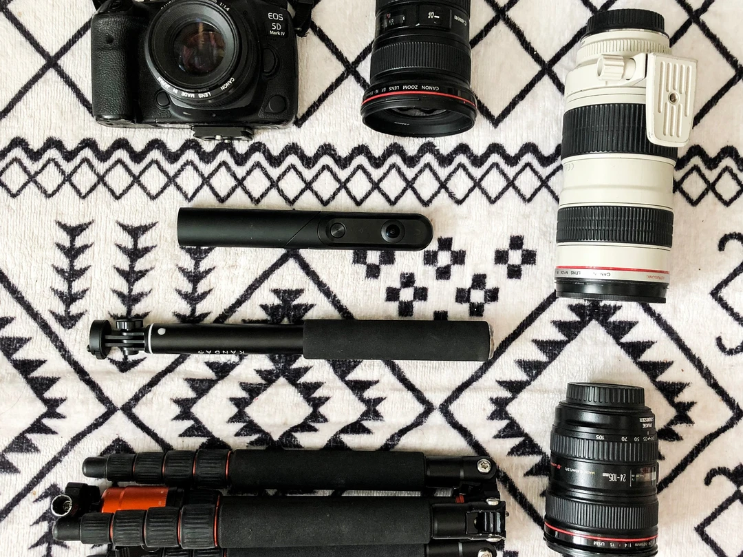
This time, I brought a Canon 5D4, mainly using 24-105mm and 70-200mm lenses, occasionally the 50mm f/1.4 and 16-35mm. Besides traditional gear, I also brought a fun panoramic camera—the Qoocam. It can take all sorts of interesting selfies, whether handheld, on a selfie stick, or placed on the ground, capturing unexpected shots.
Two Stunning Grand Canyons
I originally booked a flight to Urumqi the night before, but it was canceled, so I landed at noon the next day. We didn't linger and headed straight toward Dushanzi. Along the way, we stopped in Shawan for 大盘鸡 (big plate chicken)—it was even featured on A Bite of China!
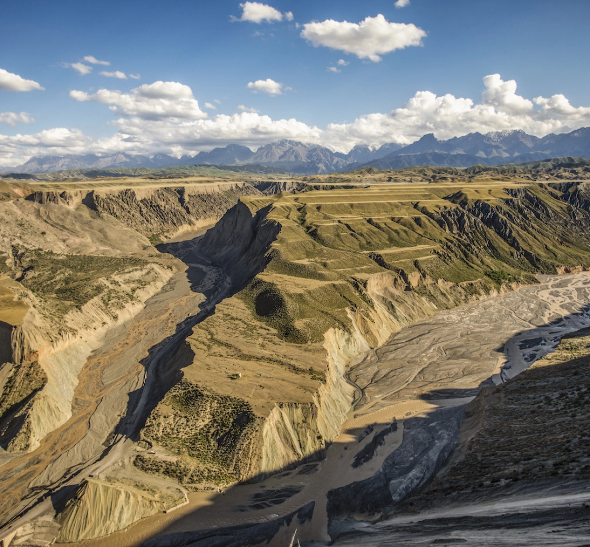
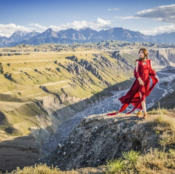
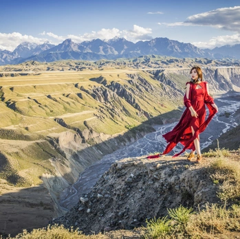
In the afternoon, we arrived at Red Mountain Grand Canyon. It's still undeveloped, with no signs along the way and few tourists, but it's been praised by foreign explorers and recommended by National Geographic magazine. It's absolutely on par with any scenic area. Red Mountain Grand Canyon is a masterpiece of nature's craftsmanship—vibrant colors, layered terraces, a breathtakingly magnificent canyon perfect for epic landscapes and portraits.
My red dress was a perfect match here. I used a wide-angle lens for canyon panoramas and a telephoto for the details of ravines and rock formations. The rugged, creviced rock faces layered against the distant stone mountains created rich depth. At the bottom of the canyon, there seemed to be a mine; large trucks came and went, kicking up dust that, under the sunlight, created a Tyndall effect—a unique spectacle of Red Mountain Grand Canyon.
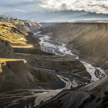
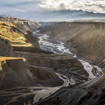
The next day, we headed to Dushanzi Grand Canyon. On the way, we spotted troops on a field training exercise and snow-capped mountains in the distance. Dushanzi Grand Canyon is also not officially developed, but a boardwalk has been built. Walking down to the bottom under the blazing sun was tough, but the photos turned out cool. This canyon was formed by the Kuitun River cutting through the tilted plain southwest of Dushanzi after rushing out of the Tianshan Mountains. The cliff walls are steep, rugged, and imposing, creating a stark visual contrast with the vast grasslands. Standing at the canyon's shoulder, you can hear the babbling river and see ravines crisscrossing the landscape.
Our driver said Xinjiang is full of canyons of all sizes, with such diverse landforms. This kind of grand scenery is hard to find for people living in the south or in cities—it's completely comparable to the Grand Canyon in the United States. What a stunning start to the trip!
The Tear of the Atlantic—Sayram Lake
Leaving the canyons, we drove 300 kilometers west to Sayram Lake.
Sayram Lake is known as "The Last Tear of the Atlantic," an alpine lake at an elevation of 2,000 meters. Surrounding it are vast grasslands, and the lake water is crystal clear and blue. In summer, the lakeside is covered with small flowers. The road circling the lake is 90 kilometers long, offering close-up views of the alpine lake and snow-capped mountains.
Private cars are currently allowed into Sayram Lake; after buying a 70-yuan ticket, you can drive around the lake. Compared to Qinghai Lake and Yamdrok Lake I've visited before, the ring road at Sayram Lake is much closer to the water, providing an excellent visual experience. Parking by the roadside is easy, so you can stop anytime to take photos.
The weather wasn't great when I arrived—strong winds and overcast skies. But such weather made for dramatic photos, though I got battered by the wind. The layered clouds reflected the lake and mountains, creating a beautiful scene. I found a patch of yellow grass by the roadside, and the whole scene felt like New Zealand—very sophisticated.
The 90-kilometer lakeside scenery was endless. When we drove to the west side of the lake, we saw forests and flower clusters along the shore—this is the classic view of Sayram Lake. Even without blue skies and white clouds, it was breathtaking. Take a photo on the flower-covered grassland.
Besides traditional shots, I took two cool panoramic photos. These were selfies, and both came from the same image with different effects. The Qoocam has a flat bottom, so it can sit on level ground, but it wobbled on the lakeside pebbles. I used three stones to prop it up. In the panoramic view, the camera itself disappears automatically, but its shadow on the ground gives it away. Of course, you can also crop it into a normal flat photo. These all came from one shot—pretty fun, right?
There doesn't seem to be lakeside accommodation at Sayram Lake, so we stayed next door in Guozigou, planning to catch the sunrise at Sayram Lake early the next morning. Unfortunately, the weather was poor, and we only got a hint of red dawn.
Living in a Green Fairyland—Guozigou
After exploring Sayram Lake, our driver turned the wheel, and there was Guozigou, where we'd spend the night.
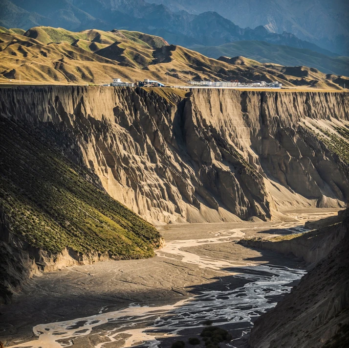
Guozigou is the natural gateway to the Yili region. Here, vertical forests, snow-capped mountains, and strange rocks complement each other. Though the weather wasn't ideal, the multiple shades of green in the grass and forests still made it feel like a fairyland. The legendary First High Bridge of Xinjiang is embedded within Guozigou. We stayed in a yurt at the Guozigou observation deck, which offered the best view. Time to shoot!
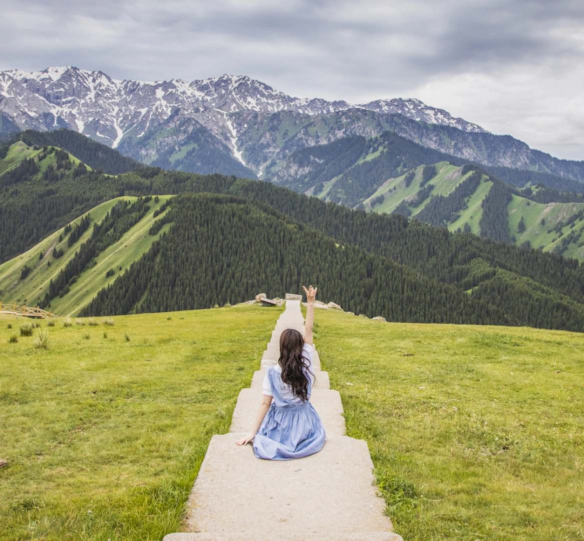
In front of the observation deck was a long staircase, a fantastic backdrop for photos. The Guozigou Bridge was right in view. To capture a panoramic shot, I pulled out the Qoocam again. It can crop out the section without people, giving a super wide 180-degree view of the expansive scenery—much wider than a regular camera, and it's a one-click shot, saving the hassle of stitching. The distant mountains, clouds, and rugged rocks were all captured in the frame.
We saw a beautiful sunset at Guozigou. The yurt we stayed in that night had no private bathroom or hot water—just enough to wash my face—but it was all worth it. On this entire trip, we stayed in the mountains at two places: Guozigou and Qiongkushitai. These were also the only two spots where I might come out at night to shoot stars and get up early for sunrise. Unfortunately, thick clouds rolled in after sunset, ruining both the starry sky and the sunrise. I could only hope for Qiongkushitai later.
The Legendary Yili Lavender
Leaving Guozigou, we drove toward Yining City to see the famous Yili lavender.
The Yili River Valley shares a similar latitude with Provence, France, making it ideal for growing lavender. The lavender produced here accounts for over 95% of China's total output. Every June and July, along the roads near Huocheng in Yili, large lavender fields can be seen and photographed. Vast expanses of purple-blue flowers sway like an ocean in the wind, their fragrance intoxicating.
There are two ways to see lavender near Huocheng and Qingshuihe. One is to visit the famous Princess Jieyou Lavender Garden in Qingshuihe town. The ticket is 35 yuan, and you can see rows of lavender similar to Provence. But it's very crowded, the lavender area isn't large, there are utility poles at the end, and the photo experience isn't great. Exiting requires walking through a long, commercialized lavender shopping route.
The other option is to visit roadside lavender fields. The largest production area is the 65th Regiment, where lavender covers the hillsides. It's not developed as a scenic spot. You can navigate to the 65th Regiment and ask a local to guide you to very large lavender fields. Usually, a tip of five or ten yuan is fine; the local who guided us didn't even accept money, letting us look freely. However, the roadside lavender isn't planted in neat rows like at Princess Jieyou, so the photo effect is a bit less polished. It rained the whole day we were there, so I only got one photo.
Overall, Yili's lavender was a bit disappointing. Maybe better weather would help, but in China, this is the only place to capture large lavender fields—so cherish it while you can.
From Kazanqi Folk Village to the Bagua City
After seeing the lavender, we stayed overnight in Yining City. Yining is home to the only Uyghur-style cultural area in Northern Xinjiang—the Kazanqi Folk Tourism Zone. Here, you can see colorful walls, distinctive Uyghur-style house decorations, and beautifully dressed Uyghur girls.
At the street entrance, there were traditional baked buns (烤包子). A Uyghur brother skillfully stirred a large pot of meat while nearby, a steamer baked the buns, filling the air with a tempting aroma. The doors and windows in the folk village were mostly painted blue—a pure, pristine sky blue. For a moment, it felt like being in Chefchaouen, Morocco. The people here look more South Asian and Middle Eastern, quite different from Han Chinese. Seeing the children here, you can't help but want to say "Hello."
Leaving Yining, we headed toward Tekes. Tekes is a fascinating city—a standard Bagua (Eight Trigrams) city with no traffic lights. On the way to Tekes, we saw stone figures on the grassland, which were quite amusing. Unfortunately, it rained the day we arrived, so I just snapped a shot from the parking lot and moved on.
Due to the rain, the road from Yining to Tekes became incredibly tough. One section had a sign like this—do you know what it means? In winter, heavy snow can completely cover the road and ditches. Many drivers misjudge the road's edge and end up in the ditch. These arrows point to the safe line, guiding drivers to stay out of the ditch.
We arrived in Tekes in the heavy rain. Tekes County is famous for its Bagua layout. Legend has it that the city was designed by Qiu Chuji, one of the Seven True Daoists of the Quanzhen School during the Southern Song Dynasty. The city has a radial circular layout, with streets laid out like a magical maze—every road connects, every street links. At the same time, Tekes boasts rich folk customs, deep historical culture, and beautiful natural scenery. You can take a Ferris wheel or a hot air balloon to see the city's aerial view.
Tekes served as our base for the next part of the trip, passing through it three times. I really wanted to take an aerial photo of the Bagua layout here, as I'd seen in other travelogues. But to be safe, I asked the police. The officer told us that normally you can fly drones, but due to inspections in recent days, it wasn't allowed. I'm not sure if that was an excuse or true, but in the end, I didn't get to fly. Hopefully, when I go back in August, I can make it happen.
Switzerland in Xinjiang—Xia Ta
Crossing Tekes, we arrived at Zhaosu County. Zhaosu is known for producing "heavenly horses" that "cross the Kunlun and reach the Western Extremes," earning it the title "Hometown of Chinese Heavenly Horses" from the Ministry of Agriculture. It's also famous for the ancient Wusun Kingdom from the Han Dynasty, making it one of the origins of Xinjiang's Wusun culture. Zhaosu sits at the foot of the Tianshan Mountains, and you can see the连绵 (unbroken) range from the highway—it really looks like Switzerland!
Everywhere in Zhaosu, you see fine horses. Are these the "heavenly horses" walking in the sky? Zhaosu also has another famous spot—thousands of acres of rapeseed flower fields at the foot of the Tianshan Mountains. This year was colder, so in mid-June, the rapeseed flowers hadn't fully bloomed. We finally found a patch that was decent and started shooting.
The main reason we came to Zhaosu was the Xia Ta Ancient Trail. This is a mysterious ancient passage. The Xia Ta River rushes out from the steep mountains, cutting through the flat grassland. Here, you can see Swiss-like beauty and get up close to massive snow-capped mountains. Half of your time in Xinjiang revolves around the Tianshan Mountains. The long mountain range is divided into various scenic areas, with cheap entrance fees and expensive shuttle buses as standard.
The ticket for Xia Ta, including the mandatory shuttle bus, is 100 yuan. But the bus only goes to a midway hot spring hotel. To reach the deeper scenery, you need to pay another 25 yuan (one way) to get to the ancient trail entrance. That's where the real scenery begins. At the end of the shuttle route, the hiking trail leads closer and closer to the snow-capped mountains. The ground is covered with small flowers, and silly marmots add plenty of fun.
As someone who hates shuttle buses, I was finally won over by this scenery. The distant snow-capped mountains made the cost worthwhile. Since I'd already spent so much, I paid a bit more to have a horse pose for photos. The weather was still bad, but the distant mountains remained magnificent. It had been three days since we saw the sun—I missed it, I really did.
Paradise on Earth—Qiongkushitai
After leaving Xia Ta, we drove back to Tekes overnight. The next morning, we set out from Tekes for Qiongkushitai.
The distance from Tekes to Qiongkushitai is 80 kilometers, but it took 6 hours to drive because the road was full of mountain curves, forcing us to go very slowly. I used a drone to capture the winding road—take a look at those big bends.
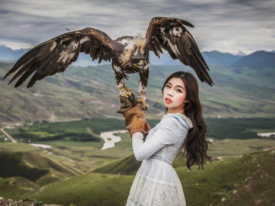
At a rest stop on the mountain road, we found a herder with a hunting eagle. I held it up for a photo, which became one of my favorites from the trip. The eagle was incredibly heavy; the herder could lift it with one hand, but I needed both hands as a woman.
The road to Qiongkushitai was winding but beautiful. Snow-capped mountains and vertical forests and grasslands accompanied us all the way. As we approached the forests near Qiongkushitai, fir trees and flowing water appeared, completely different from the earlier grassland landscape. Finally, we arrived at this small village in the mountains.
Qiongkushitai is a mysterious place hidden deep in the mountains, the starting point of the Wusun Ancient Trail. The terrain is rugged, with a masculine beauty in the grasslands. Under the blue sky and white clouds, there are silver snow-capped mountains, dark green fir forests, pale green grasslands, and colorful flower seas—several layers of color with harmonious tones, forming a natural painting.
In Qiongkushitai, all the houses are traditional wooden structures. The log-built village is rich in Kazakh culture, recording the daily lives of herders. At night, you can stay in these small houses and come out to see a sky full of stars.
After arriving at Qiongkushitai, the sun, which had been hiding for days, finally appeared! My motivation to take photos shot up! Another great spot here is the small stream next to the village, which is lovely. In the babbling water, looking up, you might see a horse gallop by—a perfect place for epic shots. Though... there was quite a bit of horse manure underfoot.
After settling in the village, our driver took us to the back mountain. There, we found beautiful grasslands and fences, vertical grasslands, and magnificent snow-capped mountains. As dusk approached, we discovered a guesthouse on a hillside. They occupied an entire slope, where you could sit and watch the sunset. The owner was very kind, welcoming us to take photos even though we weren't staying. So we shot the sunset there.
In the golden light, Qiongkushitai was stunning. Though the sun was blocked by clouds and we didn't see a truly glorious sunset, the scenery was still breathtaking.
Having failed to capture the starry sky at Guozigou, tonight's sky looked promising. I woke up the driver at 2 AM, and we went out in the middle of the night to take this photo. Even in June, the night wind was no joke! Although my face was a bit blurry, it was worth it.
Qiongkushitai was my favorite stop on this Northern Xinjiang trip. The magnificent yet fresh grasslands and snow-capped mountains, the beautiful sunset and starry sky. I'll return to Xinjiang just for this place.
Groggy at Kalajun
Since I shot the stars last night, I was groggy when we left Qiongkushitai in the morning, wasting the good weather. I didn't wake up until we were back near Tekes and saw this rapeseed flower Bagua pattern. Along the way, the rapeseed flowers against the snow-capped mountains were stunning.
This afternoon, we were headed to Kalajun. Overall, the scenery was decent, but the ticket and transportation costs were too high. The scenic area is divided into East Kalajun and West Kalajun. Each area's ticket plus shuttle bus costs 170 yuan, meaning if you want to see the whole Kalajun, it's 340 yuan. Compared to Qiongkushitai, it really wasn't worth it (yes, I've become a Qiongkushitai fan!).
I chose West Kalajun, which has a grand canyon. There are two canyon views that are quite beautiful, and this is where the management explicitly said drones are allowed, so it barely gets a thumbs-up. Another classic view at Kalajun is the "人" (person)-shaped grassland—where the light and shadow create a pattern on the grass that looks like the Chinese character "人." The classic shot requires a telephoto lens of 200mm or more.
After leaving Kalajun, we headed toward Nalati. Nalati is famous for its "Sky Grassland," but I was already tired of grasslands! So I skipped it. Fortunately, Nalati had another attraction: the Nalati Flower Sea. Thousands of acres of flowers were planted here, along with a rainbow slide popular on Douyin (TikTok). The basic ticket was 50 yuan, and a package including horse riding, slides, camel rides, etc., was 200 yuan.
Entering the flower sea, I was surrounded by cosmos and verbena. I took out the Qoocam for a selfie that felt like being on a "flower planet." It seemed like all the flowers in the world were surrounding me! The photo above was taken by holding the Qoocam directly. The hand near the lens had a noticeable distortion effect. We could also use a selfie stick. This selfie stick is magical—as long as it's in a straight line with the Qoocam, it disappears automatically. So we get a wonderful overhead effect, like an aerial shot. If you hide your hand well, it looks like a real overhead view—super cool, right? If you shoot in a forest, the trees create a fantastic radial effect in the "little planet" shot.
Crossing the Tianshan Mountains—Duku Highway
After one sunny day at Kalajun, the wind and rain returned the next day. We didn't see much sun on this trip. We had planned to go to Bayanbulak to see the "10 suns" on the grassland, but the weather was bad and the sun was gone. We wanted to drive the Qoerma section of the Duku Highway, but it was closed. So this day was basically wasted—no photos.
The next day, we drove from Bayanbulak to Kuqa, taking the southernmost section of the Duku Highway—the "Ku" part. The Duku Highway, from Dushanzi to Kuqa, is 561 kilometers long, connecting Northern and Southern Xinjiang. It traverses towering mountains and deep canyons, linking several ethnic minority聚居 (settlement) areas. Its completion shortened the distance between Northern and Southern Xinjiang from over 1,000 kilometers by nearly half, a milestone in China's road construction history. To build this road, tens of thousands of soldiers worked for 10 years, and 168 of them gave their lives.
This highway has become a paradise for self-drivers, cyclists, and photographers. It offers beautiful snow-capped mountains, lush grasslands, and magnificent canyons, allowing you to experience four seasons in one day. If you can only drive one road in Xinjiang, it has to be the Duku Highway.
This time, we took the southern section, crossing the Tianshan Mountains from Bayanbulak southward, then descending straight to Kuqa. This road was full of curves, with altitude rising and falling sharply—from flat grasslands to towering snow-capped mountains, from snowy cliffs to sunny Southern Xinjiang in an instant. It was a truly unique experience.
We parked at a safe spot, with light rain falling. I launched the drone. When it rose to 300 meters, it was snowing up there. Don't ask me if I was cold... Of course I was! When we reached the top, we finally crossed the Tianshan Mountains. After the tunnel, the other side was clear and sunny, with blue skies—it was magical.
From here, we officially moved from Northern Xinjiang to Southern Xinjiang, heading toward Kuqa, Korla, and Turpan. I'll stop here for now. When I return from Xinjiang next time, I'll update this!
Final Thoughts
Last year, I was especially captivated by Xinjiang's scenery. I organized a Xinjiang photography tour, taking many women to shoot amazing photos. This year's summer photography tour is also recruiting. Here's your chance to travel with CC!
The Xinjiang summer private photography tour is now open for registration. Eight days and eight nights of non-stop beautiful scenery. I'll lead the group the whole way, helping you capture the photos of a lifetime. If you want to experience the grandeur and distance of the borderlands, if you want to feel Xinjiang's unique charm, come join us.
About the Author: Photographer/Traveler, measuring the world with her steps and capturing the beauty of the world and herself with her camera. Published the travel selfie book Click at the Best Age. Weibo @韦苡珊CCPP, WeChat public account cclovephoto, WeChat ID weiyishanccpp.
You should also read:
Yunnan! Paradise on Earth – The Yubeng Chapter: A Soul-Cleansing Journey into Seclusion
Yunnan! Paradise on Earth – The Yubeng Chapter: A Soul-Cleansing Journey into Seclusion Prologue: Why Yubeng? If you ask me which place in Yunnan is most worth hiking to, I would answer without hesitation: Yubeng. This is not an answer I give lightly. As a…
Continue reading...
Into the Hidden Valley: A Solo Journey Through the Mysterious Dulong River
Into the Hidden Valley: A Solo Journey Through the Mysterious Dulong River Deep in the northwestern corner of Yunnan Province, tucked away from the modern world, lies a place that feels like a secret whispered among mountains. The Dulong River Valley is not just a…
Continue reading...
God’s Abandoned Palette: A Self-Drive Journey Through Yunnan’s Dongchuan Red Land
God’s Abandoned Palette: A Self-Drive Journey Through Yunnan’s Dongchuan Red Land Travel has never been about reaching some distant geographic coordinate. It’s about encountering, along the way, the version of yourself buried beneath the rubble of daily routine. During this May Day holiday, I finally…
Continue reading...